Winter storm moves through Southeast, Mid-Atlantic bringing ice, snow
The last Ice Storm Warning for the Wilmington, North Carolina, area was nearly 7 years ago

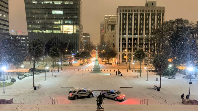
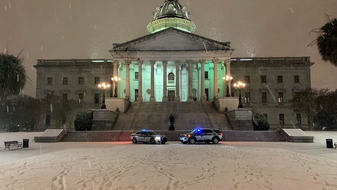
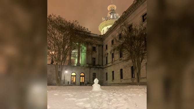
Carolinas waking up to ice, snow
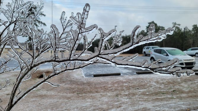
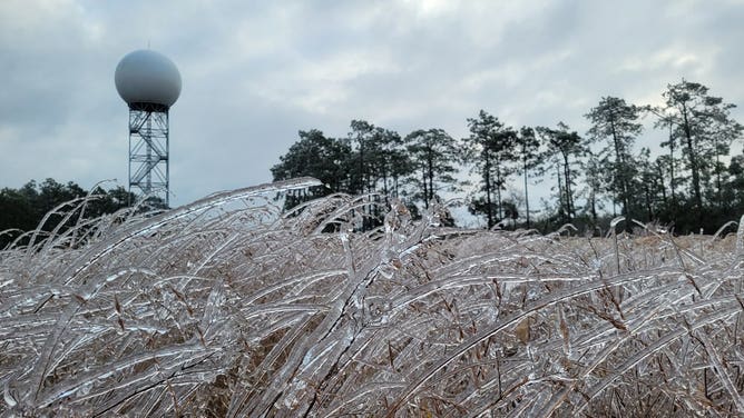
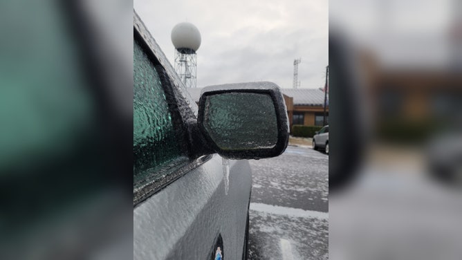
The coastal sections of North Carolina and and South Carolina are waking up Saturday as a significant and rare ice storm is spreading over the area. The most significant icing will be in North Carolina from Cape Fear to the Pamlico Sound. Up to 1/2 inches of ice accretion is expected.
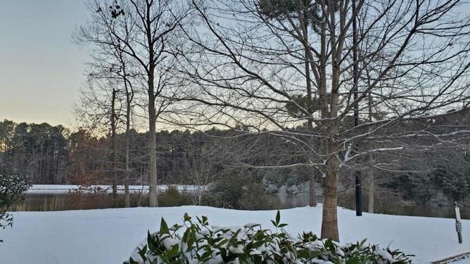
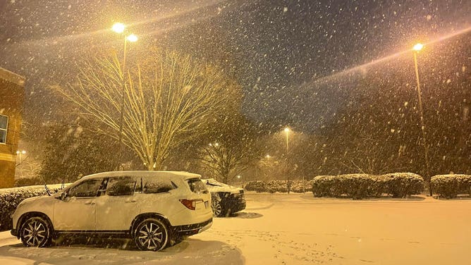
A winter storm overspreading the Southeast and southern Mid-Atlantic with snow and ice created travel headaches from Georgia to southeastern Virginia to start the weekend.
(FOX Weather)
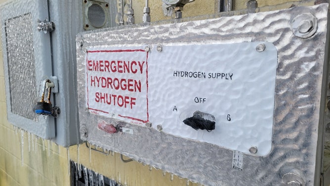
The coastal Carolinas are facing a significant ice threat, including power outages and tree damage, as freezing rain spreads across the region on Saturday. The National Weather Service says the expected ice amounts would be "unprecedented in recent history" for some areas.
(FOX Weather)
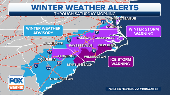
The NWS issued Ice Storm Warnings, Winter Storm Warnings and Winter Weather Advisories from the central and eastern Carolinas to southeastern Virginia and the southern Delmarva Peninsula ahead of the winter weather.
SLOW, SLEET, FREEZING RAIN AND HAIL: WHAT'S THE DIFFERENCE?
![]() Image 1 of 19
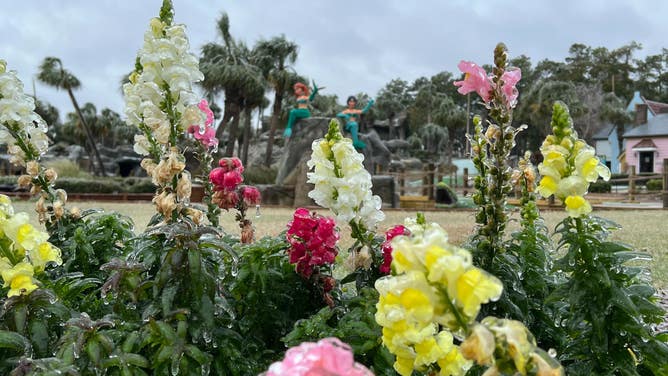
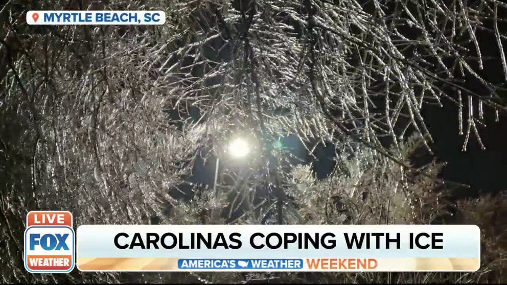
Image 1 of 19A significant and rare ice storm occurred Friday into Saturday along coastal sections of North Carolina and South Carolina. This photo was taken in Myrtle Beach, South Carolina, on Jan. 22, 2022. (Will Nunley)
![]() Image 2 of 19
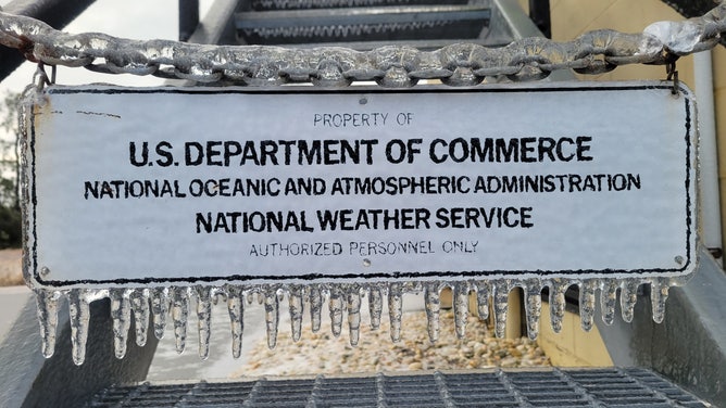
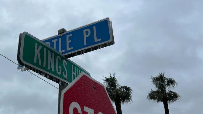
Image 2 of 19Ice coats a sign after a freezing rain event at the National Weather Service in Newport, NC. (National Weather Service, Newport, NC)
![]() Image 3 of 19
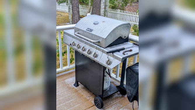
Image 3 of 19A grill sits covered in ice after a freezing rain event on Pawleys Island, SC (Pawleys Island Police Department)
![]() Image 4 of 19
Image 4 of 19A significant and rare ice storm occurred Friday into Saturday along coastal sections of North Carolina and South Carolina. This photo was taken in Myrtle Beach, South Carolina, on Jan. 22, 2022. (Will Nunley)
![]() Image 5 of 19
Image 5 of 19A significant and rare ice storm occurred Friday into Saturday along coastal sections of North Carolina and South Carolina. This photo was taken in Myrtle Beach, South Carolina, on Jan. 22, 2022. (Will Nunley)
![]() Image 6 of 19
Image 6 of 19Ice coats a building after a freezing rain event at the National Weather Service in Newport, NC. (National Weather Service, Newport, NC)
![]() Image 7 of 19
Image 7 of 19A significant and rare ice storm occurred Friday into Saturday along coastal sections of North Carolina and South Carolina. This photo was taken in Myrtle Beach, South Carolina, on Jan. 22, 2022. (Will Nunley)
![]() Image 8 of 19
Image 8 of 19A significant and rare ice storm occurred Friday into Saturday along coastal sections of North Carolina and South Carolina. This photo was taken in Myrtle Beach, South Carolina, on Jan. 22, 2022. (Will Nunley)
![]() Image 9 of 19
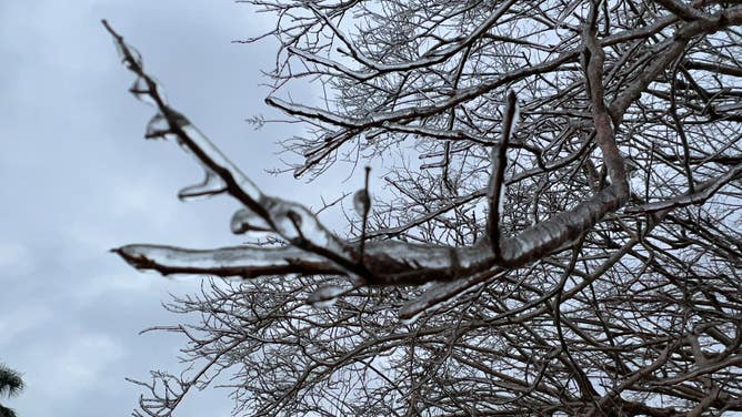
Image 9 of 19Ice coats a bush after a freezing rain event at the National Weather Service in Newport, NC. (National Weather Service, Newport, NC)
![]() Image 10 of 19
Image 10 of 19Heavy snow fell in a corridor from central North Carolina through eastern Virginia on Jan. 22, 2022. Cities include Fayetteville, Raleigh-Durham and Norfolk/Virginia Beach. This photo was taken in Durham. North Carolina. ( )
![]() Image 11 of 19
Image 11 of 19Grass is coated in ice in Newport, North Carolina, on Jan. 22, 2022. (NWS Newport/Morehead)
![]() Image 12 of 19
Image 12 of 19Snow falls in Columbia, South Carolina on Jan. 21, 2022. (South Carolina Bureau of Protective Services)
![]() Image 13 of 19
Image 13 of 19Ice coats a car after a freezing rain event at the National Weather Service in Newport, NC. (National Weather Service, Newport, NC)
![]() Image 14 of 19
Image 14 of 19Snow falls in Columbia, South Carolina on Jan. 21, 2022. (South Carolina Bureau of Protective Services)
![]() Image 15 of 19
Image 15 of 19Snow at the National Weather Service office in Raleigh, NC on Jan. 22, 2022 (National Weather Service, Raleigh)
![]() Image 16 of 19
Image 16 of 19A South Carolina Highway Patrol vechile is coated in ice after a freezing rain storm. (South Carolina Highway Patrol)
![]() Image 17 of 19
Image 17 of 19A truck crashes on a slick road in South Carolina after a freezing rain event. (South Carolina Highway Patrol)
![]() Image 18 of 19
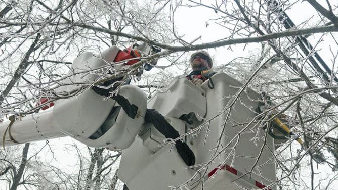
Image 18 of 19Duke Energy crews work to repair power lines after an ice storm (Duke Energy)
![]() Image 19 of 19
Image 19 of 19Snow falls in Columbia, South Carolina on Jan. 21, 2022. (South Carolina Bureau of Protective Services)


According to the NWS office in Wilmington, North Carolina, this is the first Ice Storm Warning issued for its area of responsibility since Feb. 24, 2015, nearly seven years ago.
(FOX Weather)
The Ice Storm Warning included Morehead City, Jacksonville, New Bern and Wilmington in North Carolina, as well as Conway and Myrtle Beach in South Carolina. This is where significant ice accumulations are most likely to knock out power and cause tree damage.
Coastal Carolina's wake up to icy winter wonderland
Lots of people along the coastal regions of the Carolinas are waking up to an icy winter wonderland Saturday morning. FOX Weather's Will Nunley is in Myrtle Beach, South Carolina, which is known for its beaches, golf courses and warmer weather, even during the winter months but not today.
Snow was falling in Raleigh, North Carolina when a Delta Air Lines flight slid off a taxiway.
Snow and ice are predicted to taper off in the Southeast by mid- to late morning on Saturday as the low-pressure system slides off the East Coast.
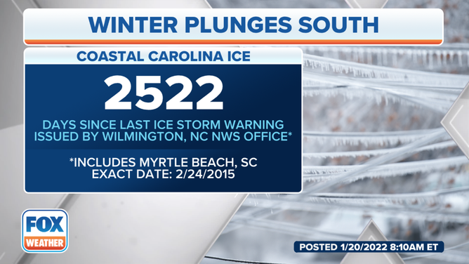
The last Ice Storm Warning issued by the National Weather Service office in Wilmington, North Carolina, was nearly seven years ago on Feb. 24, 2015.
(FOX Weather)
The storm will then track out to sea rather than up the Eastern Seaboard, so areas near the Northeast coast should have a dry, but cold, start to the weekend.
WHAT MAKES A STORM A NOR'EASTER?
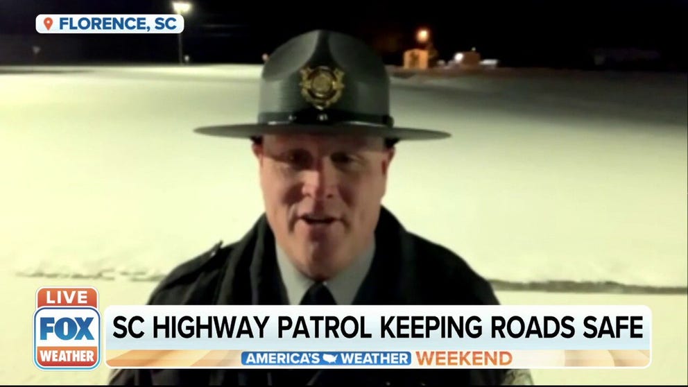
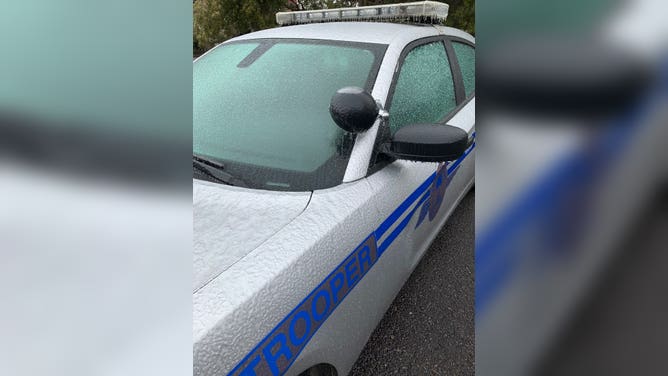
South Carolina Highway Patrol work to keep roads safe amid rare ice storm
Along the Carolinas, coastal communities are waking up to an icy Saturday morning. The South Carolina Highway Patrol is busy making sure the roads are as safe as possible for motorists. Master Trooper Brian Lee joins FOX Weather.
Temperatures might not rise above freezing in parts of northeastern North Carolina and southeastern Virginia until Saturday afternoon, if at all, so icy spots could linger even after the precipitation ends. Any residual water from daytime melting would then refreeze Saturday night as temperatures fall back below freezing into Sunday morning.
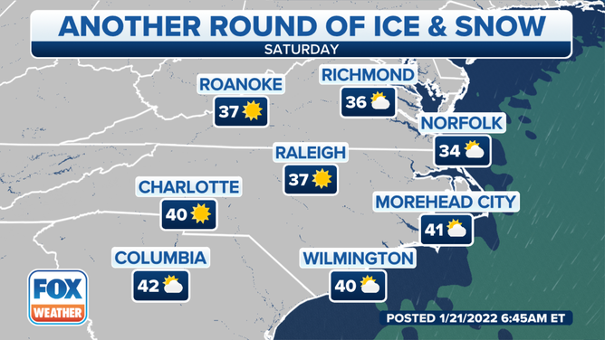
Forecast for Saturday, Jan. 22, 2022.
(FOX Weather)
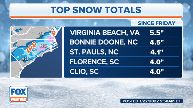
Expected snow and ice amounts
The best chance to see a few inches of snow with this system will be from northern South Carolina into central and eastern North Carolina and southeastern Virginia. Locally higher totals up to 6 inches are not ruled out in isolated spots of northeastern North Carolina and southeastern Virginia.
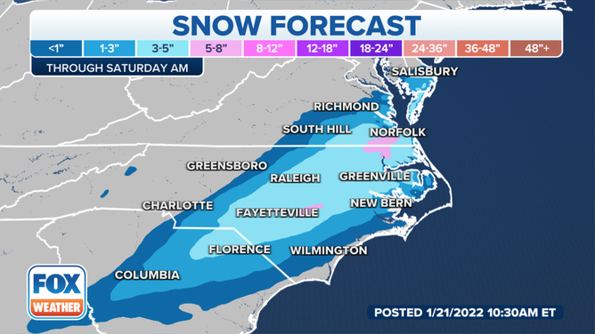
Upwards of 8" of snow was forecast for isolated spots in North Carolina and Virginia.
(FOX Weather)
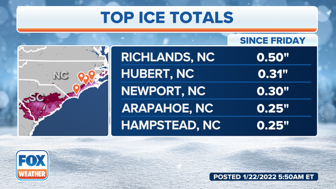
Freezing rain is likely to cause significant issues in the eastern and coastal Carolinas, especially in the lightest purple-shaded area on the map below.
A glaze of ice is also possible in other parts of the Southeast from eastern Georgia into the central Carolinas.
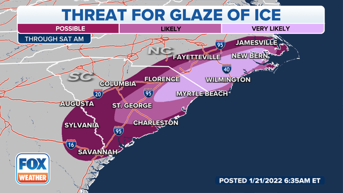
Threat for a glaze of ice through Saturday morning, Jan. 22, 2022.
(FOX Weather)
One-quarter to one-half inch of ice is forecast for parts of the coastal Carolinas through Saturday morning. Locally higher amounts of ice are not ruled out along the eastern North Carolina coastline.
Check back with FOX Weather for updates into the weekend. Be sure to download the FOX Weather app to get the latest weather alerts and forecasts for your location.