Windstorm whips through the Northeast, bringing winter chill and knocking out power
Strong wind gusts between 50-70 mph were recorded across the Northeast, including a blast that was clocked at 70 mph in Stony Brook, New York on Long Island.
Powerful windstorm causes power outages across parts of Northeast
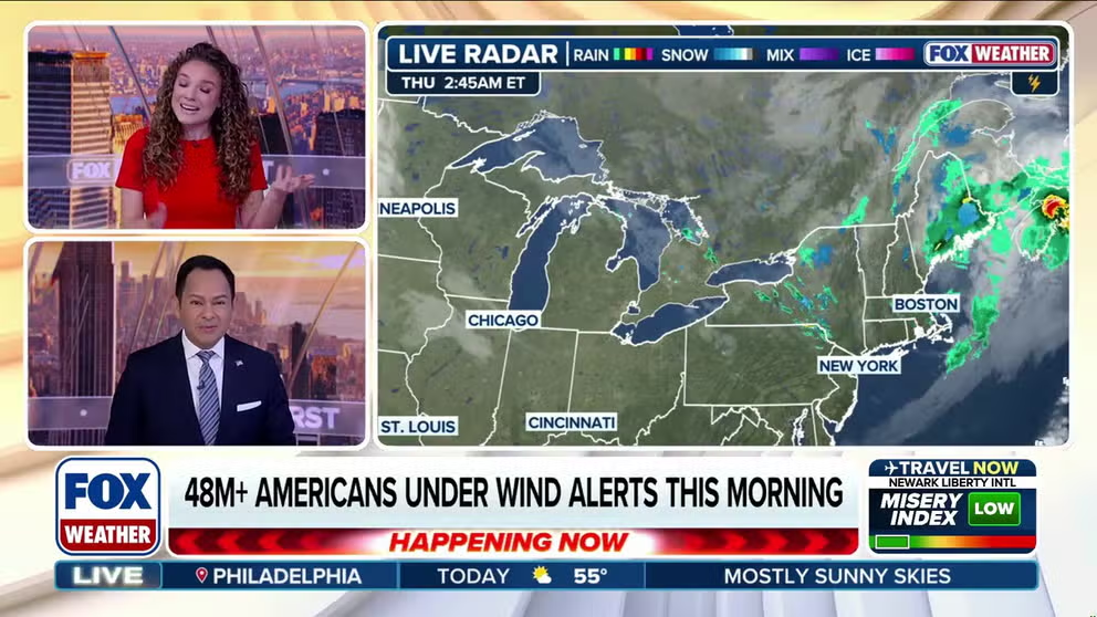
Strong wind gusts of 50-70 mph were recorded across the Northeast as fast-moving area of low pressure, known as a clipper, raced through the region. Some wind alerts remain through Thursday morning and more than 70,000 customers were without power across Pennsylvania, Maryland, New Jersey and New York.
BUFFALO, N.Y. – A fast-moving area of low pressure, known as a clipper, blasted through the Northeast Wednesday, leaving more than 70,000 customers without power across Pennsylvania, Maryland, New Jersey and New York Thursday morning.
Strong wind gusts between 50-70 mph were recorded across the Northeast, including a blast that was clocked at 70 mph in Stony Brook, New York on Long Island.
WHAT YOU SHOULD KNOW ABOUT HIGH WIND WARNINGS
Windstorm takes aim at Northeast as gusts pummel coastline
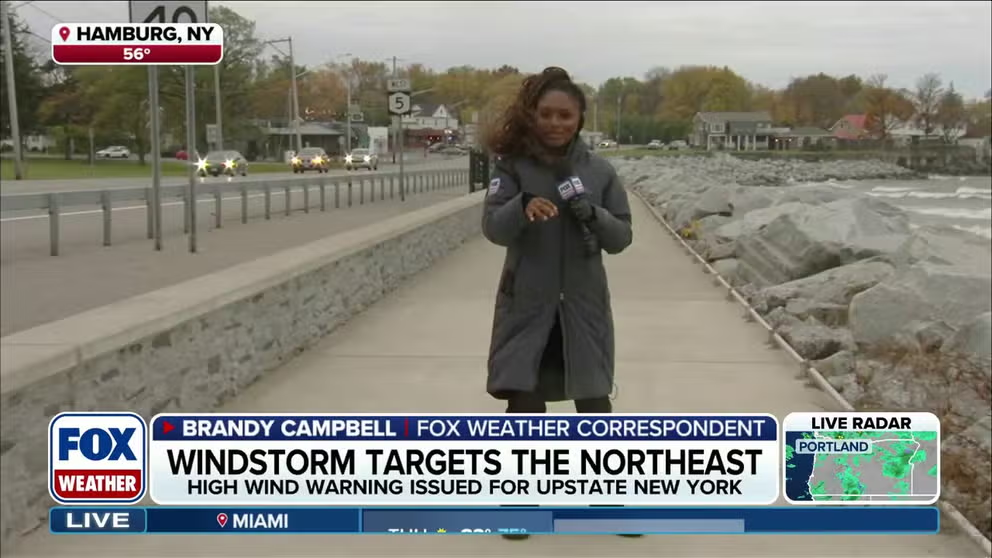
FOX Weather Correspondent Brandy Campbell is seeing the effects of a windstorm making its way over the Great Lakes into upstate New York. She reports from Hamburg, where gusts of 43 mph have already been recorded.
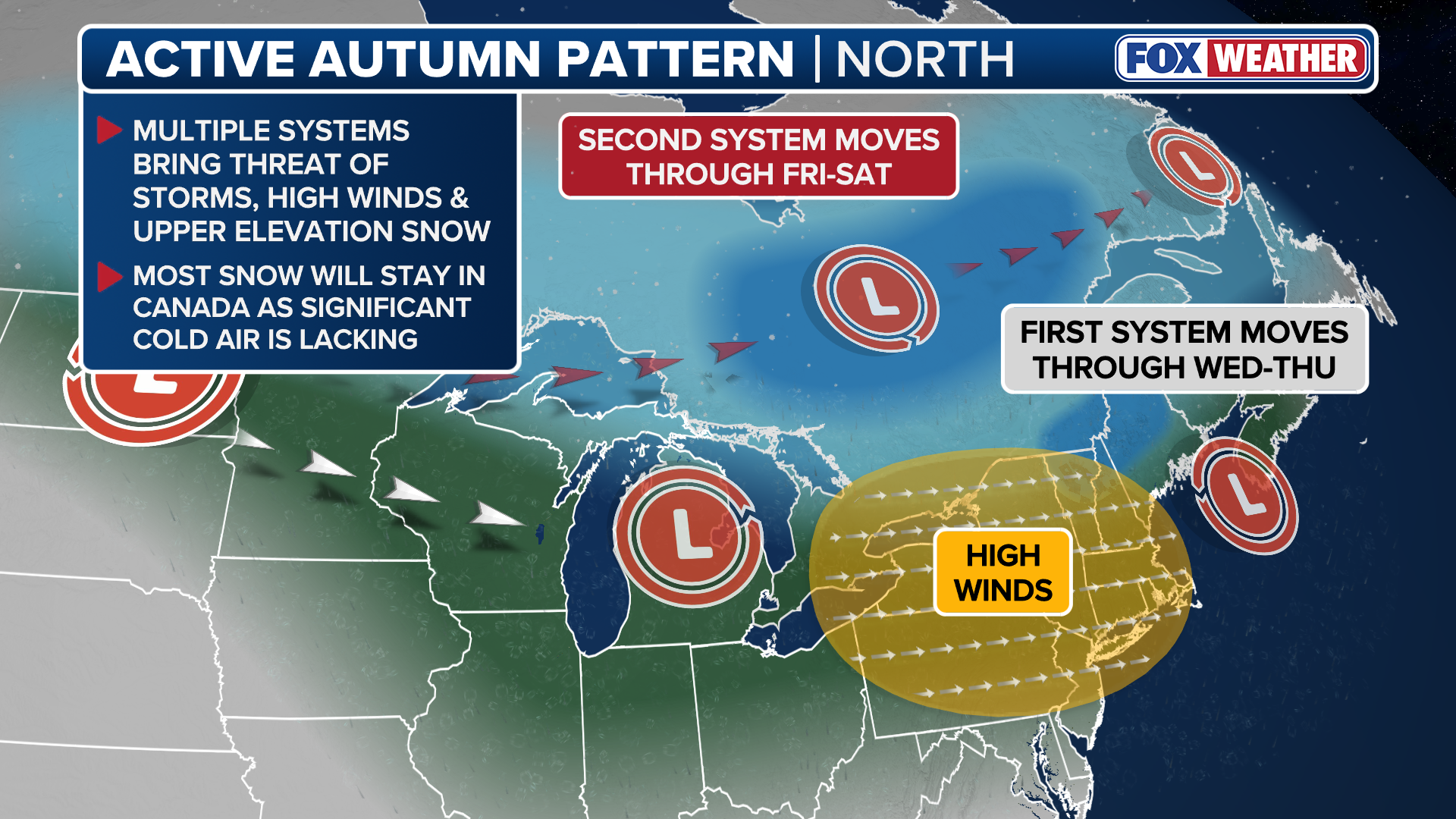
More than 60 million Americans throughout the Northeast were under High Wind Alerts on Wednesday, as a series of fast-moving storms swept across the Great Lakes.
FOX Weather Correspondent Brandy Campbell recorded a wind gust of 43 mph off the shores of Lake Erie in western New York on Wednesday afternoon.

(FOX Weather)
A second clipper system will move through the Northeast on Friday and Saturday, bringing similar conditions.
Snow will remain locked in Canada for the time being, although the FOX Forecast Center said wet snow is likely in the higher elevations of the Green and White Mountains with most accumulation above 3-4 thousand feet, with some snow possible in the mountain valleys of New Hampshire and Maine.
(FOX Weather)
Arctic air will finally spill into the Lower 48 on Sunday, ushering in the first taste of winter and potentially the first snow of the season for places across the Eastern U.S.
HOW MUCH WILL IT SNOW ACROSS AMERICA? EARLY FLAKE OUTLOOK FOR BREWING LA NIÑA WINTER
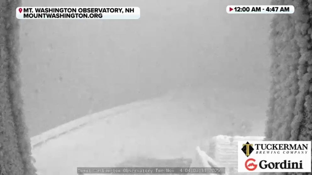
Watch: Insane winds topping 100 mph gust on New Hampshire's Mount Washington
Time-lapse footage from Tuesday morning shows near whiteout conditions on Mount Washington leading up to a 103 mph wind gust. Mount Washington is known for its snowy, windy and icy conditions, leading to the mountain receiving the title of "World's worst weather."