Severe storms could slam Ozarks to Mississippi Valley with tornadoes, damaging winds Saturday
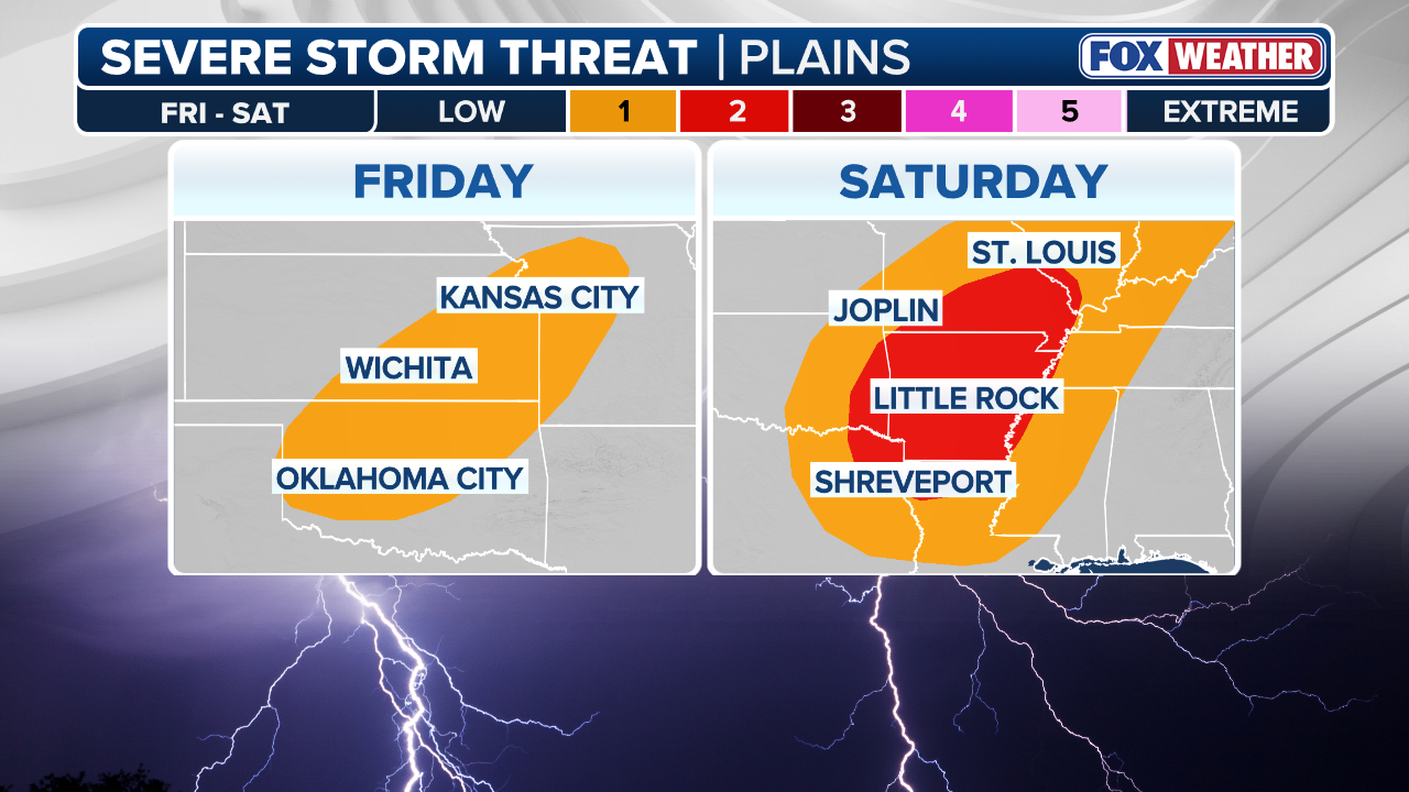
More than 45 million people from Texas to Ohio will be at heightened risk of severe weather on Saturday. Among those, some 11 million people from northeastern Texas to southwestern Illinois have been placed in a Level 2 out of 5 severe thunderstorm threat.

Friday night severe weather threat extends into the weekend for Central US
Millions of people from portions of the Plains and into the Ozarks and Mississippi Valley will be at risk of seeing some potentially dangerous severe weather over the weekend.
LITTLE ROCK, Ark. – A potentially dangerous severe weather threat is brewing for the Ozarks and Mississippi Valley this weekend due to a cross-country storm that could fire off thunderstorms capable of producing damaging wind gusts, large hail and tornadoes.
The extreme weather threat is targeting parts of Oklahoma, Kansas and western Missouri Friday, with storms likely developing in the late afternoon and evening.
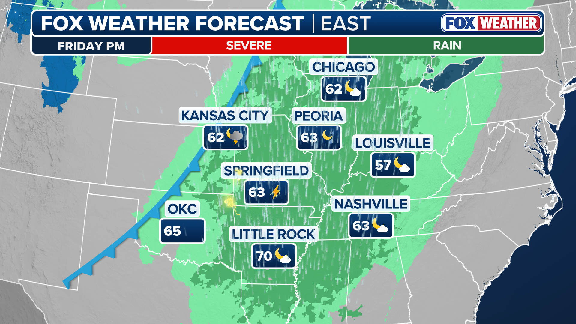
By Friday night and into Saturday, warm, humid air will be surging to the north into the Ark-La-Tex region, the Ozarks and Mississippi Valley, setting the stage for more intense and widespread severe weather.
(FOX Weather)
More than 45 million people from Texas to Ohio will be at heightened risk of severe weather on Saturday.
Among those, some 11 million people from northeastern Texas to southwestern Illinois have been placed in a Level 2 out of 5 severe thunderstorm threat, including cities like Shreveport in Louisiana, Little Rock and Fort Smith in Arkansas, Memphis in Tennessee and Springfield in Missouri.
DOWNLOAD THE FREE FOX WEATHER APP
(FOX Weather)
By Saturday afternoon, the FOX Forecast Center said the atmosphere will become increasingly unstable, and wind shear will be strong enough for the development of some supercell thunderstorms capable of producing hail, damaging wind gusts and tornadoes.
Forecasters say, however, that the exact severity of those storms will depend on just how much the atmosphere can recover from thunderstorms that develop earlier in the day on Saturday.
If the air is able to heat up again during the afternoon hours, those developing thunderstorms could become intense.

(FOX Weather)
NOAA's Storm Prediction Center said that storms should organize Saturday afternoon along the cold front that would bring an increased risk of tornadoes for northern Arkansas, southeastern Missouri, southern Illinois and western Tennessee.
The severe weather threat is then expected to shift eastward into the lower and mid-Mississippi Valley on Saturday evening and night.