Florida sweats to hottest temperatures of summer so far with heat index climbing to 110 degrees in spots
June, July, August and September typically produce the majority of the rainfall for the year across Florida. During the early months, hail, damaging winds and frequent lightning are common.

Dangerous heat sizzles Sunshine State this weekend
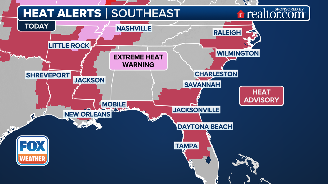
Florida is facing the hottest temperatures so far this summer, with Heat Advisories covering much of the Sunshine State this weekend as the heat index climbs to as high as 110 degrees in many areas.
ORLANDO, Fla. – Floridians are sweating through the hottest stretch of the summer so far, with Heat Advisories covering much of the state and heat indices soaring to as high as 110 degrees.
After a brief reprieve of cooler, rainy weather last week due to Invest 93L, a tropical disturbance that crossed the peninsula, cities like Jacksonville, Orlando, Tampa and Miami are now enduring intense sunshine and stifling humidity.
Air temperatures are expected to climb into the mid-90s across many communities, but the humidity will push the "feels-like" temperature even higher, creating extremely dangerous conditions for those outdoors between the hours of 1 p.m. and 6 p.m. local time.
(FOX Weather)
The heat is being driven by a ridge of high pressure parked over the Atlantic, producing a heat dome effect across much of Florida and the Southeast.
The large-scale weather setup also aids in suppressing sea breeze development, which is a natural source of afternoon and evening cooling, especially in coastal areas.
NEW TO FLORIDA? HERE'S WHEN THE SUNSHINE STATE'S RAINY SEASON GETS UNDERWAY
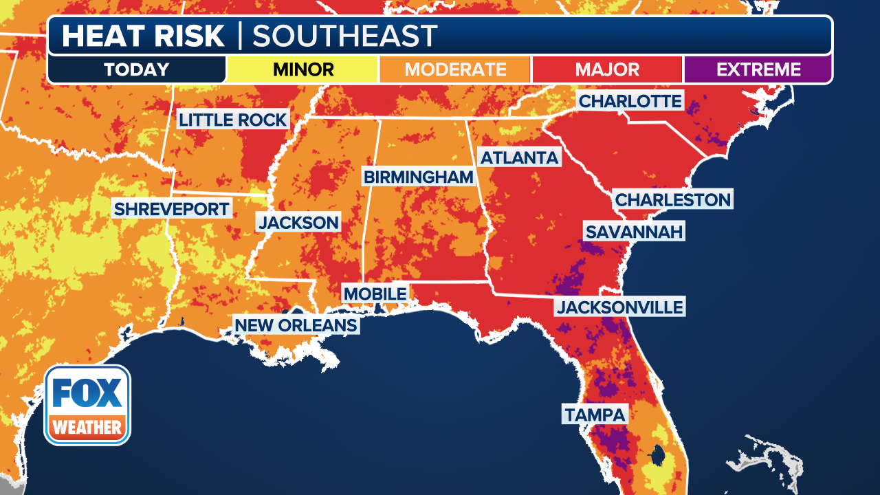
The highest heat indices are expected across interior Florida, particularly north of Interstate 4 between I-95 and I-75.
In this region, the combination of high temperatures and humidity could push heat index values upwards of 110 degrees through Sunday.
(FOX Weather)
South of I-4, conditions will remain dangerously hot as well, but will be several degrees cooler, with heat indices in the 100-110 degrees range.
A factor that is making the heat wave potentially deceptive is that actual air temperatures are largely expected to remain below record-breaking values – it will be all about the humidity and the heat index.
According to the FOX Forecast Center, a slight break from the extreme heat may arrive early this week in the form of increased rain chances and cloud cover.
As the remnants of Invest 93L interact with a potential new area of low pressure, increased precipitation chances may move in by Tuesday or Wednesday.
NEARLY 300 QUEEN CONCHS FOUND AFTER ILLEGAL HARVEST IN FLORIDA KEYS

(FOX Weather)
Climatologically, the final week of July and the first days of August mark the peak of Florida’s summer heat, so the warm weather is right on schedule in the Sunshine State.
People are advised to stay hydrated, wear light-colored clothing, limit outdoor activity during peak heat hours and seek air conditioning whenever possible.
Some communities in the state, including Jacksonville, even have staff cooling centers, which will be open as long as temperatures are in the danger zone.
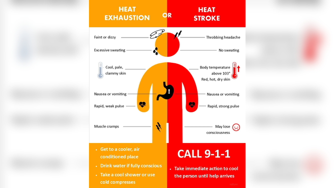
Warm weather can lead to everything from heat exhaustion to heat stroke.
(National Weather Service Sacramento / FOX Weather)