Possible tornadoes strike Virginia on Sunday as severe storms batter millions along East Coast
In addition to the reported tornadoes in Virginia, there were numerous reports of trees being brought down from Virginia to South Carolina as the severe thunderstorms rumbled across the Eastern Seaboard.

Sloppy Monday for millions as more rain moves across eastern US
The next round of rain for the Northeast and a large part of the East comes in the form of a cold front that is expected to move in later Monday into Tuesday. An additional 1-2 inches of rain will keep up what has been wet, a drought-busting 30 days. Not only will there be another flood threat, but severe storms are also possible, which does include a low-end tornado threat.
MONTROSS, Va. – At least two tornadoes were reported in Virginia as millions of people along the Interstate 95 corridor on the East Coast braced for the threat of severe weather on Sunday.
The National Weather Service said an eyewitness reported a tornado briefly touching down in a field for less than a minute outside Montross, Virginia. A possible tornado also took down a powerline in James City County near Five Forks, Virginia.
In addition to the reported tornadoes in Virginia, there were numerous reports of trees being brought down from Virginia to South Carolina as the severe thunderstorms rumbled across the Eastern Seaboard.
This came after NOAA's Storm Prediction Center had placed a large majority of the eastern U.S. from Georgia in the Southeast to the nation's capital in the mid-Atlantic in a Level 2 risk on its 5-point severe thunderstorm risk scale. That included cities like Savannah in Georgia, Columbia in South Carolina, Wilmington and Raleigh in North Carolina, Richmond and Virginia Beach in Virginia and Washington, D.C.
A Tornado Watch was issued for more than 10 million people in the mid-Atlantic, including cities like Washington and Fredericksburg and Richmond in Virginia, but the watch was allowed to expire late Sunday evening.
WATCH VS. WARNING: HERE ARE THE DIFFERENCES BETWEEN THESE WEATHER TERMS THAT COULD SAVE YOUR LIFE
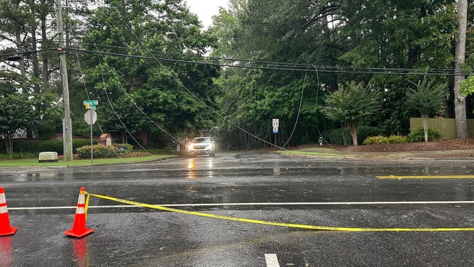
![Downed powerlines from strong winds in Roswell, Georgia.]() Image 1 of 2
Image 1 of 2Downed powerlines from strong winds in Roswell, Georgia. (Roswell Police Department/Facebook)
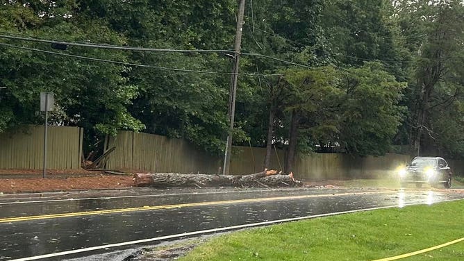
![A large tree broke away and fell on part of a roadway in Georgia on Saturday.]() Image 2 of 2
Image 2 of 2A large tree broke away and fell on part of a roadway in Georgia on Saturday. (Roswell Police Department/Facebook)
NOAA's Weather Prediction Center had also placed portions of seven states and the Washington, D.C., area at a Level 2 out of 4 risk for flash flooding.
Right on the heels of the wet weekend, another low-pressure system will strengthen across Canada and move east to start the new week, the FOX Forecast Center said. This stronger front will move through the Great Lakes on Monday, bringing more rain and a few storms, which will then move into the Northeast.
Some of these storms could be severe, with the main threat being damaging winds, but a tornado cannot be ruled out closer to the Ohio Valley.
DOWNLOAD THE FREE FOX WEATHER APP
By Tuesday, the storms will focus more along the East Coast and parts of the Interstate 95 corridor.