Several areas to watch in the Atlantic as Bonnie hits Central America
Once Bonnie is in the Eastern Pacific, the only active system will be the tropical disturbance pushing across the Caribbean, and development of that system is unlikely
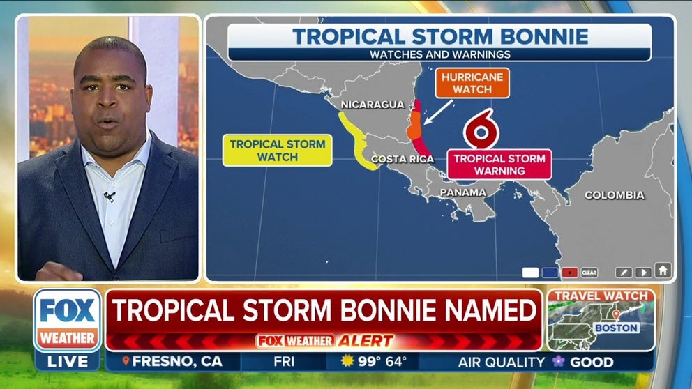
Tropical Storm Bonnie forms over southwestern Caribbean Sea
Tropical Storm Bonnie forms over the southwestern Caribbean Sea with maximum winds of 40 mph.
The Caribbean tropical disturbance we've been tracking all week has finally organized enough to be designated Tropical Storm Bonnie as it approaches Central America.
The winds have been strong enough (40-plus mph) on the northern side of the system for days. But up until Friday morning, Hurricane Hunters flying through the system had not been able to find the required westerly winds on the bottom of the circulation to meet the definition of a tropical storm.
HOW TO WATCH FOX WEATHER ON TV
Bonnie seems to be surrounded by pristine atmospheric conditions and is over very warm water, so it’s expected to strengthen before reaching Central America on Friday night.
The tropical storm is not far from the southern Nicaraguan and northern Costa Rican coast. It will bring heavy rain and very gusty winds across Central America later Friday and into Saturday.
TROPICAL STORM BONNIE FORMS IN CARIBBEAN AHEAD OF FRIDAY NIGHT LANDFALL IN CENTRAL AMERICA

(FOX Weather)
This part of Central America is quite narrow, so Bonnie is expected to survive the trek over the mountains into the Eastern Pacific with its circulation remaining intact. That means the storm will still be called Bonnie as opposed to getting an Eastern Pacific storm name. This is unusual because relatively few storms cross that narrow part of Central America. They usually track farther north and get tangled up in the big mountains. It’s only happened once this century when Otto pulled it off in 2016.
HERE’S HOW TO PREPARE FOR HURRICANE SEASON NOW
Bonnie is forecast to track north just offshore of the Pacific coast of Mexico and intensify, so they’ll be watching the storm over the next few days.
Elsewhere in the tropics

(FOX Weather)
The National Hurricane Center outlined an area of potential development off the Savannah, Georgia coast. Satellite and radar showed the developing low-pressure system Friday afternoon.
The disturbance was identified as Invest 96L, but it will have less than a day to organize before conditions become hostile for development.
An invest is simply a naming convention used by the NHC to identify an area of weather that it is investigating for possible development into a tropical depression or tropical storm within the next five days.
Regardless of development, localized heavy rain and chances for flash flooding will remain high for Georgia and the Carolinas through Saturday.

(FOX Weather)
A tropical disturbance is approaching the Caribbean islands. Its atmospheric environment is not conducive to development, so it is forecast to pass across the islands over the next few days, bringing heavy rain and some gusty winds as it moves from east to west.

(FOX Weather)
The other disturbance we were watching Thursday in the Gulf of Mexico has moved ashore in southeastern Texas, bringing very heavy rain to the Houston metro area and southwestern Louisiana. Some localized flooding is possible.
CLICK HERE TO GET THE FOX WEATHER UPDATE PODCAST
Overall, the tropics are calming down. Once Bonnie is in the Eastern Pacific, the only active system will be the tropical disturbance pushing across the Caribbean, and development of that system is unlikely. We should be good well into next week.