

Invest 97L odds rise for tropical development as Texas and Louisiana brace for thunderstorms, heavy rain
The system is showing signs of organization, with forecasters giving it a 70%, or high, chance of strengthening into a tropical depression or tropical storm.
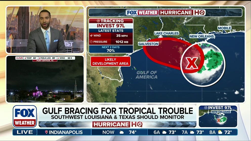
Invest 97L tropical development odds rise as heavy rain and storms threaten Texas and Louisiana
Invest 97L odds rise for tropical development late Monday or early Tuesday as Texas and Louisiana brace for heavy rain and storms. The next named storm on the Atlantic list is Edouard. FOX Weather Meteorologist Michael Estime breaks down the forecast timeline and looming impacts for the Gulf:
THE TAKEAWAY
- Invest 97L has a 70% chance of becoming a tropical depression or tropical storm.
- The disturbance began as a cluster of thunderstorms over the northern Gulf.
- The system is expected to reach the Texas or Louisiana coast late Monday or Tuesday morning.
The Gulf Coast is bracing for a stormy stretch as Invest 97L churns across the region, bringing a cluster of thunderstorms and heavy rain through Wednesday.
WHAT IS A HEAT DOME AND HOW CAN IT AFFECT YOU DURING THE SUMMER MONTHS?
The system is showing signs of organization, with forecasters giving it a 70%, or high, chance of strengthening into a tropical depression or tropical storm.

(FOX Weather)
The disturbance began as a cluster of thunderstorms over the northern Gulf after a dip in the jet stream over the weekend helped set the stage for its development. The cluster has since evolved into a small tropical disturbance.
KARINA STRENGTHENS INTO A HURRICANE IN THE PACIFIC, FORECAST TO BECOME A CATEGORY 3+ STORM
The system is currently trapped beneath a heat dome and high pressure system that is bringing hot weather to the Midwest. That high pressure system is expected to slowly nudge the disturbance toward the upper Texas coast.
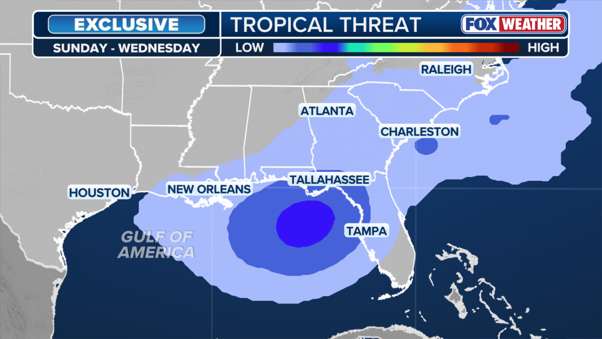
(FOX Weather)
The National Hurricane Center (NHC) said there is a 70% chance of tropical development, noting that the warm Gulf waters and atmospheric conditions appear reasonably conducive for development.
An "invest" is a designation used by the National Hurricane Center to identify an area that is being investigated for potential development into a tropical depression or tropical storm within the next seven days.
Residents from Galveston, Texas, to Southwest Louisiana should monitor the development of Invest 97L closely.

(FOX Weather)
The system is expected to reach the Texas or Louisiana coast late Monday or Tuesday, bringing the potential for heavy rain and thunderstorms, with the NHC now calling for a tropical depression or tropical storm to form before it reaches either area.
This would either be Tropical Depression Five or Tropical Storm Edouard.
Regardless of its development status, the Houston Metro could be in the bullseye for at least 3 to 5 inches of rain from the system as it moves inland slowly on Tuesday.
The Weather Prediction Center has added a Level 2 out of 4 flood threat that includes Houston.
Additionally, coastal flooding could play a major role and depending on how quickly the disturbance moves inland, there could be flooding well north of Houston on Wednesday, the FOX Forecast Center said.
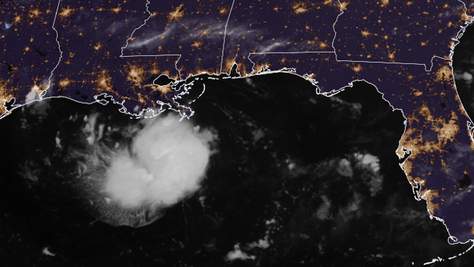
Satellite imagery of Invest 97L brewing in the Gulf early Monday morning.
(CIRA / NOAA)
Hurricane hunters are scheduled to investigate the disturbance early Monday morning, providing forecasters with additional data on the system’s strength and organization.
Small systems can sometimes spin up quickly in the northwestern Gulf, where the curvature of the coastline and extremely warm waters can contribute to rapid development, according to the FOX Forecast Center.
Stay with FOX Weather for the latest.