Strengthening El Nino leads to 'large uncertainty' with hurricane season outlook
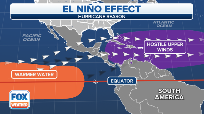
El Niños are known to suppress tropical activity in the Caribbean, Gulf of Mexico and the Atlantic Ocean. Forecasters said the impacts primarily stem from increased vertical wind shear, which can prevent tropical cyclones from forming and strengthening.
Colorado State University releases updated outlook for 2023 Atlantic hurricane season
Colorado State University hurricane researchers released their updated tropical outlook on Thursday and are maintaining their previous forecast that the 2023 Atlantic hurricane season will see above-average activity.
Colorado State University hurricane researchers released their latest tropical outlook on Thursday, which continues to call for a busy season across the Atlantic despite a strengthening El Niño in the Pacific.
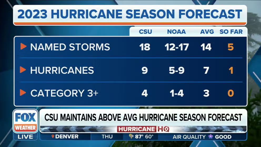
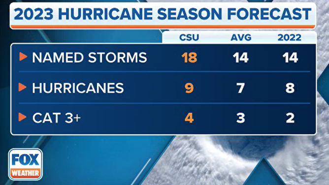
Forecasters expect 18 named storms to form, with nine strengthening into hurricanes and four cyclones becoming major with winds of at least 115 mph.
The outlook is unchanged from CSU’s July update, but forecasters caution there is greater uncertainty due to global climate patterns being in flux.
The 2023 El Niño is in the process of strengthening across the Pacific Ocean, which on its face, would lead to reduced tropical cyclones in the Atlantic basin, but CSU experts believe this is not the case.
CSU updated 2023 Atlantic hurricane season forecast
(FOX Weather)
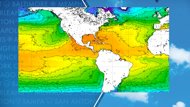
Forecasters point to the above season activity that is already in the books and historically warm water temperatures in the Atlantic basin as two indications that the year could wind up busier than average.
So far, in 2023, five tropical cyclones have formed, and the basin has already seen its first hurricane.
WHY 2023 OUTLOOKS RUN THE GAMUT FOR HOW BUSY THE SEASON IS EXPECTED TO BE
Through the first two months of the season, the rate of formations has run about a month or two ahead of climatology, despite being in an El Niño pattern.
Typically, El Niño events reduce tropical cyclone activity in the Atlantic basin through increased vertical wind shear and cooler water temperatures – both of which have not been observed across large parts of the basin.
Forecasters warn due to El Niño’s eventual onslaught, the forecast contains more uncertainties than usual.
El Nino impacts on the western Atlantic basin.
(FOX Weather)
If a classic El Niño were to gain a foothold across the basin, the outlook would significantly overestimate the number of hurricanes and major storms.
Forecasters in 2022 overestimated the amount of expected significant cyclones in the basin, but inaccuracies were not because of El Niño. During August, which is typically the second-busiest month for hurricane activity, dry air and higher pressures dominated the basin, causing it to be one of the quietest months.
Last August was historic for the lack of tropical cyclone activity and became only the second time in the modern satellite era that neither a tropical storm nor a hurricane formed.
HERE’S WHAT AN EL NINO CLIMATE PATTERN IS
Water temperatures across the Atlantic and Pacific
(FOX Weather)
Early indications for August 2023
The FOX Forecast Center said there are mixed signals about whether August will be known for its activity or if it’ll fail to meet expectations.
Sea surface temperatures in large parts of the Gulf of Mexico, Caribbean Sea and Atlantic Ocean are above average but dry air remains plentiful, which is expected during the first half of the month.
Plumes of the Saharan Air Layer, or what is commonly known as SAL, have recently reached the Gulf Coast, enhancing sunrise and sunset colors and impacting air quality.
NOAA says the air surrounding the dust plume has 50% less moisture than the typical atmosphere, which means the presence of the SAL can be detrimental to cloud formation and thunderstorm activity.
If atmospheric conditions become more nominal, August could live up to climatology and be a busy month for forecasters, but there are no indications over at least the next week of an uptick in activity.
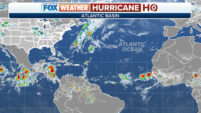
Tracking the tropics across the Atlantic
(FOX Weather)