NHC monitoring 2 disturbances in Eastern Pacific for development
The Eastern Pacific is typically more productive during El Niño events than the Atlantic Basin due to warmer water temperatures, more moisture and less wind shear. So far in 2023, the Eastern Pacific has seen hurricanes Adrian and Beatriz form.
NHC monitoring 2 disturbances in Eastern Pacific for development
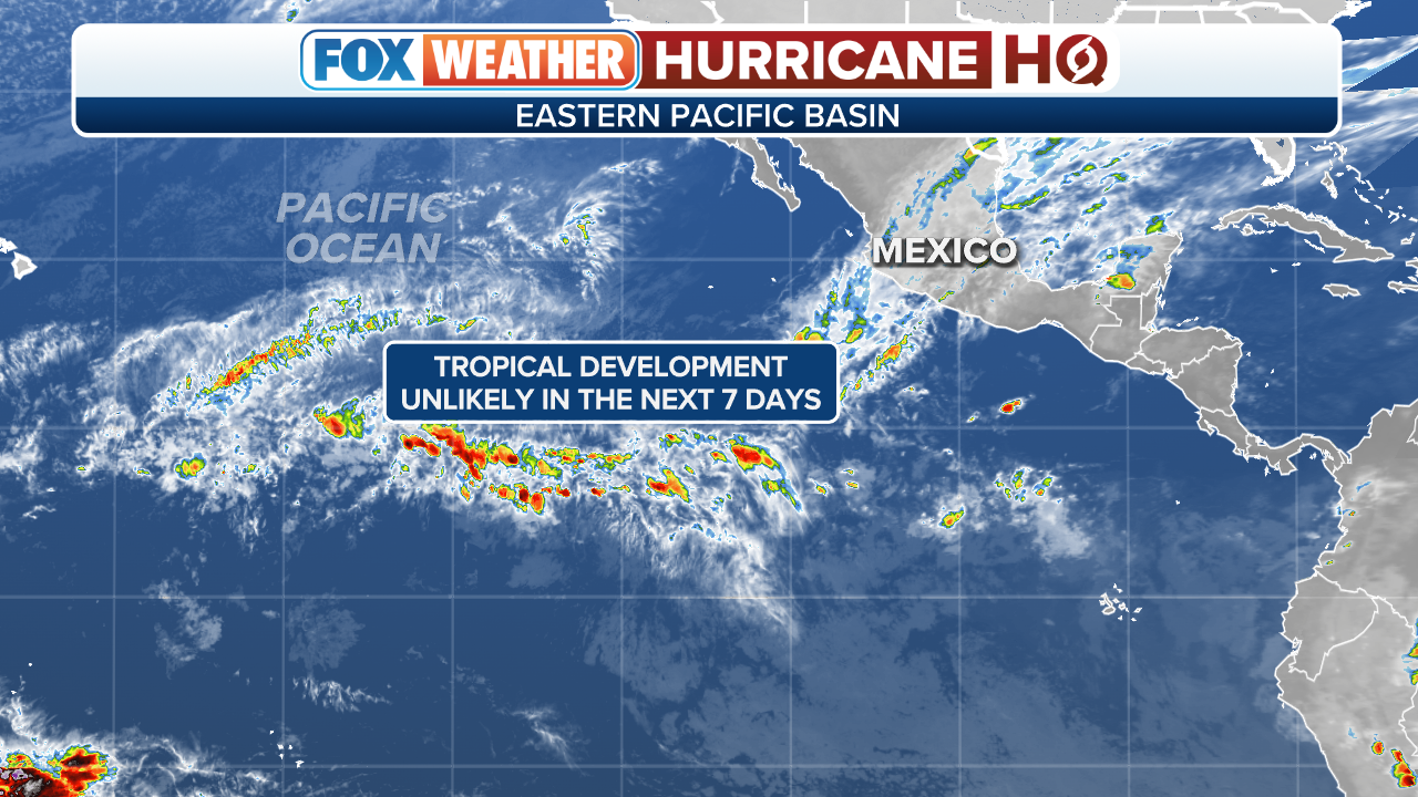
As the Atlantic Basin takes a break from producing tropical cyclones, the Eastern Pacific has become a hotbed, with two areas of disturbed weather being given chances for development.
As the Atlantic Basin takes a break from producing tropical cyclones, the Eastern Pacific has become a hotbed, with two areas of disturbed weather being given chances for development.
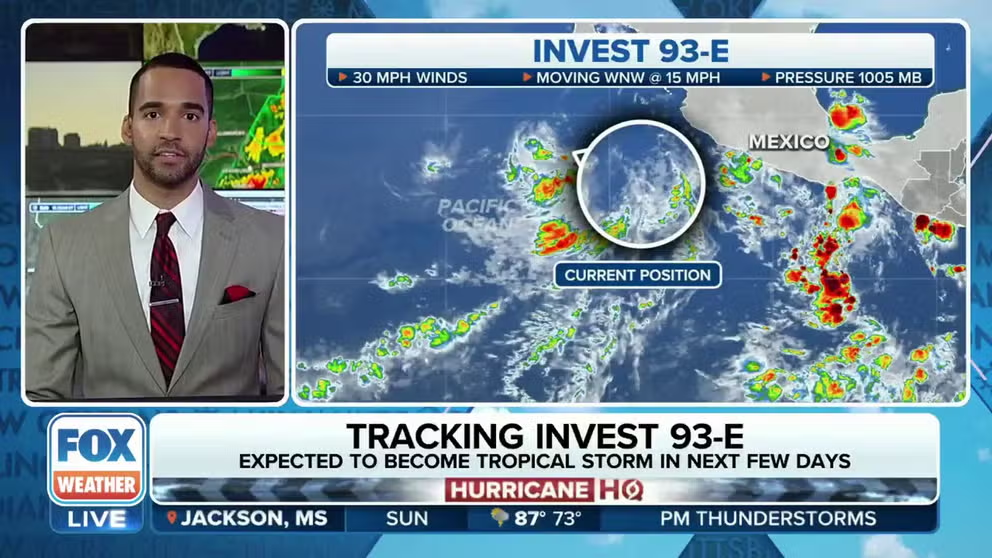
The National Hurricane Center (NHC) has identified the first disturbance off the Mexican coast as Invest 93E and could soon designate the second area of disturbed weather off Central America as Invest 94E.
An invest is the designation the NHC uses to identify an area of disturbed weather being investigated for possible tropical development.
(FOX Weather)
Computer forecast models show both disturbances working westbound over the next week over the open ocean.
The NHC said Sunday the second disturbance had a higher chance of development than Invest 93E.
The next system that orangizes into a tropical storm with winds of 40 mph will be named "Calvin."
UPDATED ATLANTIC HURRICANE SEASON FORECAST NOW SEES BUSIER SEASON DESPITE ONSLAUGHT OF EL NINO
Due to the proximity of the potential cyclones to Central America, higher-than-average seas are expected along the Mexican coastline.
The increased motion in the ocean can often lead to a heightened threat of rip currents along beaches.
WHAT TO EXPECT IN THE TROPICS AS HURRICANE SEASON ENTERS JULY

(FOX Weather)
Low chance of development in central Atlantic
The NHC says a non-tropical low is expected to form in a couple of days a few hundred miles east-northeast of Bermuda in the central Atlantic Ocean.
This system could gradually acquire subtropical characteristics toward the end of the week while it drifts southeastward over the central Atlantic. A subtropical storm derives most of its energy from the clash of warm and cold air but doesn't have fronts associated with it.
The low will pose no threat to the U.S. as it's expected to turn northward by next weekend.

(FOX Weather)
Elsewhere across the Atlantic, upper-level winds and dry air are making their way through the basin, which is common during July.
The FOX Forecast Center said the plumes of Saharan dust are being tracked across the Atlantic Ocean, which help reduce the available moisture for thunderstorms.
Plumes of the Saharan Air Layer are common during the early- and mid-summer as winds carry the tiny particles across the Atlantic Ocean, and they may even be spotted over the skies of Florida during the next week.

(FOX Weather)
The particles can make for vivid sunrises and sunsets, and if significant enough, can lead to a reduction in air quality.
July is generally a slow month for tropical cyclone development in the Atlantic Basin before the season ramps up in late summer and fall, but influences such as El Niño can dictate how busy the month will be.
The month averages just one named storm, and the cyclone usually stays below major hurricane strength.