Darby making closest approach to Hawaii; Tropical Storm Warning issued for offshore waters
Darby’s center is expected to pass more than 100 miles south of the Big Island
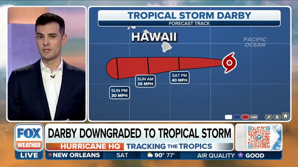
Tracking Tropical Storm Darby
Darby is expected to pass south of the Hawaiian Islands over the weekend, but the island chain could feel some effects.
HILO, Hawaii – A weakening Darby is expected to pass south of the Big Island on Saturday but be close enough to produce some outer fringe impacts on the island chain.
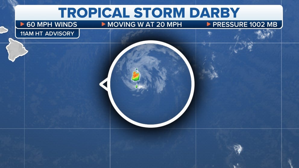
As of the latest report from the National Hurricane Center, Tropical Storm Darby had maximum sustained of around 60 mph and was heading westward at about 16 mph.
On the forecast track, the cyclone will pass over 200 miles south of Hilo, Hawaii, this weekend.

Because of the cyclone’s deterioration and its small size, sustained tropical-storm-force winds will stay offshore, but that does not mean the islands will escape without some fringe impacts.
HOW TO WATCH FOX WEATHER ON TV
Meteorologists say the combination of a ridge of high pressure to the north and the cyclone to the south will mean a large pressure gradient that will create blustery conditions through the weekend.
Gusts greater than 30 mph will be possible, especially on the Big Island and beaches.
These strong winds could help could increase the fire threat level for areas that miss out on rain and keep seas and surf rough into the workweek.

Officials said waves of more than 8 feet will be possible, especially on east-facing beaches.
In addition to the winds and surf, a few passing rain showers will be possible on the Big Island.
Emergency managers warn Hawaii’s steep valleys can cause fast-flowing runoff that could be dangerous if enough rain falls.
CLICK HERE TO GET THE FOX WEATHER UPDATE PODCAST

A Tropical Storm Warning has been issued for the offshore waters of Hawaii.
The National Weather Service Office in Honolulu expects winds upwards of 50 mph and seas that could reach 14 feet for areas in the Pacific.
Due to the weather threats, the Hawaii Emergency Management Agency has activated its emergency operations center to respond to any impacts over the weekend.
"When you combine those potential impacts with the high surf we expect this weekend, we want to make sure we’re ready for anything, just in case," Luke Meyers, administrator of HI-EMA, said.
DROUGHT THREATENS DRINKING WATER SUPPLY TO CENTRAL PACIFIC ISLANDS
Hurricane Darby's demise
Satellite animation of Darby from a major hurricane into a tropical storm in the Pacific Ocean.
Pacific keeps on producing
The National Hurricane Center is tracking another cyclone off the coast of Mexico.
The NHC says Tropical Depression Six has sustained winds of around 35 mph and is expected to strengthen into "Estelle" by Saturday.
Forecasters say environmental conditions appear conducive for strengthening, and the system could become a hurricane during the early workweek.

Forecast models show the cyclone will generally head in a west-northwest to northwest and parallel the coast of Mexico.
On the forecast track, major impacts will stay offshore and be limited to high seas and rough surf through the upcoming workweek.
Once the cyclone becomes a tropical storm, it will be the Eastern Pacific’s sixth named storm of the season.

During a typical year, the sixth named storm doesn’t form until August 3, meaning the basin will continue its streak of being well ahead of average.
Meteorologists say the temporary weakening of La Niña and related atmospheric conditions could be playing a role in the busy season.
The hurricane season in the Eastern Pacific runs through November 30.
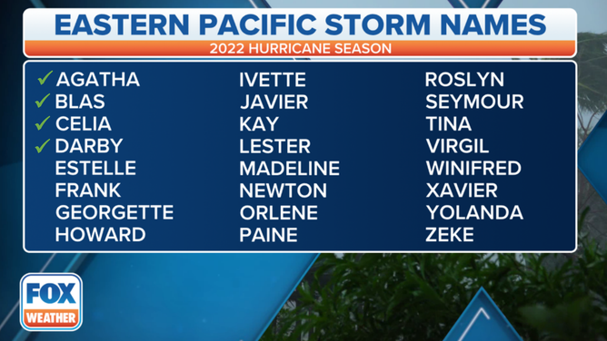
2022 naming list for the Eastern Pacific.
(FOX Weather)