

Timeline: When and where Hurricane Isaias will impact the Gulf coast
Here is a timeline of what the FOX Forecast Center is expecting leading up to and after landfall.
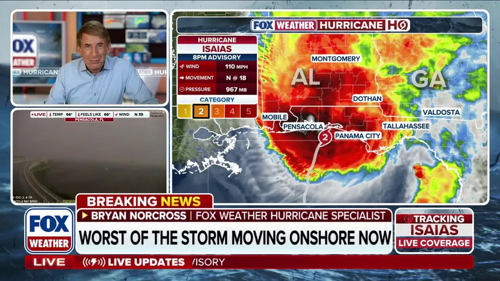
Widespread power outages begin as Hurricane Isaias approaches landfall
🌀 ISAIAS IMPACTS: FOX Weather Hurricane Specialist Bryan Norcross shares an exclusive analysis of Hurricane Isaias' latest impacts as it nears landfall, along with what to expect tonight as it brings serious impacts to the Southeast.
Hurricane Isaias has slightly weakened to a Category 2 as it bears down on the northern Gulf Coast with landfall imminent, triggering dangerous conditions across the region.
Landfall is expected around 9 to 10 p.m. EST between Pensacola and Destin, Florida.
Here's the storm's latest timeline according to the latest forecasts:

(FOX Weather)
The National Hurricane Center said that weather conditions are deteriorating quickly and Gulf Coast residents are being urged to seek shelter immediately.
Isaias is expected to bring heavy rain, flash flooding and even tornadoes across the northern Gulf Coast as well as feet of dangerous, life-threatening, storm surge along the coastline.
Friday
Hurricane Isaias is expected to complete its sharp turn to the north through the day Friday as it accelerates on its final approach to the northern Gulf Coast.
Heavy rain will increase in intensity through the day from Louisiana to Florida, while strong winds are expected to begin impacting the coast later in the afternoon.
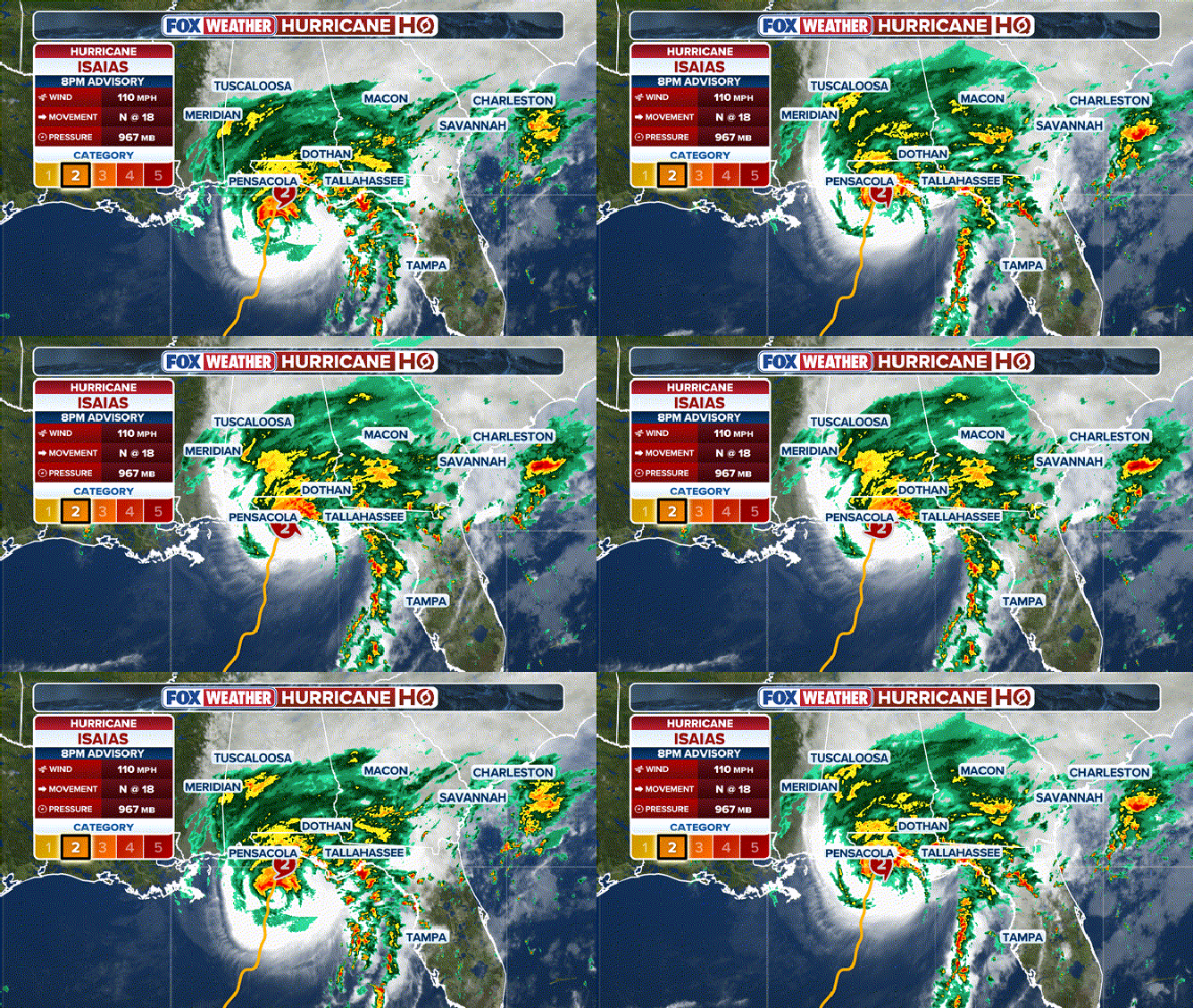
Hurricane Isaias as of 8 p.m. ET NHC update.
(FOX Weather / FOX Weather)
Strong wind gusts between 30 and 40 mph will arrive along the Louisiana, Mississippi, Alabama and western Florida coastlines by late morning Friday.
Wind gusts will then strengthen in the evening hours to 50 and 60 mph across coastal Mississippi, Alabama and Florida, including Mobile and Panama City, Florida.
WHAT'S THE DIFFERENCE BETWEEN A HURRICANE MAKING A DIRECT HIT AND LANDFALL?
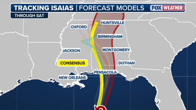
Computer forecast model track for Hurricane Isaias.
(FOX Weather)
Landfall is forecast Friday evening, with hurricane-force gusts of 110 mph or stronger expected from Mobile to Panama City as the storm comes ashore.
FOX Weather Hurricane Specialist Bryan Norcross noted that several dynamic factors still remain at play, which will determine how strong and exactly where Isaias will make landfall, namely the storm's angle of approach and how the winds will impact the storm as it comes ashore.
Currently, Isaias is forecast to weaken just before reaching the coast, but the National Hurricane Center expects Isaias to remain a dangerous hurricane at landfall.
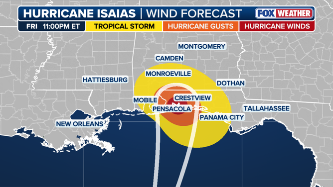
Winds approaching landfall
(FOX Weather)
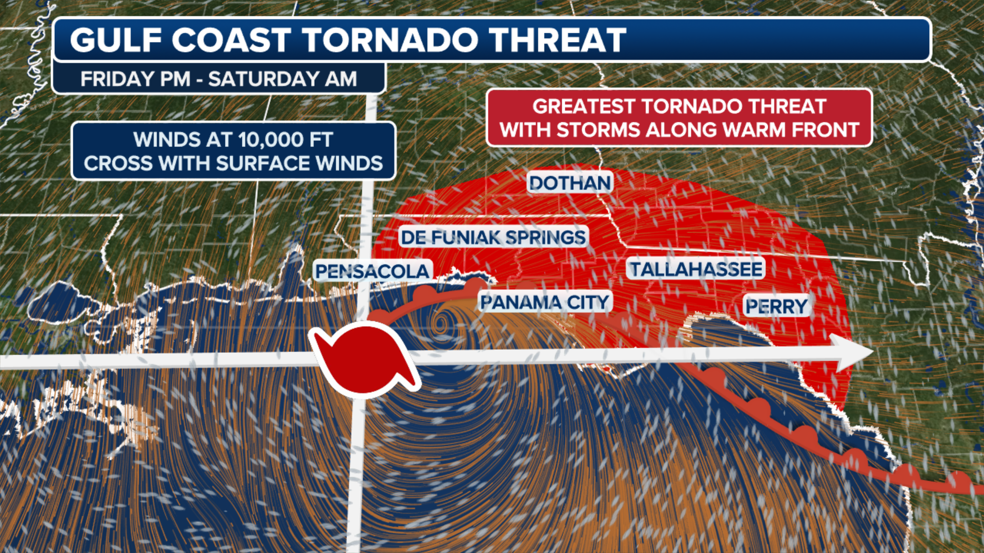
Starting Friday evening, severe storms capable of producing tornadoes are forecast to develop across the Florida Panhandle ahead of Isaias.
A Level 2 out of 5 risk of severe thunderstorms has been issued for late Friday for southern portions of Alabama and the western Florida panhandle.
(FOX Weather)
It is expected that some areas will see 6 to 10 inches with localized higher amounts of up to 15 inches, which will lead to flash and urban flooding and eventually river flooding.
NOAA's Weather Prediction Center (WPC) has issued a flash flood risk for Friday across portions of Louisiana, Mississippi, Alabama, Florida, Georgia, as well as southern portions of Tennessee, southwestern North Carolina and western South Carolina.
A Level 3 out of 4 flash flood risk covers Mobile, Alabama, and the Florida Panhandle west of Panama City. A Level 2 risk includes Atlanta and Montgomery, Alabama, and eventually shifts inland into Saturday to include the Carolinas and Tennessee Valley.
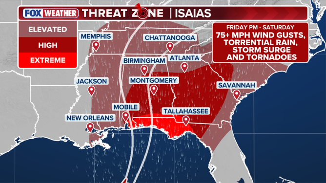
Exclusive FOX Weather Threat Zone
(FOX Weather)
Saturday
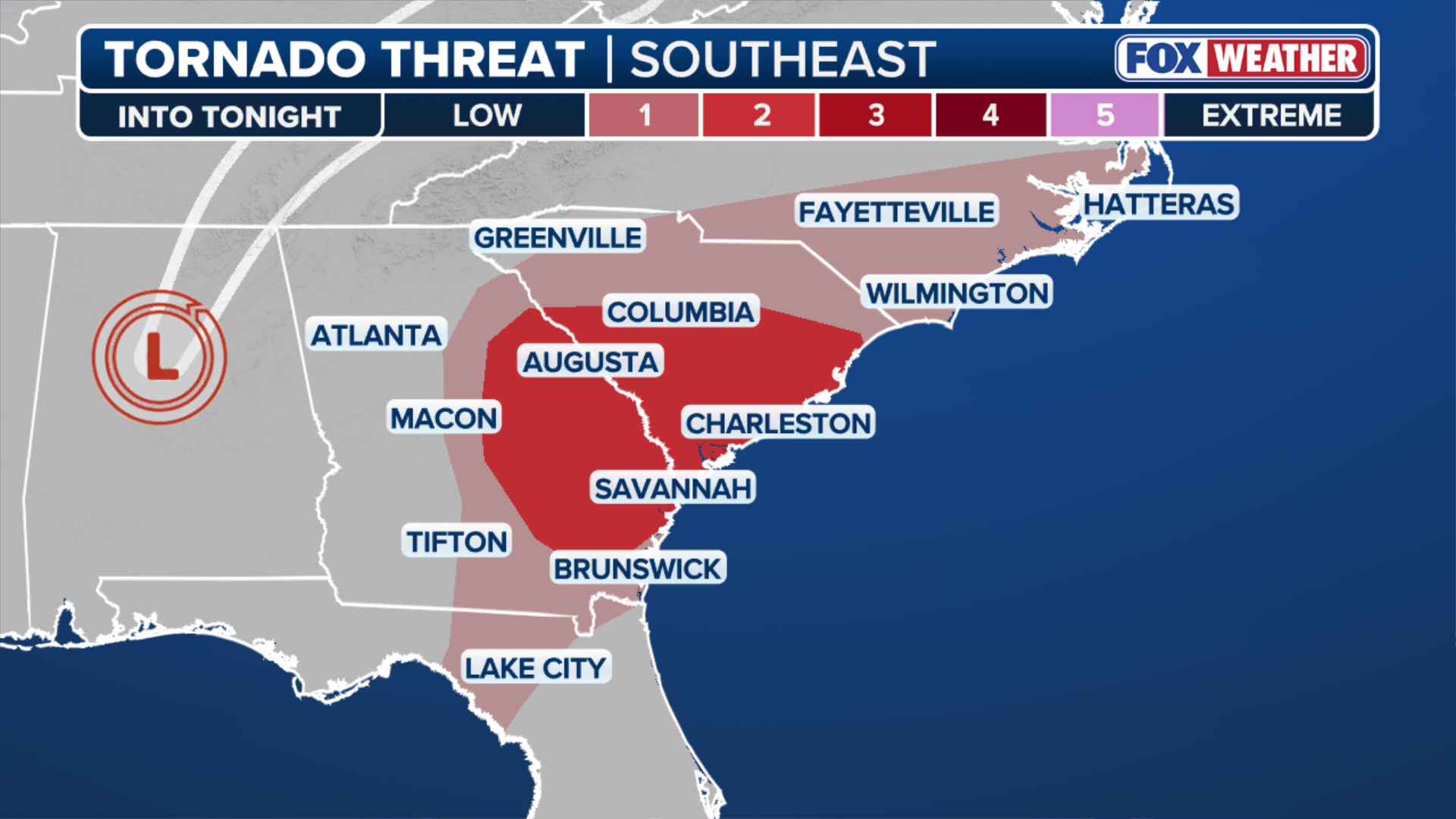
The FOX Forecast Center said a Level 2 out of 5 severe weather risk will continue through Saturday morning because of the threat of tropical tornadoes. The tornado threat will expand across a much larger area across the Gulf Coast and the South, including much of Georgia and portions of central South Carolina.
CALIFORNIA DECLARES STATE OF EMERGENCY AS POTENTIALLY HISTORIC SUPER EL NIÑO LOOMS
(FOX Weather)
The system is expected to move inland late Saturday morning and will continue to bring inches of rain across a wide stretch of the Southeast, including western North Carolina.
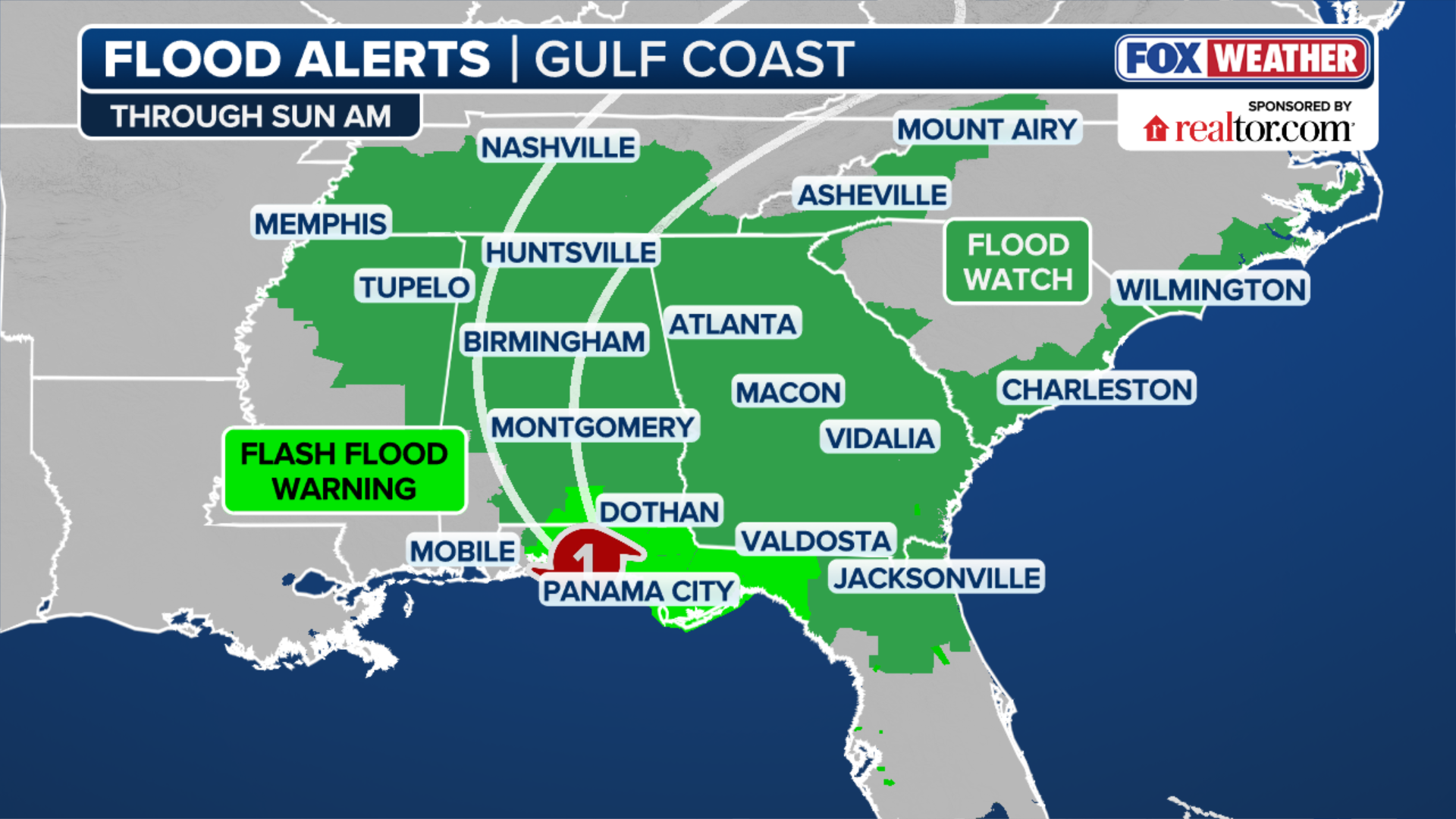
A Level 2 of 4 flash flood threat exists from Tallahassee north into western North Carolina, as well as along the Southeast coast and into the Tennessee Valley.

(FOX Weather)
The FOX Forecast Center said at least 5 to 8 inches of rain is expected from Charleston to Wilmington, North Carolina. Flood Watches extend from the Florida Panhandle north into Middle and West Tennessee.
Farther west, moisture moving into the higher elevations of the Appalachians will raise concerns about flash flooding.
The region remains particularly vulnerable to tropical flooding, especially after Hurricane Helene devastated parts of the Appalachians just two years ago.
(FOX Weather)
Rainfall totals could reach up to 3 inches, with locally higher amounts possible.
Sunday
By Sunday, rain will spread north along the East Coast, where a Level 1 out of 4 flash flood threat exists from Norfolk, Virginia, to Providence, Rhode Island.

(FOX Weather)
Urban flash flooding will be possible, with up to 3 inches of rain expected. However, most of the rain should occur early on Sunday.
Strong wind gusts will continue as the storm begins to weaken, with the highest gusts closer to the storm’s center.
Isaias will be the first Atlantic hurricane to make landfall in the Lower 48 since devastating Hurricane Milton in 2024.
Stay with FOX Weather for the latest.