Third Alberta Clipper of the week impacts Northeast on Thursday; more systems to follow into the weekend
This latest Alberta Clipper in the parade is expected to be more wet than white
Third Alberta Clipper of the week impacts Northeast on Thursday
The third Alberta Clipper of the week impacts the Northeast on Thursday.
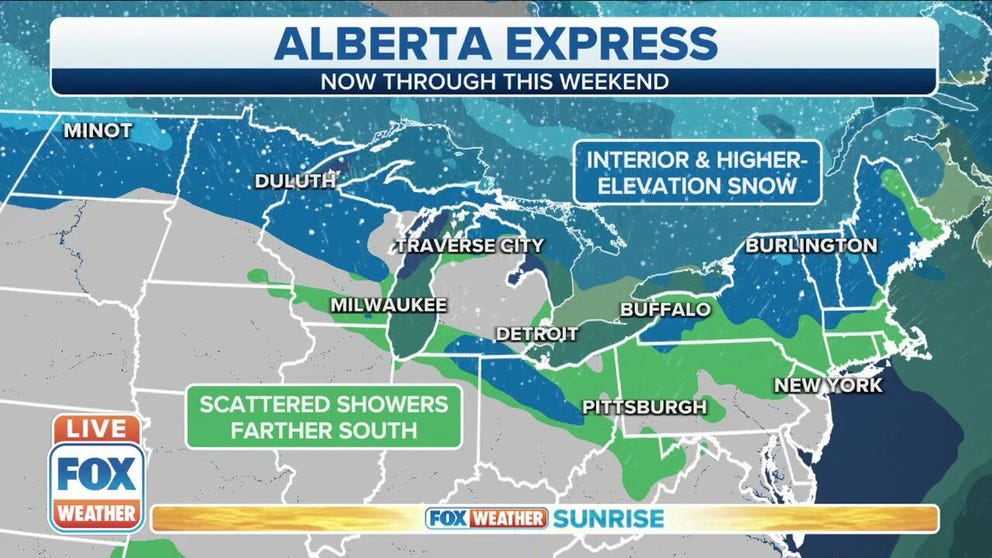
The third Alberta Clipper since Sunday is sweeping across the Northeast with more rain and snow on Thursday, and that will be followed by additional clipper systems into the weekend.
Alberta Clippers are fast-moving weather systems that receive their name from where they originate in western Canada. They sweep across the northern tier of the United States rather frequently during the late-fall and winter months and provide quick bursts of snowfall.
The first clipper system raced through the Great Lakes and Northeast Sunday into early Monday, dropping accumulating snow from Michigan to Pennsylvania to Maine. Flurries were reported as far south as New Jersey. Then, a second clipper dove into the Great Lakes late Monday and swept through the Northeast on Tuesday, with dustings of snow reported in many areas.
SNOW PROVIDES WINTRY BACKDROP IN GREAT LAKES, NORTHEAST AS ALBERTA CLIPPER SWEEPS ACROSS REGION
However, this latest Alberta Clipper in the parade is expected to be more wet than white as warmer-than-average temperatures engulf most of the United States.
(FOX Weather)
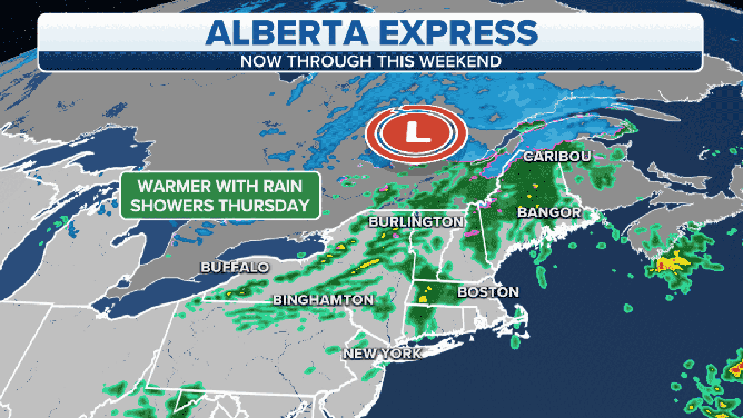
On Thursday, rain is expected from parts of Pennsylvania to upstate New York and northern New England. Temperatures will be well above average during the day, so there are no concerns for wintry precipitation in most of the region.
The only exception is far northern New England, particularly northern Maine and northern New Hampshire, where periods of snow or a wintry mix are expected Thursday morning. However, even these areas should eventually change to rain in the afternoon as milder air arrives.
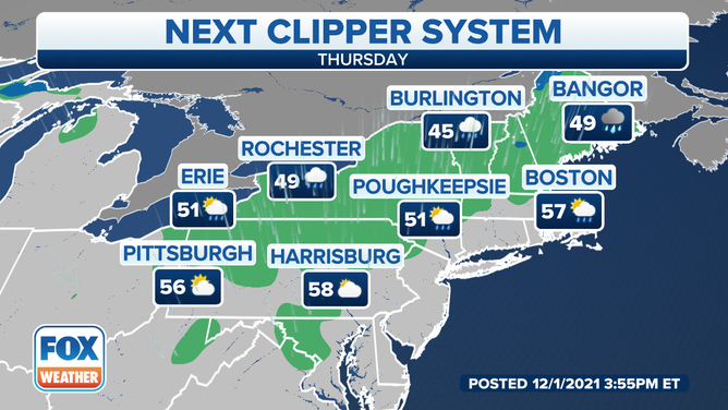
Forecast for Thursday, Dec. 2, 2021.
(FOX Weather)
Thursday night, some snow showers could develop in parts of western Pennsylvania, upstate New York and northern New England as much colder air rushes in behind the clipper system. Any snow showers should come to an end Friday afternoon.
A few inches of snow is possible in northern New England between any snow Thursday morning and again Thursday night into early Friday, with the highest accumulations in Vermont's Green Mountains and New Hampshire's White Mountains.
Very minor accumulations are possible in western Pennsylvania and upstate New York with any snow showers Thursday night into Friday morning, generally just a dusting to an inch or two over the higher elevations. Locally higher amounts are possible in the high peaks of the Adirondacks.
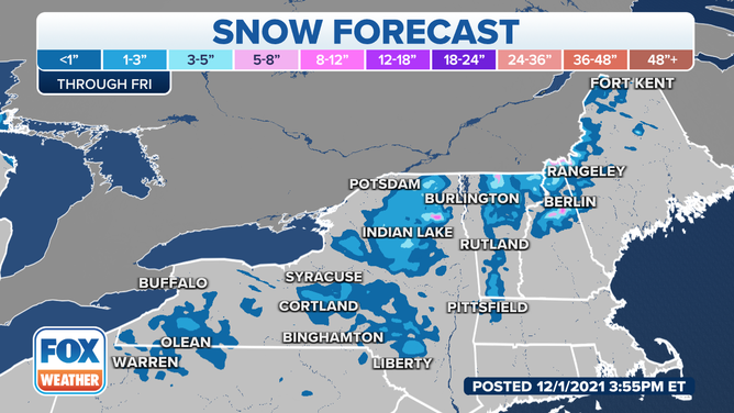
Snow forecast through Friday, Dec. 3, 2021.
(FOX Weather)
We are tracking the possibility of additional Alberta Clippers into the weekend that could bring more light snow or rain to the Great Lakes and Northeast. Any snow accumulations with these systems would likely be minor.