

Super El Niño declared as forecasters warn of major shifts in weather during winter season
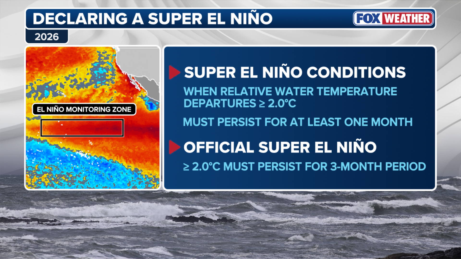
Water temperatures in the Niño 3.4 region of the equatorial Pacific, where forecasters monitor the strength of El Niño, have climbed to 2.0°C above average, meeting the threshold for the designation.
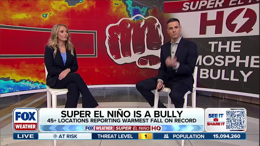
File: The Atmospheric Bully: Super El Niño flexes its muscles — what happens next?
A brewing Super El Niño is flexing its influence across the atmosphere, shaping weather patterns from the Southwest to the Atlantic. FOX Weather Meteorologists Ian Oliver and Haley Meier break down how the powerful climate pattern will continue to affect the U.S. this fall and winter.
THE TAKEAWAY:
- NOAA announced that the 2026 El Niño has reached Super El Niño status.
- Water temperatures in the Niño 3.4 region of the equatorial Pacific have climbed to 2.0°C above average for three consecutive months.
- A Super El Niño will have a major impact on the 2026–2027 winter, causing more storms in the southern tier of the U.S. and above-average temperatures in the northern tier.
NOAA's Climate Prediction Center (CPC) announced Thursday that the 2026 El Niño has officially reached Super El Niño status, also known as a Very Strong El Niño.
Water temperatures in the Niño 3.4 region of the equatorial Pacific, where forecasters monitor the strength of El Niño, have climbed to 2.0°C above average, meeting the threshold for the designation.
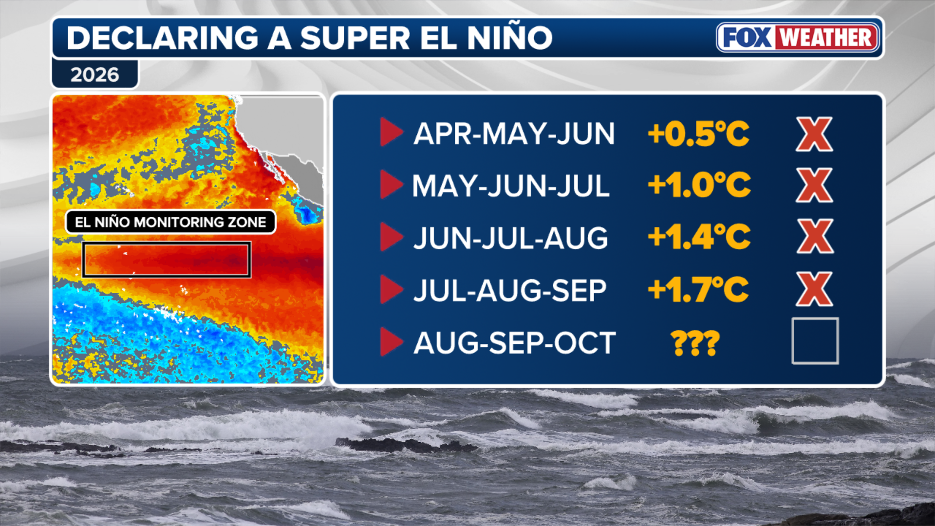
To determine the strength of the climate pattern, forecasters use a three-month average of ocean temperatures rather than daily readings. This approach helps account for short-term fluctuations and provides a more consistent picture of changing ocean conditions.
(FOX Weather)
The latest evaluation found that the three-month period from August through October reached the 2°C threshold. An earlier assessment covering July through September did not record temperatures high enough to qualify as a Super El Niño.
NASA SATELLITES REVEAL STRIKING OCEAN COLOR CHANGE AS SUPER EL NIÑO STRENGTHENS
El Niño has been in effect since late spring, gradually strengthening throughout the summer and into the fall.
Forecasters had anticipated for months that the climate pattern would reach Super status by late fall, with conditions potentially lasting through spring 2027. By then, La Niña conditions are forecast to take over.
(FOX Weather)
Even before officially reaching Super status, El Niño has already shown the potential to influence weather patterns around the world, particularly during hurricane season in the Atlantic and Pacific basins.
SUPER EL NIÑO FUELED WINTER COULD UNLEASH MORE STORMS, DRIVING MORE ACTIVE PATTERN INTO THE SOUTH
The last Super El Niño occurred during 2015–2016, making the current event particularly significant.
How will Super El Niño impact the 2026-27 winter?
One of the hallmarks of a Super El Niño pattern is an extended, highly active Pacific jet stream. This acts as a storm conveyor belt, steering repeated systems and moisture across the southern tier of the country.

Coastal erosion causes sinkhole to swallow driveway of Nicolas Cage's Malibu home
The home of Hollywood blockbuster star Nicolas Cage was damaged after a massive sinkhole swallowed the driveway. Authorities said severe coastal erosion caused the collapse, with the sinkhole estimated to be about 30 feet by 30 feet in size. Drone footage shows the extent of the damage with the entire driveway in the in the hole as the ocean crashes under the house and over the debris. Officials confirmed the home was unoccupied at the time and no injuries were reported.
According to NOAA's Winter Outlook for the 2026–27 season, increased storm activity is expected from Southern California across the southern U.S. and into Florida.
California, the Southwest, Texas, the Gulf Coast, the Southeast and parts of the Mid-Atlantic could experience more frequent storms and above-average precipitation.
Florida could be particularly vulnerable to periods of heavy rainfall and even severe weather.
Signs of this active pattern were already evident last week, when multiple rounds of storms brought flooding to parts of the Sunshine State.
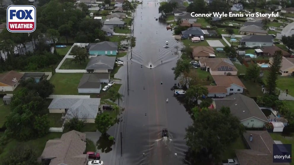
East Coast of Florida endures serious flooding with more rain on the way
Check out the scene in Palm Bay, Florida, where roads are completely flooded, forcing locals to use canoes and boats to travel through the area, with more rain expected through Wednesday.
Along the Pacific Coast, repeated atmospheric river events could bring periods of heavy rain and mountain snow.
How will temperatures be impacted?
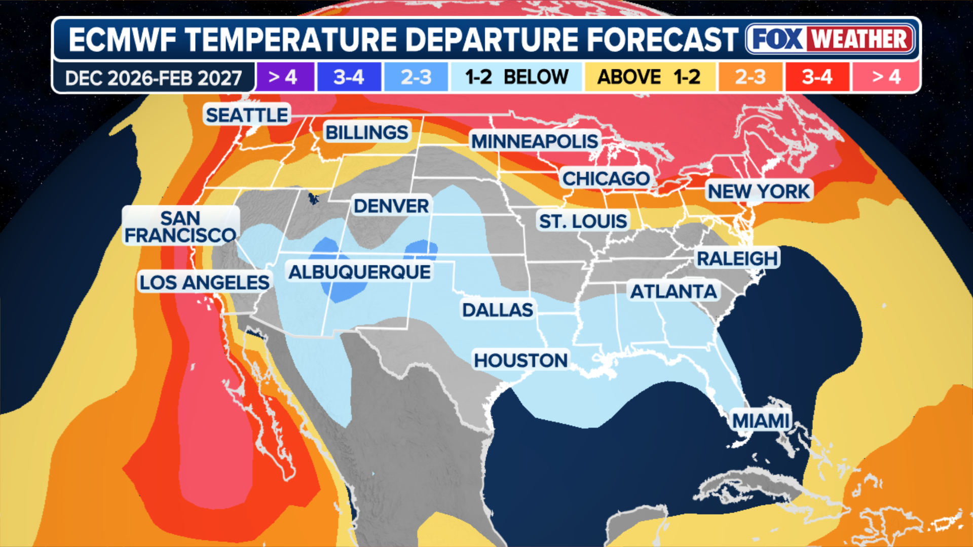
Super El Niño can also influence winter temperatures across the country, creating a noticeable divide between the northern and southern U.S.
(FOX Weather)
This pattern is largely driven by the position of the jet stream, which typically shifts farther south during El Niño winters. The resulting circulation can allow milder Pacific air to spread across the northern states while directing stormier conditions into the South.
SUPER EL NIÑO THEN AND NOW: HOW THIS YEAR'S STRENGTHENING EVENT COMPARES TO HISTORIC EXTREMES
Persistent high pressure and Pacific-influenced air across the Pacific Northwest, Northern Plains, Upper Midwest and Great Lakes could contribute to above-average winter temperatures. Much of Canada is also expected to experience a warmer-than-average winter.
Meanwhile, frequent precipitation, extensive cloud cover and active storm tracks across the southern U.S. could keep daytime temperatures below average in parts of the Southwest, Southern Plains and Gulf Coast.
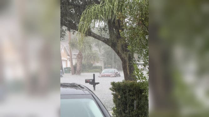
Serious flooding in Melbourne, Florida.
(Hannah Scott)
What does Super El Niño mean for snowfall?
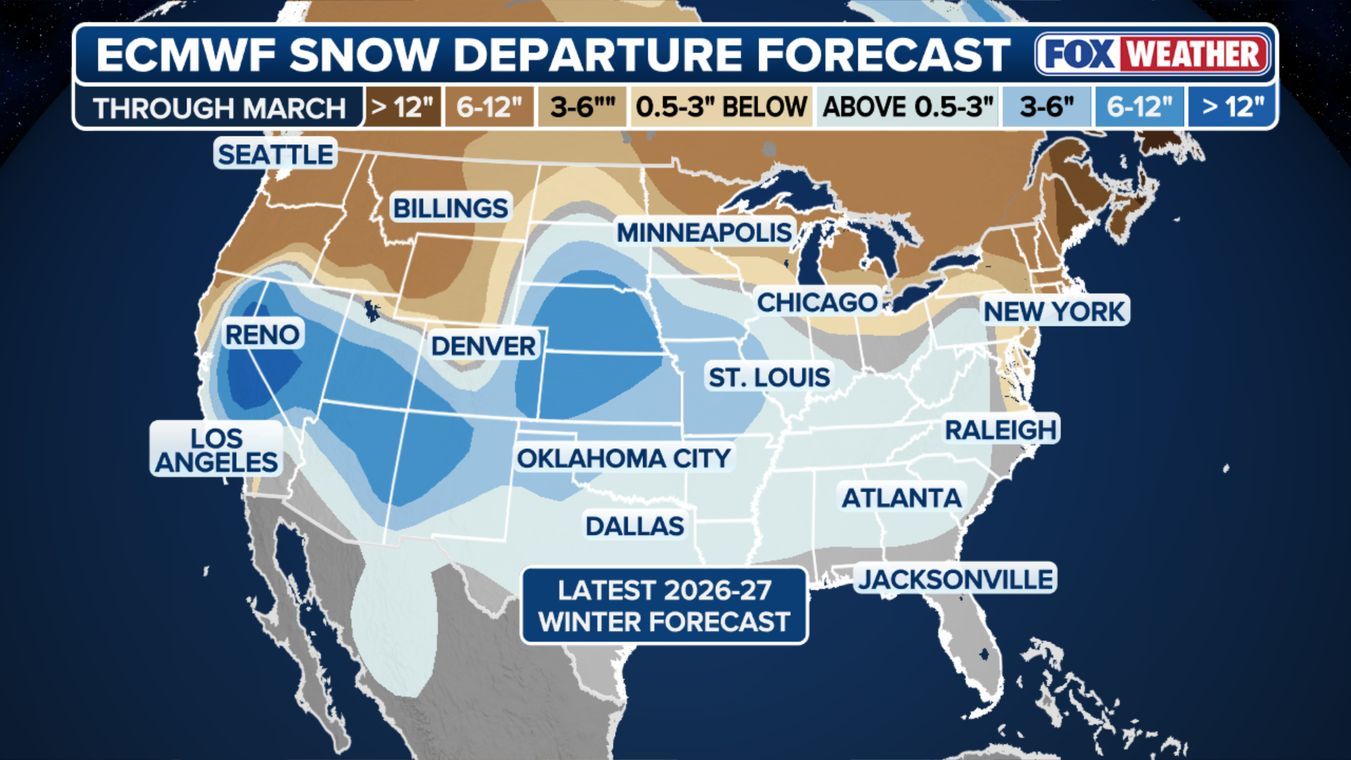
Snowfall potential can also shift significantly during a Super El Niño winter.
Because snowstorms depend on the overlap of abundant moisture and sufficiently cold temperatures, changes in the jet stream can create contrasting outcomes across some of the country's major winter weather regions.
With the active Pacific jet stream directing moisture toward California and the Southwest, mountain elevations in the Sierra Nevada and Southern Rockies could see significant snowfall.
(FOX Weather)
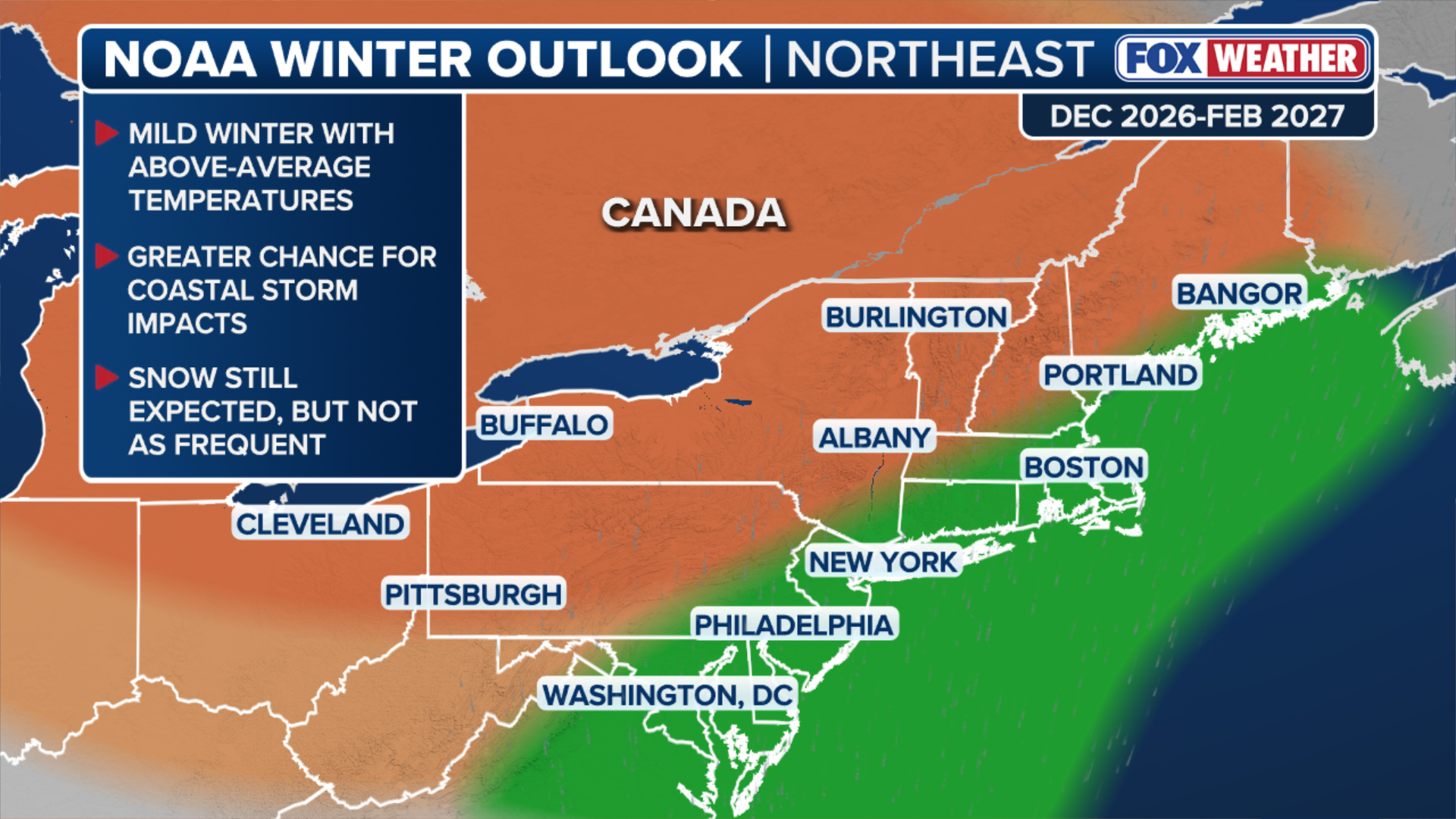
Farther east, an energized southern storm track could increase the potential for heavy precipitation and coastal nor'easters from the Southern Plains to the Mid-Atlantic.
If cold air masses push far enough south and interact with this active corridor of moisture, the setup could support high-impact winter storms.
However, with the northern branch of the jet stream typically displaced farther north during El Niño, traditionally cold and snowy regions could see below-average seasonal snowfall. This includes parts of the Northern Rockies, Midwest and Northeast.
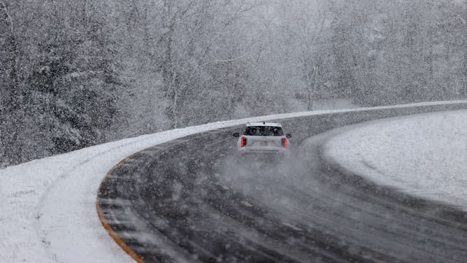
North Attleboro, MA - February 12: A car maneuvers through a snowy I-95 South.
(Jonathan Wiggs/The Boston Globe / Getty Images)
That doesn't mean winter storms are off the table. Individual Arctic air outbreaks can still bring bitterly cold temperatures and significant snowfall, even in an overall warmer-than-average winter.
'HISTORIC' EL NIÑO INCREASINGLY LIKELY, WITH 83% CHANCE OF BECOMING THE STRONGEST ON RECORD
How does a Super El Niño impact nor'easters?
Nor'easters can become more frequent during El Niño winters because the large-scale weather pattern often favors storm development across the southern U.S. before systems move toward the East Coast.
(FOX Weather)
Unusually warm waters in the tropical Pacific influence the jet stream, often strengthening the subtropical jet across the southern U.S. This can create a more active storm track from the Gulf Coast and Southeast toward the Atlantic Seaboard.
Rather than tracking north through Canada, more weather disturbances can move east across the southern states before turning northeast along the coast, creating favorable conditions for nor'easter development.
These storms strengthen by drawing energy from sharp contrasts between warm and cold air.
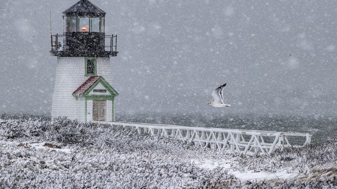
Nantucket, MA - February 13: Brant Point Light during the height of the snowstorm gets a flyby from a gull.
(Stan Grossfeld/The Boston Globe / Getty Images)
During El Niño winters, storms moving northward can pull warm, moisture-rich air from the South into contact with colder air over the Northeast.
This temperature contrast can help storms rapidly intensify, potentially producing powerful winds, heavy precipitation, coastal flooding and, when temperatures are cold enough, significant snowfall.
However, even though nor'easters will be more prevalent during El Niño, it does not guarantee there will bring more impacts in the form of rain, snow and wind.