Tornado watch issued as severe storms move across parts of the Southeast
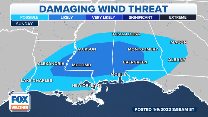
Strong, gusty winds appear to be the biggest threat, but tornadoes and hail can’t be ruled out.
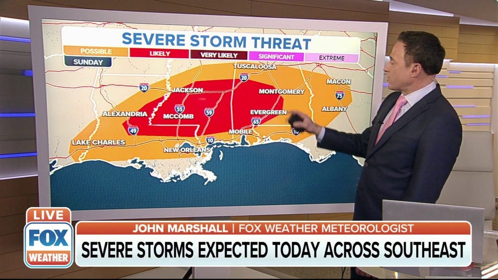
Severe storms expected across the Southeast on Sunday
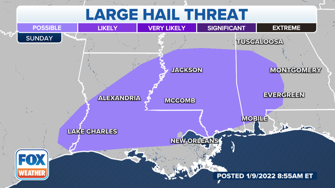
Strong winds, large hail, and the chance for tornadoes are all possible Sunday across parts of the Southeast.
Strong winds, large hail, and the chance for tornadoes are all possible Sunday across parts of the Southeast.
With the ongoing storms from Saturday pushing east and plenty of moisture streaming in from the Gulf of Mexico, severe storms will be likely across Louisiana, Mississippi and Alabama.
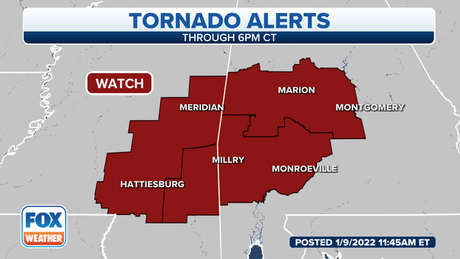
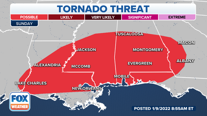
A tornado watch is in effect for parts of Mississippi and Alabama until 6 p.m. Central
(FOX Weather)
And because of the favorable conditions for some tornadoes, a watch has been issued for parts of Mississippi and Alabama until 6 p.m. Central.
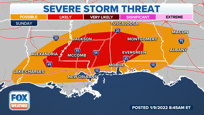
Severe storm threat for Sunday, Jan. 9, 2022.
(FOX Weather)
THE 5-POINT SEVERE THUNDERSTORM RISK CATEGORY SCALE EXPLAINED
Strong, gusty winds appear to be the biggest threat, but tornadoes and hail can’t be ruled out.
![]() Image 1 of 3
Image 1 of 3Damaging wind threat for Sunday, Jan. 9, 2022. ( )
![]() Image 2 of 3
Image 2 of 3Tornado threat for Sunday, Jan. 9, 2022. ( )
![]() Image 3 of 3
Image 3 of 3Large hail threat for Sunday, Jan. 9, 2022. ( )
With all the ongoing storms, a flooding threat exists through Monday.
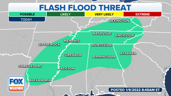
Flooding threat for Sunday, Jan. 9, 2022.
This same system produced severe weather in eastern Texas on Saturday, where several tornado warnings were issued around the Houston metro region.
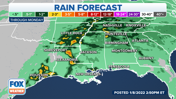
Rain forecast through Monday.
The front is expected to clear most of the country by Monday except for portions of the Sunshine State.
Isolated thunderstorms will be possible for parts of South Florida, but they are expected to remain below severe limits.
The cold front will live up to its name and help usher cooler air to start the workweek.
Download the FOX Weather app now to track the storms using 3D radar.