Severe storm threat impacts 1,600 miles; devastating damage reported in Matador, Texas
Damage was reported in Matador, Texas, after the National Weather Service says a confirmed tornado ripped through the city.
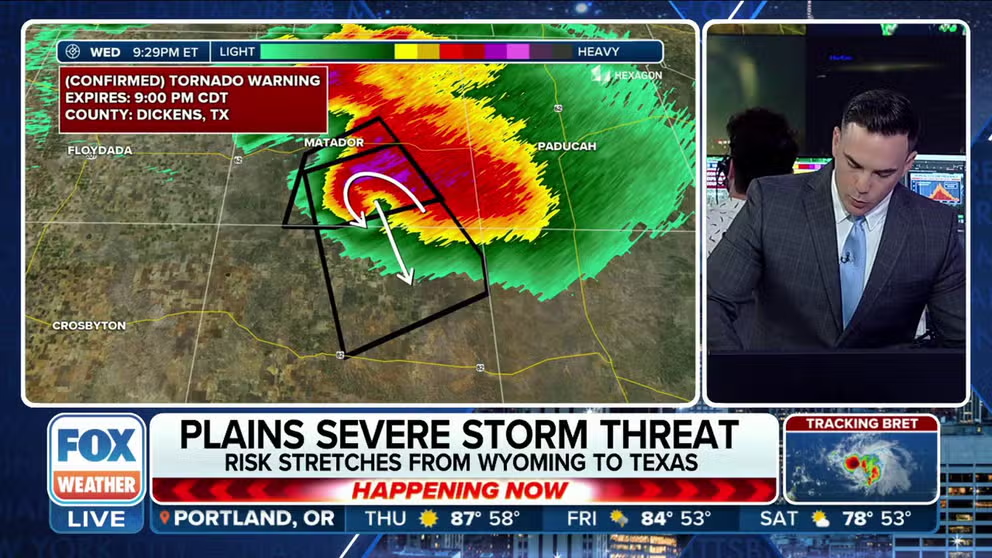
Confirmed tornado moved through Matador, Texas
A tornado has reportedly caused damage in Matador, Texas. FOX Weather's Steve Bender has the details on the storms wreaking havoc in Texas.
Watches for severe storms stretched more than 1,600 miles Wednesday as severe storms produced tornadoes and strong winds that knocked out power to nearly half a million in Texas alone.
Law enforcement in Matador, Texas, confirmed damage after a tornado ripped through the city. Lubbock Fire and Rescue were called to the town to help with search and rescue operations.
Multiple tornadoes were seen moving through Northeast Colorado, including a landspout in Sterling.
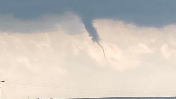
A landspout over northeastern Colorado. June 21, 2023.
(Lavalla Reher / Facebook / FOX Weather)
As the storms moved through Colorado, golf ball-sized hail was seen.
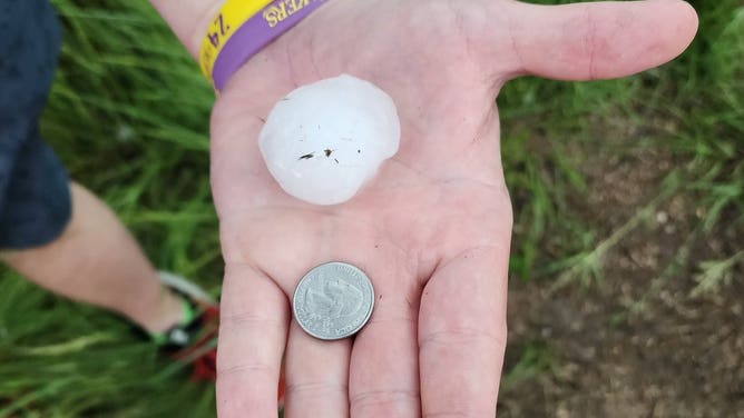
Hail that fell over North Sterling State Park in northeastern Colorado. June 21, 2023.
(@realAbeSandy / Twitter / FOX Weather)
Additionally, flash flooding was an issued in Colorado. The Colorado Springs Fire Department conducted multiple water rescues as high waters caused vehicles to become stuck.

A black SUV stuck in floodwater in Colorado, as white hailstones float on the water's surface. June 21, 2023.
(@CSFDPIO / Twitter / FOX Weather)
In the image above, a black SUV is stuck in floodwater as tiny white hailstones float around it.
Colorado Springs Fire Department officials have asked drivers to avoid the area, as several roads have been blocked or shut down.
Nearly 500,000 without power in Texas Wednesday evening
(FOX Weather)
Nearly half of a million customers in Texas were without power on Wednesday evening as severe storms ripped through the state.
Strong winds were reported in Houston just before the power went out.
In Motley County, the location of the Matador tornado, the whole county reported without power as of late Wednesday evening.
Tornado, Severe Thunderstorm Watches issued

(FOX Weather)
Because of the risk of severe weather, Severe Thunderstorm and Tornado Watches were issued for several areas of the central Plains.
The radar loop below shows where the worst storms are located.

(FOX Weather)
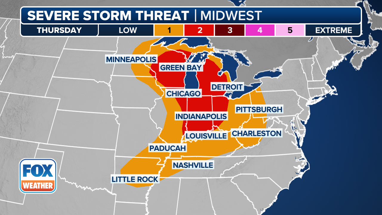
Severe storm threat for Thursday
(FOX Weather)
For many areas hit by storms on Wednesday, the severe weather threat will persist on Thursday.
An area stretching from southeastern Wyoming down to northeastern New Mexico will likely be under a severe storm threat, whereas the threat is possible between southwestern Nebraska down to west Texas.