Active pattern will produce more severe weather across South
Thunderstorms will be capable of producing large hail and damaging winds, but an isolated tornado cannot be ruled out
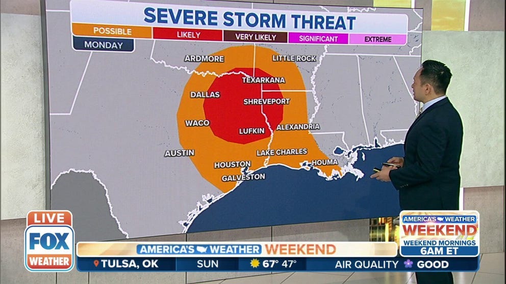
Multiple rounds of severe weather brewing for the South
The southern U.S. is under the threat of severe weather at the beginning and end of the week.
A storm system that will move through the South during the workweek will produce several rounds of thunderstorms from Texas through Florida, and some may be strong to severe.
Meteorologists say the wet weather is expected to kick off on Monday across The Lone Star State as a low-pressure system takes advantage of moisture streaming in from the Gulf of Mexico.
Storms are expected to start popping during the afternoon and evening hours and could produce large hail and damaging winds.
HOW TO WATCH FOX WEATHER ON TV
Meteorologists say the tornado threat could remain limited because ingredients won’t be in place for a widespread outbreak, but an isolated tornado or two cannot be ruled out.

The threat is expected to move eastward into the Arklatex region during the evening hours and into Tuesday morning.
Storms are expected to weaken over parts of Arkansas and Louisiana before another round of rain develops on Tuesday.
GAS PRICES IMPACTING THE PRICE OF STORM CHASING
Tuesday’s storms could impact the same region that saw significant weather on Saturday with damaging winds and tornadoes.
As the system marches eastward, parts of southern Georgia and Florida are all in the zone for possible severe storms.

Hail, damaging winds and the possibility of a few tornadoes exists before the storm system pushes off into the Atlantic by Wednesday morning.

The Florida Panhandle could see the heaviest rain with as much as three inches possible between Pensacola and Tallahassee.
After the wet weather moves out, attention will turn to the Plains where the next storm system is expected to develop on Thursday.