Severe Thunderstorm Watches issued as storms produce damaging winds, hail across Midwest
Thunderstorms will be capable of producing hail, damaging winds and tornadoes
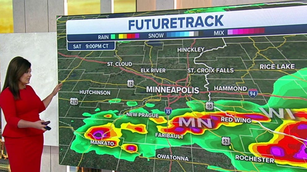
Tracking severe storms moving across the Upper Midwest
The severe thunderstorms Saturday have already spawned dangerous weather outside of Chicago and round two will be coming up later in the day for the rest of the Midwest.
A quick-moving storm system will blast through the Midwest this weekend in what forecasters are calling the most significant severe weather event in at least two weeks.
Meteorologists anticipate that the combination of instability and moisture will be sufficient for thunderstorms to erupt during the late afternoon and evening.
HOW TO WATCH FOX WEATHER ON TV
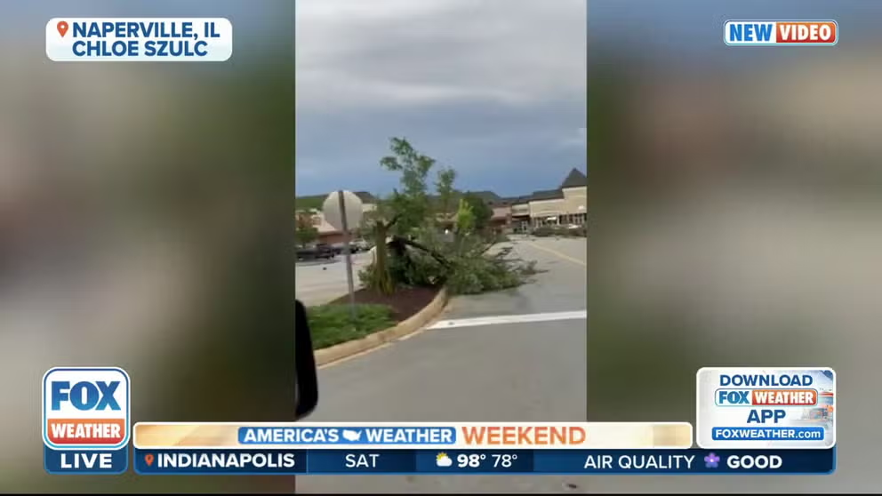
Damage seen after tornado in Chicago suburbs
The National Weather Service confirmed a tornado in Naperville, Illinois, early Saturday morning. Damage was seen in a shopping center in the south part of the city.
Heat triggera severe weather, and that was already happening early Saturday in Chicago, where storms brought strong winds, hail and two tornadoes.
![]() Image 1 of 3
Image 1 of 3Damage in Naperville, IL, after the NWS confirmed a tornado moved through early Saturday. (Twitter: @ChloeSzulc)
![]() Image 2 of 3
Image 2 of 3Damage in Naperville, IL, after the NWS confirmed a tornado moved through early Saturday. (Twitter: @ChloeSzulc)
![]() Image 3 of 3
Image 3 of 3Damage in Naperville, IL, after the NWS confirmed a tornado moved through early Saturday. (Twitter: @ChloeSzulc)


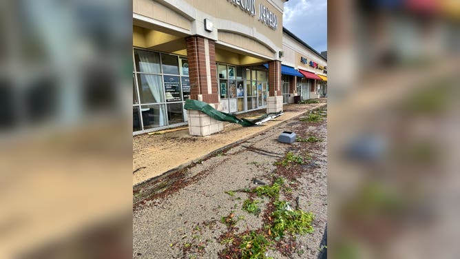
The National Weather Service confirmed the two tornadoes Saturday. An EF-0 hit a Naperville shopping center, and another EF-0 touched down in Crest Hill before moving into Joliet.
"Some heat is still building over part of the Central Plains and Upper Midwest," FOX Weather meteorologist Amy Freeze said. "Part of that heat can trigger showers and thunderstorms."
A Tornado Warning was issued for northwest Will County and South Central Cook County in Illinois until 6:30. The NWS Chicago reports a confirmed tornado was located over Romeoville, northwest of Chicago, just before 6 a.m. CT, moving southeast at 40 mph.

Severe Thunderstorm Watches have been issued for parts of the Midwest ahead of ongoing severe storms.
Forecast models show daytime heating will help many areas reach 90 degrees before the storms pop during the afternoon and evening.

"We have a storm system moving in, and we have a very likely risk of severe weather from Minneapolis, to La Cross to Wausau, Wisconsin," FOX Weather meteorologist Jane Minar said. "But the threat extends across much of Minnesota, Wisconsin, down into northern Iowa and Illinois."

WE'VE ENTERED AMERICA'S MOST ACTIVE TIME FOR DAMAGING WINDS FROM SEVERE THUNDERSTORMS
The threat is expected to progress into the Great Lakes region overnight from Saturday into Sunday.
The showers and thunderstorms are expected to start losing intensity as they work into a more stable environment, and the system enters southern Canada.

The trailing front will help to kick off showers and thunderstorms on Sunday from the Northeast into the Ohio and Missouri valleys.
Meteorologists believe the severe weather ingredients will not be as favorable as on Saturday, but there will be enough moisture and instability to produce scattered strong to severe storms.
The Storm Prediction Center has highlighted an area from near Kansas City through Upstate New York for the possibility of seeing damaging wind gusts and hail.

CLICK HERE TO GET THE FOX WEATHER UPDATE PODCAST
Be sure to download the FOX Weather app to track any storms in your area and receive potentially life-saving weather alerts issued by the National Weather Service. The free FOX Weather livestream is also available 24/7 on the website and app and on your favorite streaming platform. The FOX Weather Update podcast also provides weather information for the entire country.