Severe weather threat moves to Gulf Coast after dropping large hail in Texas, Oklahoma
Severe storms rumbled through North Texas and southern Oklahoma on Thursday, producing upwards of baseball-sized hail and gusty winds leaving some damage, but the FOX Forecast Center warned the threat is not over yet for parts of the South as the line of storms moves east along a cold front Friday.
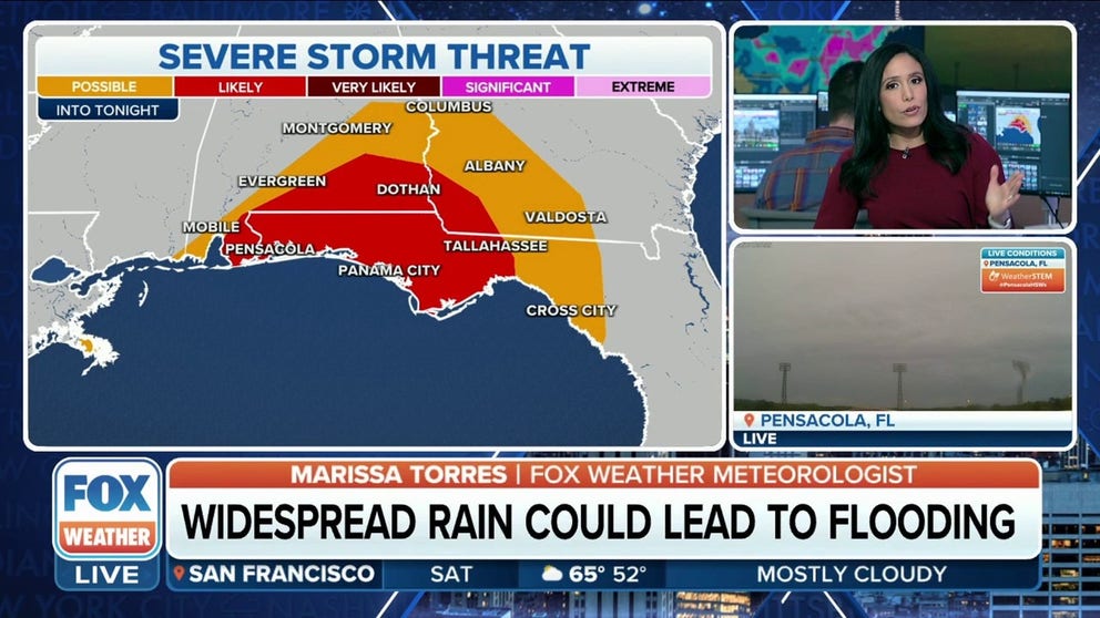
Severe storm threat continues for Gulf Coast Friday night
The greatest risk for severe storms Friday evening will be along the central Gulf Coast.
Severe storms rumbled through North Texas and southern Oklahoma on Thursday, producing upwards of baseball-sized hail and gusty winds leaving some damage, but the FOX Forecast Center warned the threat is not over yet for parts of the South as the line of storms moves east along a cold front Friday.
The storms maintain the potential to produce hail and damaging wind gusts to 60 mph, with an isolated tornado or two possible.
HOW METEOROLOGISTS DETERMINE IF A TORNADO IS TO BLAME FOR STORM DAMAGE

(FOX Weather)
Greatest threat for severe storms across central Gulf Coast Friday
The FOX Forecast Center says a line of thunderstorms will slide eastward Friday along or just ahead of a cold front from coastal Texas into Louisiana and along the Gulf Coasts of Alabama and Mississippi, including New Orleans and Mobile, with an isolated threat for damaging winds and a tornado or two stretching into southwestern Georgia and the Florida Panhandle.

(FOX Weather)
"Given the timeline, it continues to stretch off to the east as we go throughout the day on Friday. So, Friday morning could prove to be even more of a difficult morning commute," FOX Weather meteorologist Jane Minar said.
DOES MARCH REALLY COME IN LIKE A LION AND GO OUT AS A LAMB?
Dallas-area car dealership damaged as storms swept through Metroplex
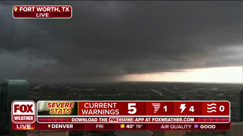
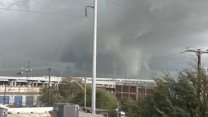
Supercell spotted moving through Fort Worth, TX
Dark clouds loom over Fort Worth, Texas on Thursday as a supercell moves through the area.
Crews were cleaning up damage Thursday night as severe weather tore through parts of Texas.
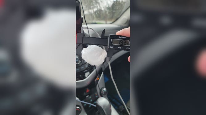
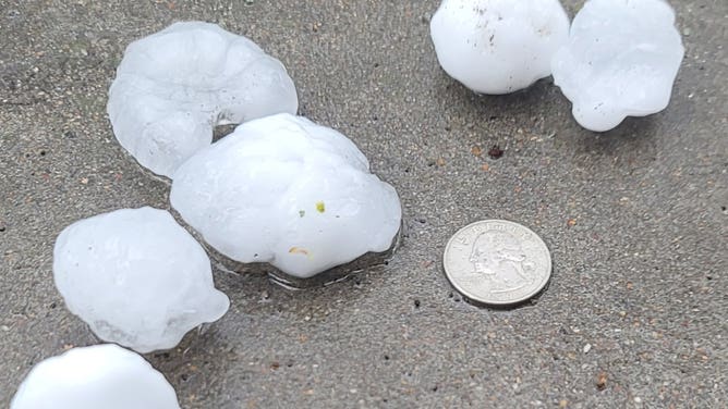
Thunderstorms developed into isolated supercells during the afternoon and became significant hail producers, with stones the size of quarters, golf balls – and even larger. Hail stones the size of a half-dollar-sized were spotted in Parker County, Texas, west of Forth Worth, while hail nearly 2 inches across was measured near Interstate 20 and a 3-inch hail stone was found in Bellaire.
Those were just a few of the dozens of severe weather reports NOAA's Storm Prediction Center received during the afternoon, and the threat of dangerous storms even triggered authorities in Fort Worth to sound tornado sirens as Tornado Warnings were issued for the Dallas/Fort Worth area.
One of those ferocious storms caused significant roof damage at the Autos of Dallas car dealership in Irving, leaving a trail of debris across the parking lot and employees scrambling.
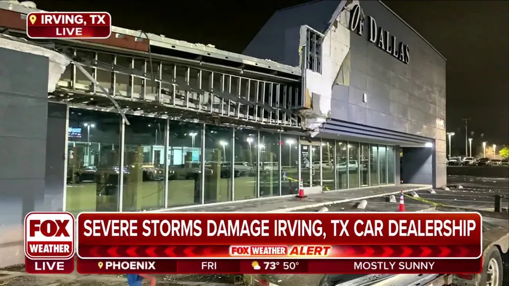
Severe storms damage North Texas car dealership
A car dealership in Irving, Texas sustained major damage from severe storms Thursday. FOX Weather multimedia journalist Brandy Campbell provides a closer look at the damage.
"We were standing on the porch and filming clouds, and we saw rotation, and we thought, 'we've got to get inside,' " David Mullens, general manager of Autos of Dallas, told FOX Weather. "The minute we walked inside the facade blew over, and the wind was blowing and… it was terrible. I don't know how fast (the wind) was blowing, but it was sideways."
The National Weather Service will determine if the damage was the result of straight-line winds or perhaps a brief tornado.
"It was scary, a lot of people screamed," Mullens continued. "I was just walking in the door and I turned and looked and saw it come down and also the windows we're fluctuating, like a vacuum or something."
Luckily there were no reports of injuries.
![Satellite image Thursday]() Image 1 of 5
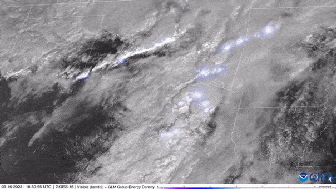
Image 1 of 5Severe storms marching across Oklahoma and Texas on Thursday. ( )
![Scud clouds in Texas]() Image 2 of 5
Image 2 of 5Cleburne, Texas ominous clouds (Bob Pack/LSM)
![Texas hail]() Image 3 of 5
Image 3 of 5Two inch hail near Weatherford, Texas (AndrewJustinWX)
![Ominous clouds in Fort Worth, Texas at I-30 & Vickery Blvd. March 16, 2023.]() Image 4 of 5
Image 4 of 5Ominous clouds in Fort Worth, Texas at I-30 & Vickery Blvd. March 16, 2023. (@housekeysmusic_ / Twitter)
![Texas hail from 3/16]() Image 5 of 5
Image 5 of 5Hail from 3/16 in Parker County, Texas (Tim Farmer)
The adverse weather caused temporary flight restrictions at the Dallas/Fort Worth International Airport where a wind gust of 58 mph was reported and winds at Dallas Love Field gusted to 55 mph. About 25,000 people in Texas were without power early Friday morning, according to PowerOutage.US.
"These storms had a lot of hail with them, but we just have not had that tornado element, which is great news as it moves through the metro of Dallas (Thursday) afternoon," said Brett Adair, a field meteorologist. "On the flooding component, we've had some areas, though, where we had really, really heavy rains because these supercells, if they're not dropping large hail, they're dropping copious amounts of rain."
Storm looks to dampen Spring Break plans in Florida
Showers and a few thunderstorms are expected across the Sunshine state this weekend as this cold front stalls out across the region.
While severe weather is not expected, heavy rain could lead to a few instances of flooding. Around 1-2 inches of rain are possible in some spots stretching from Orlando to Miami, dousing many spring break plans.