

Over 33M Americans from Texas to New Jersey face renewed flood threat as 1,000-mile long severe storms rage on
A Level 2 out of 4 flood risk is in place for parts of Ohio, Pennsylvania and West Virginia through Friday morning.
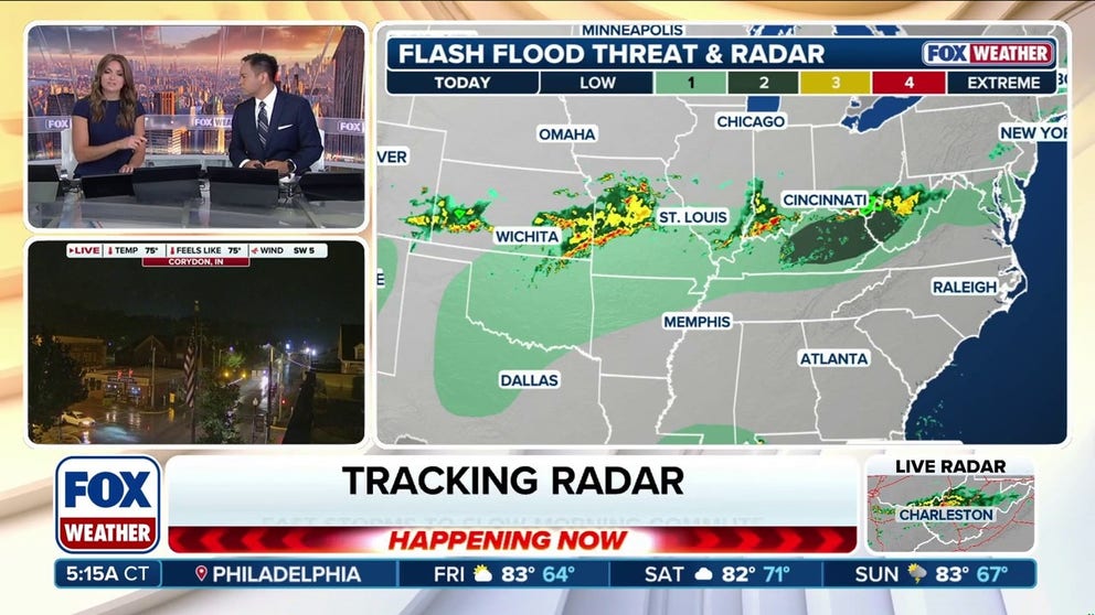
Flood threat renews over Ohio Valley, Appalachians as storms stretch from Texas to New Jersey
A sprawling flash flood threat stretches along a 1,300-mile corridor from North Texas to southern New Jersey Thursday, with some of the heaviest rain expected across the central Appalachians and Ohio Valley — a region that has dealt with repeated flooding in recent weeks.
THE TAKEAWAY
- Rain and thunderstorms will slam North Texas through the Ohio Valley to the I-95 corridor in the Mid-Atlantic.
- Flooding will be the main threat, especially in parts of Ohio, Pennsylvania and West Virginia.
- The front will move into the Southeast on Friday, bringing more showers and downpours.
A sprawling flash flood threat stretches along a 1,300-mile corridor from North Texas to southern New Jersey Thursday, with some of the heaviest rain expected across the central Appalachians and Ohio Valley — a region that has dealt with repeated flooding in recent weeks.
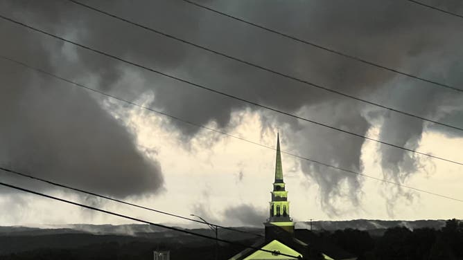
Storm clouds over Kirkwood, Missouri, Wednesday, Sep. 10, 2026.
(Jeff)
Storms are being driven by a massive cold front that's sagging south and brought severe weather to parts of the Mid-Mississippi Valley and eastern Great Lakes on Wednesday.
Thunderstorms were ongoing across southern Ohio early Thursday, which are expected to move across the Appalachians through the day and arrive over Washington, D.C. and other parts of the Mid-Atlantic by Thursday night.

(FOX Weather)
Flooding will be the biggest threat as storms tap into tropical moisture moving north from the Gulf.
SEVERAL DAYS OF HEAVY RAIN AND THUNDERSTORMS TO PERSIST ACROSS THE GULF COAST
A Level 2 out of 4 flood risk is in place for parts of Ohio, Pennsylvania and West Virginia through Friday morning.
Heavy rain could quickly cause flooding in mountain valleys, along rivers and in urban areas.

(FOX Weather)
There is an unusually large amount of moisture over much of the country, that's creating unusually humid conditions for this time of year.
Thunderstorms are expected to fire along the cold front in the Southern Plains beginning Thursday afternoon, potentially producing rain rates of 2-3 inches per hour.
KNOW YOUR FLOOD TERMINOLOGY: WHAT FLOOD WATCHES, WARNINGS AND EMERGENCIES REALLY MEAN
Most storms will not be severe, but a few could produce wind gusts of 50 to 60 mph, especially in northern Arkansas and southern Missouri.
(FOX Weather)
By Friday, the front will reach the Southeast, bringing more showers and downpours and a Level 1 flash flood threat from the Carolinas to the Gulf Coast and Florida, the FOX Forecast Center said.
Stay with FOX Weather for the latest forecast.