Significant burst of Saharan dust is on its way to the Gulf Coast
Saharan dust can create vibrant sunrises and sunsets but also reduce air quality.
Plume of Saharan dust tracking across Atlantic to reach US this weekend
The Atlantic looks quiet for the foreseeable future with no storms expected. A plume of Saharan Dust tracking across the Atlantic Ocean will reach the U.S. by this weekend, leading to beautiful sunrises and sunsets in the South. There is one area to watch in the Pacific with a high chance of development over the next five days. Any eventual impacts to land are uncertain at this time.
Parts of the Gulf Coast could be in store for African dust beginning by next week as a massive plume of the air layer makes its 5,000-mile journey across the Atlantic basin.
While most of the dust will hardly be noticeable, it could create vibrant sunsets and reduce air quality.
Large plumes of the dust typically emerge from Africa’s Sahara Desert during the late spring and summer months as easterly winds transport the minute particles westward.
The airborne particles can reflect sunlight and even reduce cloud formation for hundreds of miles.
Forecast models show the dust could stick around for most of the workweek along the Gulf Coast, from Florida through Texas.

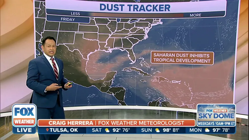
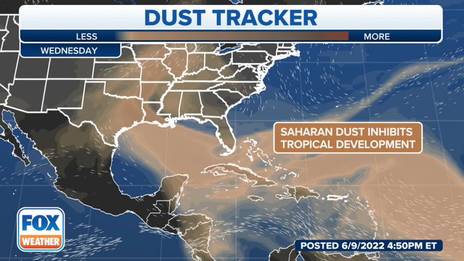
Dust being tracked across the Atlantic basin
Saharan dust inhibits tropical development
HOW TO WATCH FOX WEATHER ON TV
The Saharan Air Layer is known to suppress tropical cyclone formation, which could help keep the basin quiet for several days.
The National Oceanic and Atmospheric Administration says SAL typically has about 50 percent less moisture than a typical column of tropical air.
The dust is easily tracked by various satellites that NOAA says is usually spotted between 5,000 and 20,000 feet above ground level.
The first significant dust plume of the season emerged off the coast of western Africa last month before eventually making it to Florida.
5 THINGS TO KNOW ABOUT THE SAHARAN DUST PLUME
Because of its composition, skies can appear to have varying shades of red, orange and pink during sunrises and sunsets.
The variety of colors and dry air can help make for picturesque views that any tourist or resident hopes to see.
Saharan dust is expected to transverse the Atlantic basin over the next couple of days.
(FOX Weather)