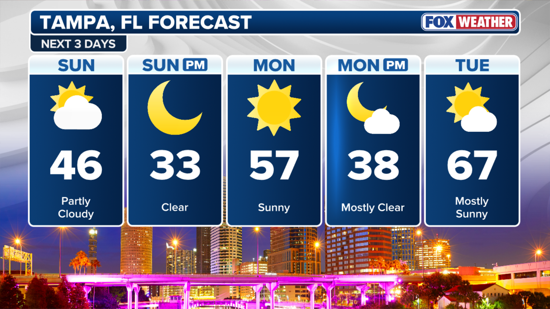
Rare Gulf-effect snow flurries spotted across Tampa Bay, Florida as extreme arctic air invades the state
Areas from the Florida panhandle all the way down to the Fort Myers/Naples area could see snowflakes.

Arctic air takes aim for Florida as record-breaking cold possible for Sunshine State
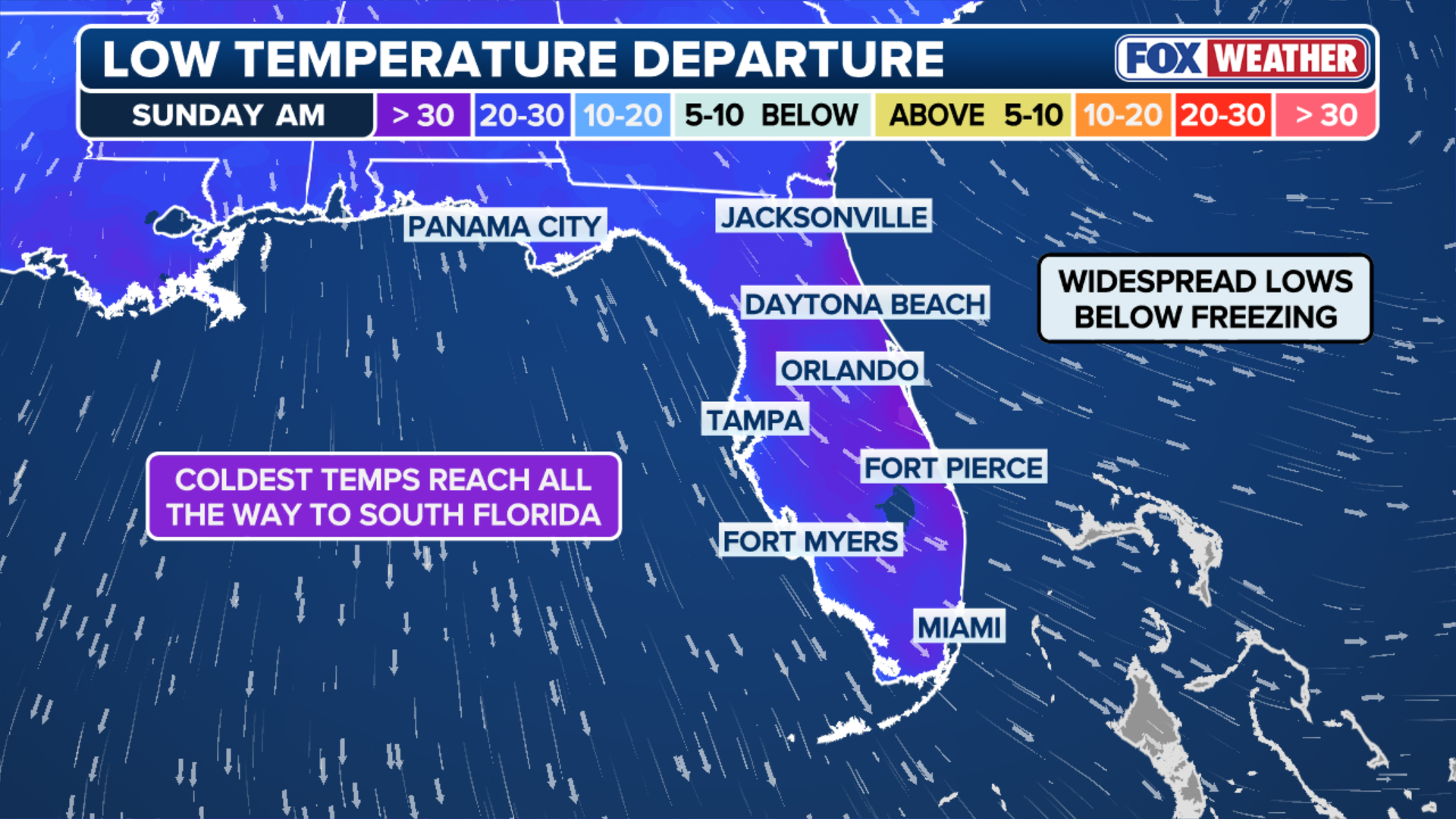
Florida could see some of its coldest temperatures in over a decade as arctic air invades the South. Miami could see temperatures in the mid-30s. A few snowflakes are even possible for the sunshine state.
A shot of extremely cold air is moving into Florida this weekend and with it comes a rare chance for snow along the Gulf Coast.
Early Sunday morning, the National Weather Service office in Ruskin, Florida reported rare snow flurries as extreme arctic air surged over the relatively warm waters of the Gulf of America.
LIVE UPDATES: NOR'EASTER CLOBBERS CAROLINAS WITH RECORD SNOW
This "Gulf-effect" phenomenon, meteorologically similar to lake-effect snow, occurred as temperatures plummeted into the mid-to-upper 30s, allowing light rain to transition into dancing flakes for the first time in the Tampa Bay area in 16 years.

Flurries spotted in Florida amid extreme, rare arctic air blast.
(FOX Weather)
While no accumulation was recorded, the sighting marks a historic moment for the region during one of its most significant cold snaps since 2010.
The nor'easter that is expected to impact several states along the East Coast this weekend is also setting the stage for a wave of unusually cold air that will reach deep into South Florida.
(FOX Weather)
Areas from the Florida panhandle all the way down to the Fort Myers-Naples area could see snowflakes, though the chance is very low.
Miami could see temperatures just a few degrees above freezing, breaking a record set in December 2010.
Temperatures like these are rarely seen in the Sunshine State
On Saturday night, lingering moisture from the storm could mix with the bitter cold air and potentially create some flurries or a rain/snow mix along the Gulf Coast.
RARE DEEP FREEZE UNDERWAY IN FLORIDA AS INTENSIFYING BITTER BLAST EXTENDS AS FAR SOUTH AS MIAMI
(FOX Weather)
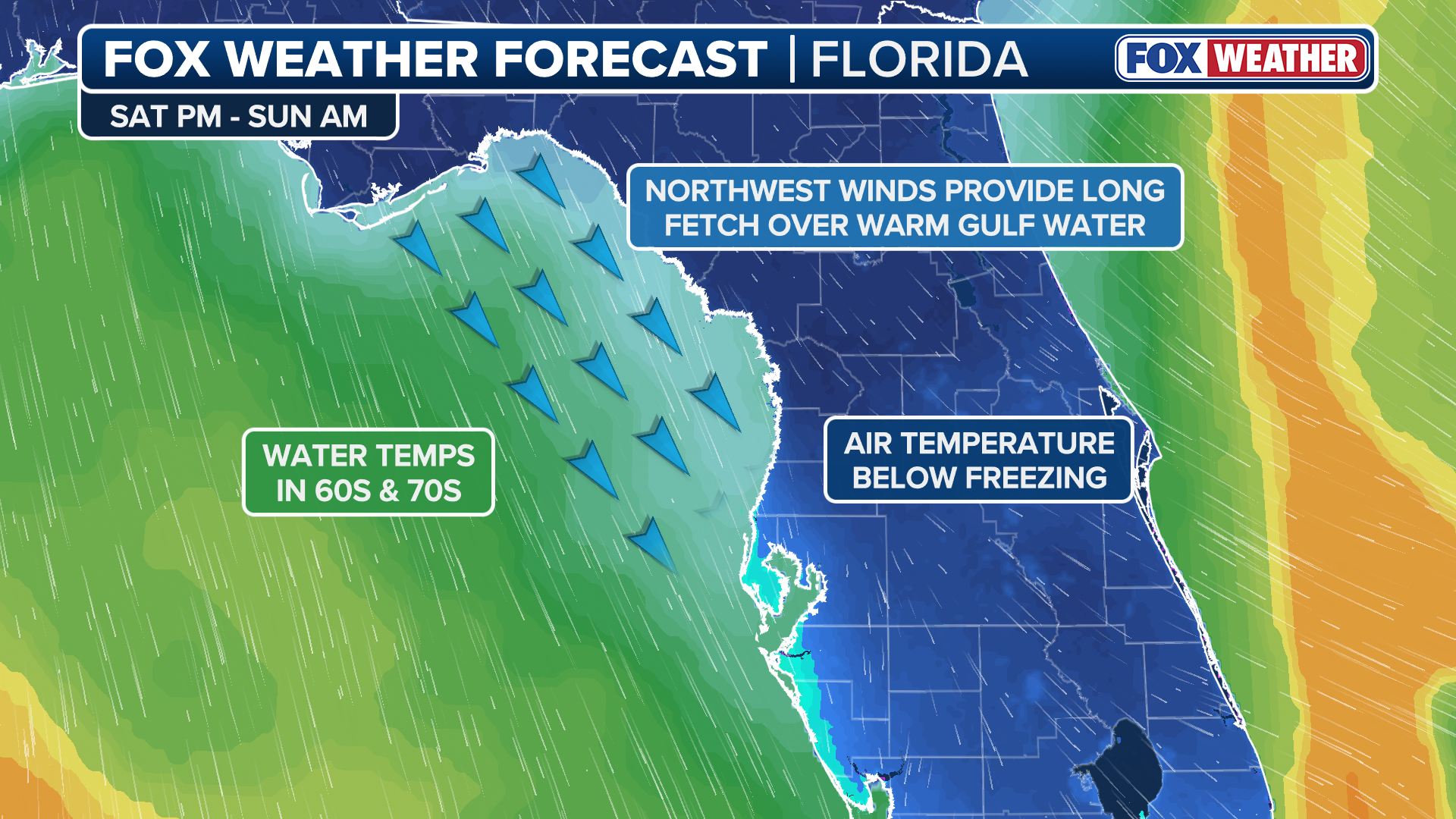
It's a rare phenomenon, and it's not common in the area. Lake-effect snow forms when very cold arctic air moves over warmer water. The air just above the water warms slightly, rises quickly through the colder air above, forming clouds and producing snow downwind.
![Snow covers a Florida beach after a snowstorm.]() Image 1 of 4
Image 1 of 4Snow covers a Florida beach after a snowstorm. (Ruth)
![FILE - A snow plow clears a pathway from snow on February 9, 2025 in Boston, Massachusetts. (Photo by Scott Eisen/Getty Images)]() Image 2 of 4
Image 2 of 4FILE - A snow plow clears a pathway from snow on February 9, 2025 in Boston, Massachusetts. (Photo by Scott Eisen/Getty Images) ( )
![Large Winter Storm Brings Rare Snowfall To Florida]() Image 3 of 4
Image 3 of 4TALLAHASSEE, FLORIDA - JANUARY 22: A car drives on snow after snowfall on January 22, 2025 in Tallahassee, Florida. The National Weather Service has placed northern Florida under a winter storm warning and some are predicting the largest Gulf snow and ice storm in more than 100 years. (Photo by Miguel J. Rodriguez Carrillo/Getty Images) ( )
![]() Image 4 of 4
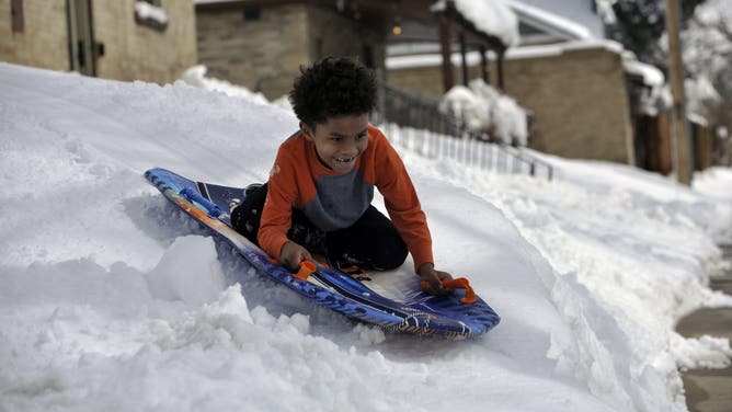
Image 4 of 4DENVER, CO - MARCH 15: Ezra Walker, 6, sleds down a hill outside his family's home in the Clayton neighborhood in Denver, Colorado on Monday, March 15, 2021. Denverites dug out a day after a weekend snowstorm dumped snow across the area. (Photo by Patrick Traylor/MediaNews Group/The Denver Post via Getty Images) ( Patrick Traylor/MediaNews Group/The Denver Post)


In Florida, a "Gulf-effect" setup could happen if cold air moves over the relatively warmer Gulf waters. But for this to happen, there needs to be a long fetch of northwest winds picking up moisture, combined with a big enough difference between the water temperature and the cold air above.
The larger the temperature difference, the faster the air rises, boosting the chance of snow.
The chance for a rain/snow mix on Saturday night is low, and any snow that does fall would likely melt immediately upon hitting the ground.
(FOX Weather)
But it's important to note that any snow along Florida's Gulf Coast is rare, especially along the peninsula.
WHAT FACTORS GO INTO A SNOW DAY FOR SCHOOL DISTRICTS?
Historically, Tampa, Florida, has only recorded measurable snow twice: 0.2 inches on Jan. 19, 1977, and 0.1 inches on Feb. 13, 1899. Naples, Florida, which could also get flurries, has never recorded measurable snow.
While flurries have been spotted in Central Florida before, accumulating snow is exceptionally difficult due to the normally warm ground and Gulf waters.