Polar vortex locks in over most of US, days of arctic temperatures ahead for millions through January
The core of the polar vortex, which contains some of the coldest air on the planet, has shifted south over much of the eastern U.S. and will allow waves of subfreezing temperatures to grip parts of the Midwest.

Polar Vortex locks in over most of the US, ushering days of arctic cold
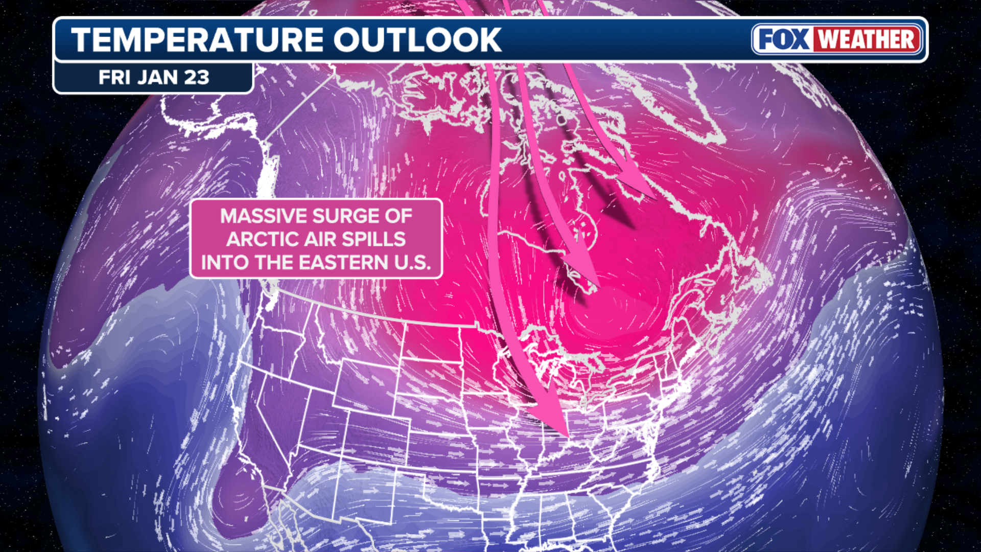
A displacement of the Polar Vortex will usher in days of Arctic cold through the end of January. The core of the Polar Vortex, which contains some of the coldest air on the planet, has shifted south over much of the eastern U.S. and will allow waves of subfreezing temperatures to grip parts of the Midwest. It will be slightly warmer but not by much across the Northeast, while enough cold air could take hold across the South to set the stage for rare winter snowstorms.
The displacement of the polar vortex over the eastern half of the U.S. will usher in days of arctic cold through the end of January.
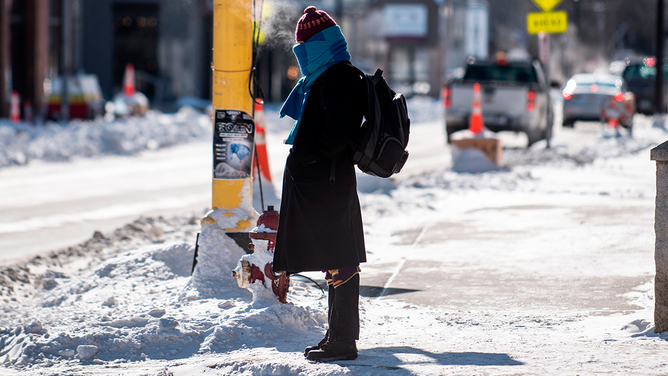
Brutal, life-threatening wind chill temperatures have already taken hold across the Northern Plains, Upper Midwest and parts of the Ohio Valley and interior Northeast — the first of several arctic outbreaks.
The core of the polar vortex, which contains some of the coldest air on the planet, has shifted south over much of the eastern U.S. and will allow waves of subfreezing temperatures to grip parts of the Midwest.
It will be slightly warmer, but not by much across the Northeast, while enough cold air could take hold across the South to set the stage for rare winter snowstorms.

The northeastern US and Canada are experiencing an Arctic blast that could see some areas record their lowest ever wind chill temperatures.
(ANGELA WEISS/AFP via Getty Images / Getty Images)
On Monday, more than 230 million Americans woke up to below-freezing temperatures. The Upper Midwest, like Milwaukee, Chicago and the Twin Cities, experienced temperatures below zero or in the single digits and wind gusts from 20 to 40 mph, which made the region feel like -10 to -30 degrees.
By Tuesday, over 70 million Americans will be affected as the cold air continues over the Midwest while it spreads to the Northeast. Cities like Cleveland and Pittsburgh will face a wind chill of -15 to -5 degrees.
Cold Weather Advisories are in effect through Tuesday.
(FOX Weather)
The I-95 corridor, including New York City, will likely not experience the intense arctic air, but low temperatures in the morning combined with the gusty northwestern winds will still put many cities in the single digits.
The first wave of the arctic cold will ease slightly by Wednesday as winds will start to relax across the north. That being said, even though conditions will be less severe, the cold will remain widespread and impactful.

Arctic air, subfreezing temperatures grip millions across Northern Tier
Brutal cold has taken hold across the Northern Plains, Upper Midwest and parts of the Ohio Valley and interior Northeast. Cold Weather Advisories are in effect through Tuesday. Life-threatening wind chill temperatures between -20 and -40 degrees are expected across much of the Upper Midwest through the week. The artic air will reach the Northeast Coast by Tuesday.
The next surge of arctic air is expected to arrive on Thursday, leaving no time for the Midwest to recover.
The powerful arctic high will be centered north of the U.S. and will funnel in extremely dense, cold air southward into the lower 48.
A woman is bundled up as winter weather conditions sweep across the U.S.
(STEPHEN MATUREN/AFP via Getty Images / Getty Images)
Temperatures could feel like they're in the -20 to -30 degree range. Areas that are located closer to the northern border may see -40 degrees by Friday.
These temperatures will set the stage for life-threatening conditions such as creating the perfect environment for frostbite to occur in as little as 10 to 30 minutes.
HERE’S HOW LONG IT’LL TAKE YOU TO GET FROSTBITE AS WIND CHILLS DIP BELOW ZERO
This second wave of arctic air is expected to dominate the weather pattern through the weekend and could play a critical role in the development of the potential next winter storm for the South and East Coast.