Flood threat remains in the Northeast on Sunday, but clearing is expected at the start of the new workweek
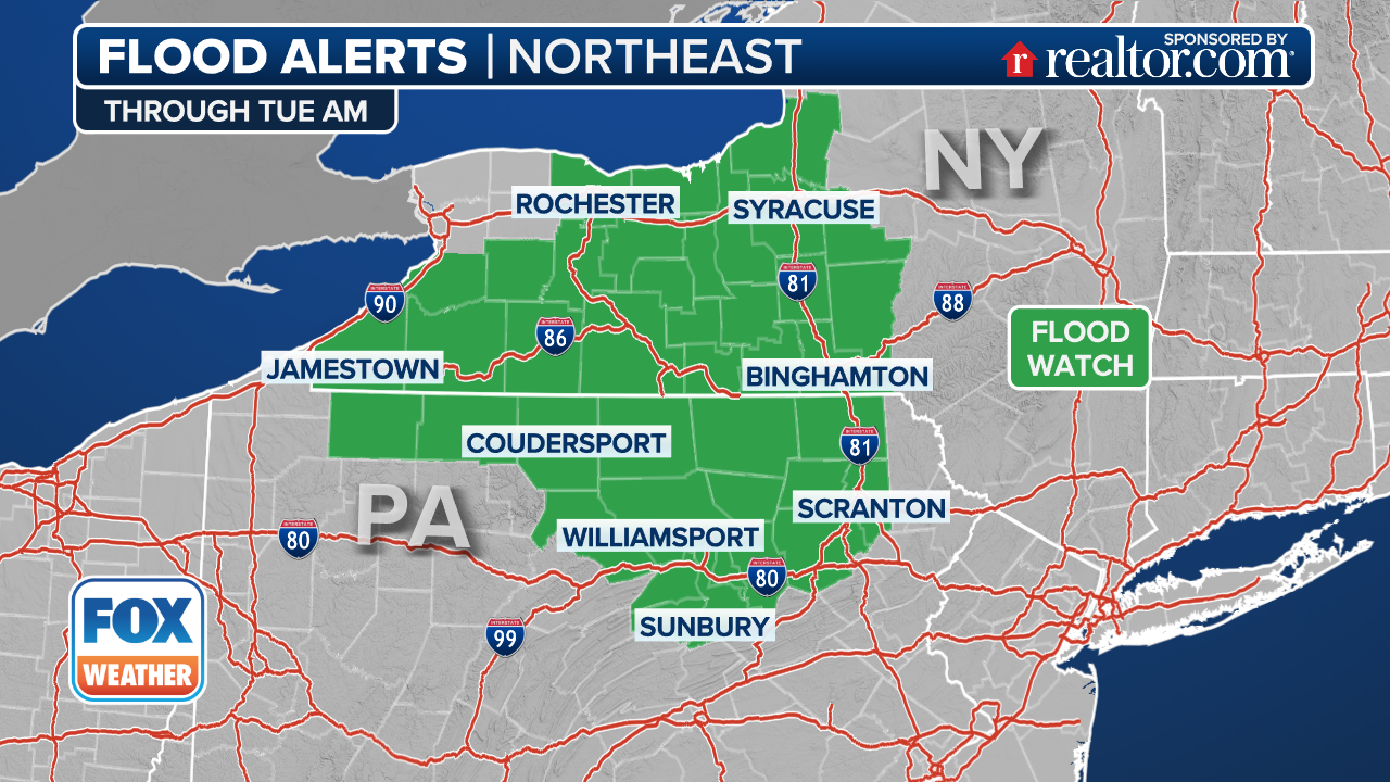
Flood Watches remain in effect in the Northeast as parts of the region could pick up an addition inch or so of rain on Sunday
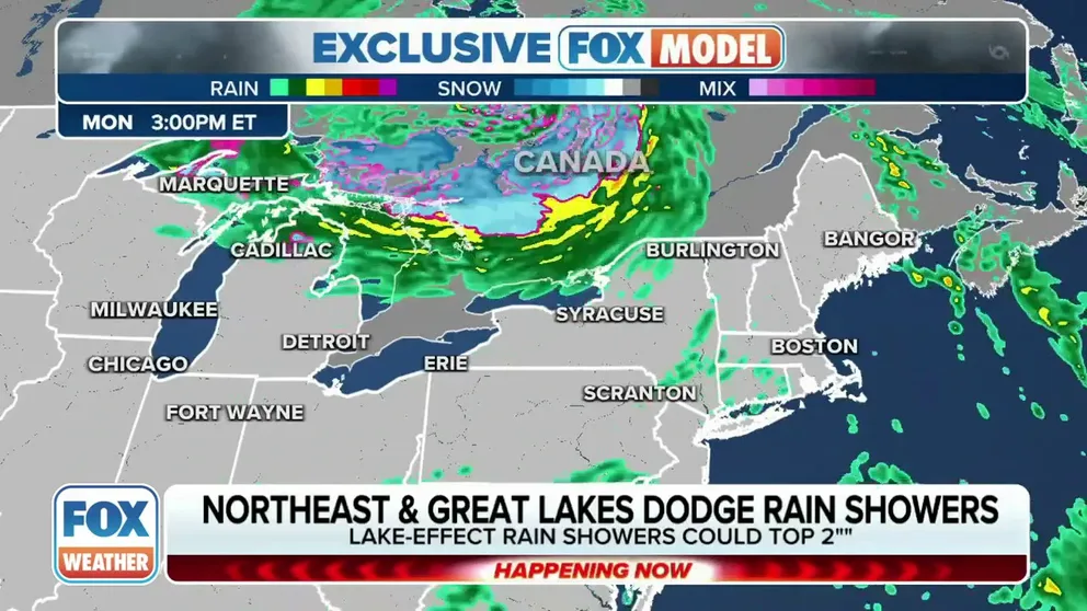
Northeast, Great Lakes dodge rain on Sunday
A storm system is pulling away from the Great Lakes region and the Northeast, but some lingering rain could fall through the middle of the week.
NEW YORK – It’s been another soggy Sunday for portions of the Northeast and New England after a powerful cold front combined with moisture from what was once Tropical Storm Philippe over the weekend.
Philippe was downgraded to a post-tropical cyclone on Friday before it merged with the potent cold front that swept across the U.S. last week, which made a mess across the region.
On Sunday, places like upstate New York, Vermont, New Hampshire and Maine were expected to remain wet.
"All of this was a part of that moisture factor that we had pumping into the region (Saturday) and is now starting to exit off towards the north into Canada," FOX Weather meteorologist Kiyana Lewis said.
WHAT TO EXPECT IN TROPICS AS HURRICANE SEASON ENTERS OCTOBER

(FOX Weather)
It’s not expected to be a complete washout on Sunday, but heavy rain is expected in some locations, which could bring an additional inch or so through the rest of the day.
A Flood Watch is in effect through Monday morning for portions of western New York state, including Watertown and Hastings.
(FOX Weather)
During fall in New England, the peak of foliage can increase the risk of flash flooding in certain areas, the FOX Forecast Center said. This is because the gusty winds can cause leaves to fall faster, potentially blocking storm drains and culverts.
However, it's worth noting that the soil conditions in the region have been drier than usual, which can help reduce the risk of flash flooding in some areas.
Wind gusts of 30-40 mph expected through Sunday
In addition to the heavy rains, strong wind gusts are expected throughout the region.
Wind gusts of 30-40 mph are expected through Sunday as the low passes through. As a result, some power outages may occur.
Any wind gust over 57 mph is considered damaging, but a brisk day can lead to smaller limbs being dislodged and falling into power lines.

(FOX Weather)
Weather improves from west to east
The rains will continue to push north and eastward Sunday and eventually move out of Maine into southeastern Canada, allowing drier weather to move in from south to north.
The region should be relatively dry on Monday. Showers return for midweek, and long-range forecast models suggest stormier weather may return to the Northeast next weekend.
Many river levels, especially in interior New York and Maine, are expected to remain elevated through the workweek.