Storms easing Mississippi, Ohio Valley drought as flash flood threats increase, prompting water rescues
After a prolonged drought, parched ground can act like a hard surface causing more runoff and flash flooding rather than letting the water soak in like a sponge, as flash flood threats continue for areas that have already been inundated with severe rain.

Heavy rain continues to batter Mississippi and Ohio River Valley as flood threats continue
Heavy rain continues to batter the Mississippi and Ohio River Valley producing a widespread 3-5 inches from Texas to Missouri, prompting water rescues and road closures as flash flood threats continue through Sunday. Stick with FOX Weather for the latest updates as these rounds of storms move through the area.
Heavy rain continues to move through the drought-stricken Mississippi and Ohio River Valley as a stretch of storms brings beneficial rounds of precipitation to the area through Tuesday, with the changing weather pattern bringing a wet start to spring.
(FOX Weather)
These storms do come with a "but," however, as rainfall totals in some areas have already exceeded 2 inches and could reach up to 8 inches in some locations.
This poses a significant threat: after a prolonged drought, parched ground can act like a hard surface, causing more runoff and flash flooding rather than letting the water soak in like a sponge.

(FOX Weather)
With the persistent heavy rain, multiple states continue to be in the zone for flash flooding concerns through Sunday.
Portions of the region have been issued a level 1 out of 4 flash flood threat for Friday — except portions of Ark-La-Tex, where a level 2 out of 4 exists.
But the levels could increase as soils become more saturated and rainfall continues.
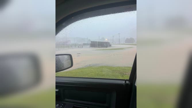
![Flooding in Louisville, Mississippi]() Image 1 of 3
Image 1 of 3FILE: Flash flooding inundates a home in Louisville, Mississippi on July 13, 2022. (@JohnJohnReb / Twitter)
![Flooding in Ackerman, Mississippi]() Image 2 of 3
Image 2 of 3FILE: Flash flooding inundates Ackerman, Mississippi on July 13, 2022. (Ackerman Police Department)
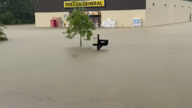
![Flooding in Starksville, Mississippi]() Image 3 of 3
Image 3 of 3FILE: A Dollar Store is flooded after heavy rains hit Starksville, Mississippi on July 13, 2023. (Carrie Carter/Facebook)

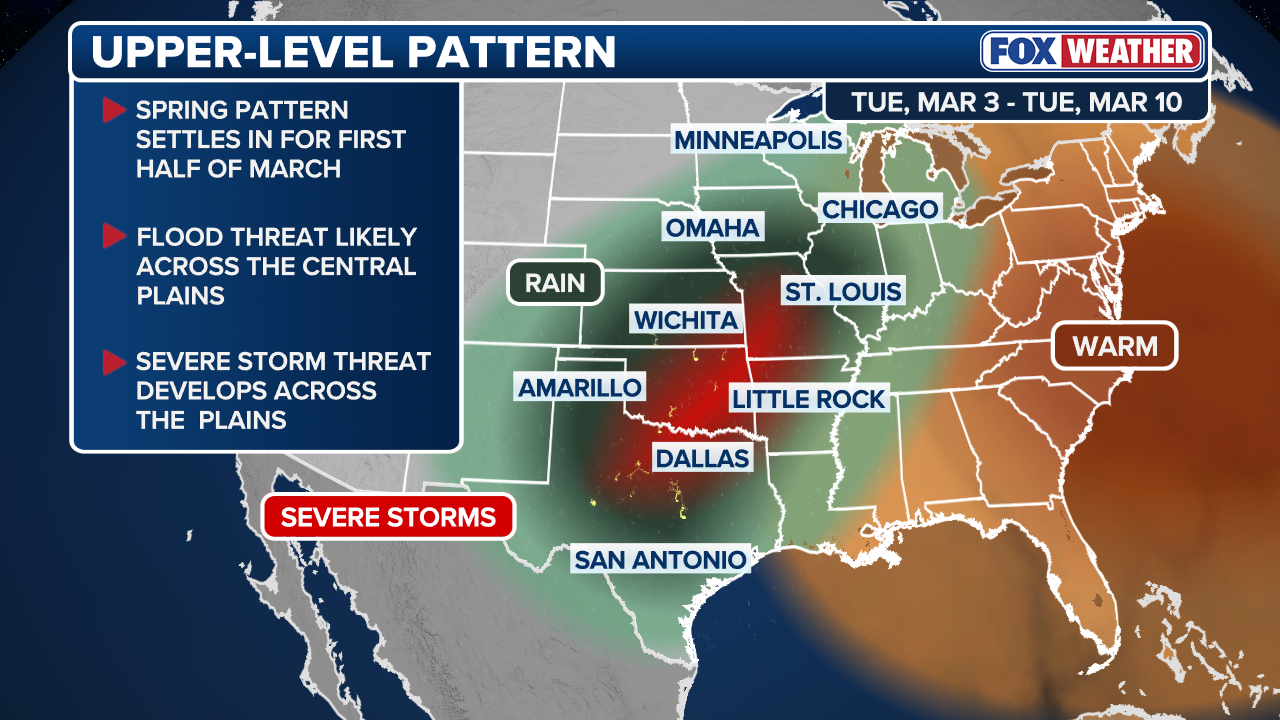
A series of upper-level disturbances will continue to emerge from the Rockies and track into the Southern Plains later this week, triggering more storm development as they enter a more moisture-rich environment.
The FOX Forecast Center said combined with an area of high pressure anchored along the East Coast, this pattern will help funnel deep Gulf moisture into the central United States.
Flood Watches continue through Thursday midday for Central and Southern Indiana and Ohio.
Just so far this week, Indianapolis, the city, the parade of storms, has almost completely erased its yearly deficit.
In fact, Tuesday marked the state's 7th wettest March day on record, with a staggering 2.59 inches of rainfall.
Springfield, Illinois, reached its 5th wettest March day on record with 2.32 inches, as well.
FLORIDA DROUGHT FUELS FIRE POTENTIAL AMID EXTREME DRY SPELL
One after another, rounds of thunderstorms and heavy rain led to a Flash Flood Warning for Dallas, TX on Wednesday night, where inches of rain were reported and caused numerous roads to be shut down due to flooding, mainly in northeastern Dallas.
This has also promoted a few water rescues around the area due to high water levels.
Additional rounds of storms are expected Friday into Saturday across the Southern Plains, where the flood threat will persist and could even increase, with major cities, including Austin, Dallas, Little Rock, Memphis, and St. Louis potentially seeing heavy rain into Saturday.
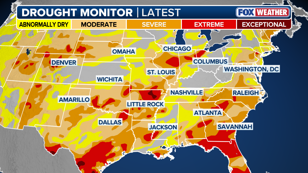
That said, the drought's grip on Arkansas remains severe, affecting nearly the entire state.
(FOX Weather)
Currently, extreme to exceptional drought covers about 29% of the region, and Little Rock is entering March with a 6-inch rainfall deficit from the winter season.
The projected "parade of storms" offers a chance to erase those recent losses in a single week. However, because the drought is a long-term issue, this rainfall is viewed as a significant first step toward recovery rather than a total solution.

(FOX Weather)
As the weather pattern flips, the result is a setup producing multiple rounds of widespread rain, providing much-needed relief from serious drought.