Rare split in Polar Vortex to usher in warm weather across winter-weary Eastern US near beginning of March
Hope springs eternal: millions across the eastern half of the country are rooting for the return of warm weather after many have endured their coldest winter in recent years.
Split in Polar Vortex to actually drive spring warmup
The polar vortex is splitting — an exceedingly rare phenomenon for this time of year that will be an unusual driver of warmer temperatures, as the calendar flips to March and meteorological spring.
The polar vortex is splitting — an exceedingly rare phenomenon for this time of year that will be an unusual driver of warmer temperatures, as the calendar flips to March and meteorological spring.
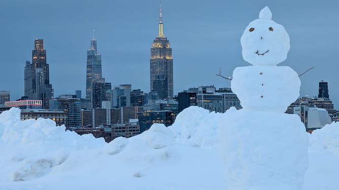
![HOBOKEN, NJ - FEBRUARY 23: A snowman stands in a park in front of the skyline of midtown Manhattan and the Empire State Building in New York City following a snowstorm on February 23, 2026, in Hoboken, New Jersey.]() Image 1 of 7
Image 1 of 7HOBOKEN, NJ - FEBRUARY 23: A snowman stands in a park in front of the skyline of midtown Manhattan and the Empire State Building in New York City following a snowstorm on February 23, 2026, in Hoboken, New Jersey. ((Photo by Gary Hershorn/Getty Images))
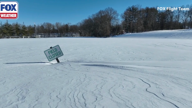
![A sign saying the field was closed after the blizzard in Orangetown, NY.]() Image 2 of 7
Image 2 of 7A sign saying the field was closed after the blizzard in Orangetown, NY. (FOX Flight Team)
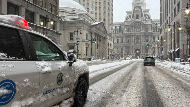
![Philadelphia cleans up roads after major blizzard.]() Image 3 of 7
Image 3 of 7Philadelphia cleans up roads after major blizzard. (Philadelphia Office of Emergency Management/Faebook)
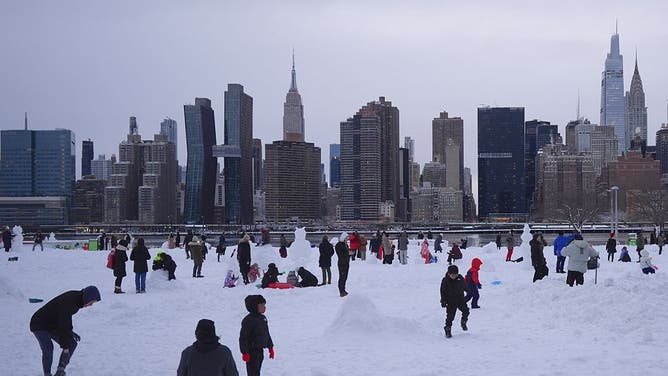
![NEW YORK, UNITED STATES - FEBRUARY 23: Families and citizens enjoy snow after a powerful, multi-day blizzard dumped about 19 inches of snow in Long Island City, New York, United States on February 23, 2026.]() Image 4 of 7
Image 4 of 7NEW YORK, UNITED STATES - FEBRUARY 23: Families and citizens enjoy snow after a powerful, multi-day blizzard dumped about 19 inches of snow in Long Island City, New York, United States on February 23, 2026. ((Photo by Selcuk Acar/Anadolu via Getty Images))
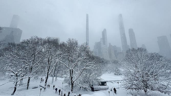
![Pedestrians walk through snow in Central Park during a winter storm in New York, US, on Monday, Feb. 23, 2026.]() Image 5 of 7
Image 5 of 7Pedestrians walk through snow in Central Park during a winter storm in New York, US, on Monday, Feb. 23, 2026. (Photographer: Chris Ratcliffe/Bloomberg via Getty Images)
![Heavy snow falling in Brockton, MA during Blizzard '26.]() Image 6 of 7
Image 6 of 7Heavy snow falling in Brockton, MA during Blizzard '26. (Ryan Linn)
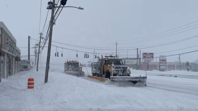
![Snow plows clear the roads in Farmingdale, New York.]() Image 7 of 7
Image 7 of 7Snow plows clear the roads in Farmingdale, New York. (@nysdotli / X)

The core of the polar vortex contains some of the coldest air on the planet and typically sits over the North and South Poles about 10-30 miles above Earth’s surface in the atmospheric layer known as the stratosphere.
WHY SPRING SHOULD ACTUALLY BEGIN ON MARCH 1
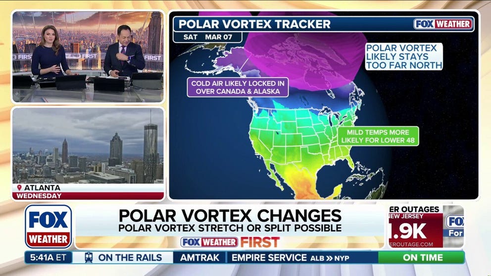
The FOX Forecast Center is monitoring a major warmup within the stratosphere which is currently splitting the polar vortex into two lobes — a phenomenon scientists have termed a "Sudden Stratospheric Warming Event (SSWE)."
Temperatures within this layer can increase by more than 50 degrees in just a matter of days, stretching and weakening the vortex.
(FOX Weather)
While a weaker polar vortex allows that frigid air to spill lower in the atmosphere and drive freezing surface temperatures, current projections through the first week of March keep the core of the coldest air centered over Canada and Alaska.
According to the FOX Forecast Center, this specific positioning will allow milder air from the Pacific Ocean to dominate much of the Lower 48 during the first two weeks of March.
(SOURCE GOES HERE)
What makes this climate setup truly remarkable is that this appears to be the second SSWE of the season.
"Major warming events typically occur only once every other year. Experiencing two distinct major warming events in a single winter season is relatively rare, happening roughly once every decade," the FOX Forecast Center said.

(SOURCE GOES HERE)
This first split of the polar vortex happened in late November 2025 and ushered in weeks of Arctic cold across the eastern US and an early start to winter, where a lobe of frigid air parked much closer to the Lower 48.
FIRST BIG FREEZE OF SEASON GRIPS EASTERN US, AS ARCTIC AIR AND SNOW REACH THE SOUTH
Unlike that setup, this time, the polar vortex will shift closer to Alaska and northern Canada.
A weakened Polar Vortex also often promotes atmospheric blocking patterns — in this case, the jet stream will lock in place just south of this lobe of the vortex, acting as a barrier that will keep the coldest air in Canada while allowing for an extended period of warmer, spring-like weather for the vast majority of the country.

FILE - Plants are displayed for sale in Manhattan's flower district in New York, U.S., on Thursday, March 24, 2016.
(Photographer: Michael Nagle/Bloomberg via Getty Images / Getty Images)
This will be a welcome change for the eastern half of the country, in what has been the snowiest winter in recent years for many locales, punctuated by January's historic winter storm. The Northeast, in particular, is also still recovering from a record-setting blizzard this past weekend.
Despite this long-awaited reprieve, the FOX Forecast Center is warning against packing away the winter coats just yet, as the weakened polar vortex will create an unstable weather pattern.
HOBOKEN, NJ - FEBRUARY 23: A snowman stands in a park in front of the skyline of midtown Manhattan and the Empire State Building in New York City following a snowstorm on February 23, 2026, in Hoboken, New Jersey.
((Photo by Gary Hershorn/Getty Images) / Getty Images)
Beyond this two-week warm-up, the jet stream, which was a shield, locking in warm air across the Lower 48, will take on a more snake-like pattern that could funnel down shots of late-season Arctic air.