

Tropical Storm Odalys churns in the Pacific as potential next hurricane fuels Southwest flood threat
Invest 99E is forecast to become the eastern Pacific’s next hurricane, potentially threatening Mexico’s western coast, while its moisture surges northward ahead of a dip in the jet stream, renewing the flood threat across the Southwest.
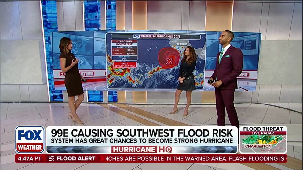
Pacific basin hot with tropical activity as Invest 99E could cause Southwest flood risk
Tropical Storm Odalys has formed in the East Pacific, and is moving northwest at 8 mph, according to the National Hurricane Center. The storm is not expected to impact land, but Odalys is just the latest in a series of tropical systems impacting the Pacific basin amid a brewing Super El Niño this hurricane season.
THE TAKEAWAY
- Tropical Storm Odalys has formed in the East Pacific.
- Invest 99E is forecast to become the next hurricane in the Eastern Pacific.
- The storm will usher in Pacific moisture that will fuel a flood threat in the Southwest.
- A Level 2 out of 4 flash flood risk is already in place for Tuesday.
Tropical Storm Odalys has formed in the East Pacific, and is moving northwest at 8 mph, according to the National Hurricane Center.
The storm is not expected to impact land, but Odalys is just the latest in a series of tropical systems impacting the Pacific basin amid a brewing Super El Niño this hurricane season.
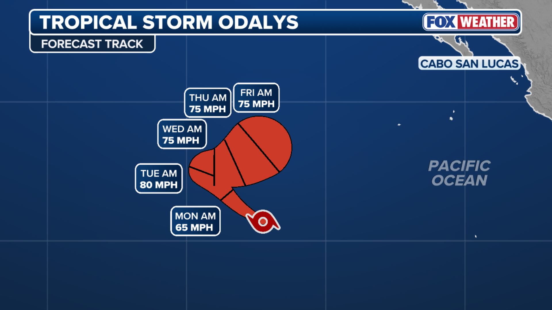 Tropical Storm Odalys forecast cone.
(FOX Weather)
The opposite can be said for the Atlantic basin, which is off to its quietest start on record, dating back to the beginning of the satellite era (1960).
TROPICAL STORM FAY FORMS IN THE ATLANTIC AMID BREWING SUPER EL NIÑO
Another brewing hurricane moving north over the Pacific will funnel tropical moisture into the Southwest, fueling a dangerous flood threat as the region braces for another round of heavy rain after weeks of relentless storms.
 Area to Watch in the Eastern Pacific.
(FOX Weather)
Invest 99E is forecast to become the eastern Pacific’s next hurricane, potentially threatening Mexico’s western coast, while its moisture surges northward ahead of a dip in the jet stream, renewing the flood threat across the Southwest.

The Maricopa County Sheriff's Office deployed a helicopter to rescue two motorists stranded in floodwater on Sept. 16.
(Goodyear Fire Department)
To close out the weekend, typical monsoonal thunderstorms will develop as afternoon heating peaks across the Southwest.
THE HIGHEST-ELEVATION TORNADOES IN U.S. HISTORY
By Tuesday, the pattern will shift as a surge of tropical moisture associated with Invest 99E increases the flood threat once again.
 Southwest Rain Forecast.
(FOX Weather)
A Level 2 out of 4 flash flood risk is already in place for Tuesday, including Roswell and hard-hit Ruidoso, where rainfall rates could reach 1 to 2 inches per hour.
With a high chance of development next week, Invest 99E could form into a tropical depression by this weekend or early next week, before the system gradually drifts northward toward the Mexican coast.
According to the FOX Forecast Center, long-range forecasts show the potential for a strong hurricane to develop as it inches closer to Mexico next week.
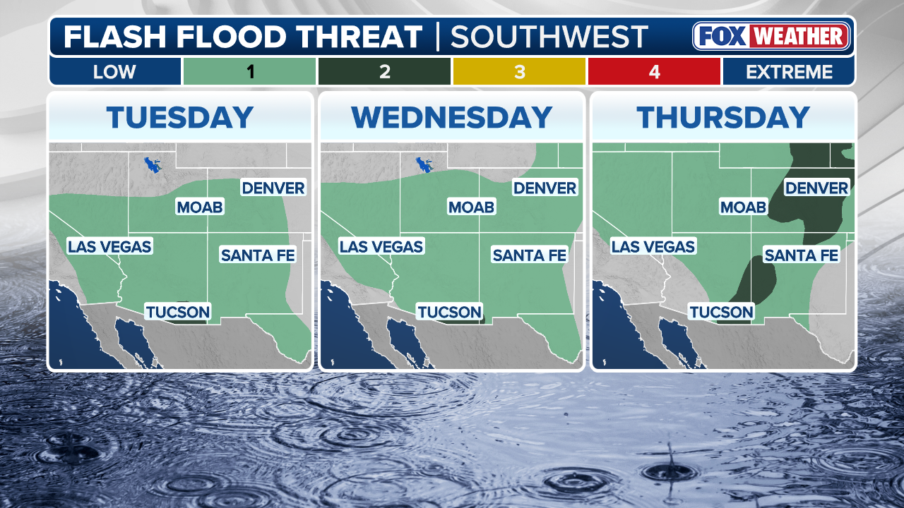 Southwest Rain Forecast.
(FOX Weather)
Headed into the middle part of next week, more moisture is expected to continue to surge north into the Southwest, mainly New Mexico.
Depending on how 99E's movement north unfolds, the flood threat could continue into Wednesday and Thursday.
KNOW YOUR FLOOD TERMINOLOGY: WHAT FLOOD WATCHES, WARNINGS AND EMERGENCIES REALLY MEAN
Right now, a 2 out of 4 flash flood exists on Wednesday with the potential of more flooding to occur in eastern New Mexico.
 Southwest Rain Forecast.
(FOX Weather)
Current rainfall forecasts show the potential for 3 to 5 inches of rain through next week across central and eastern New Mexico and far western Texas.
Totals could exceed 6 inches if trends continue toward a more northerly track as the FOX Forecast Center continues to monitor any changes in the flash flood risk in the coming days.