Severe weather possible along I-95 corridor as days of rain soak Northeast
Severe storms are likely Monday along the I-95 corridor from the Carolinas to New Jersey. Flooding is also possible where the heaviest rain falls.

Wet weather expected in Northeast for several days
The Northeast and the I-95 corridor are forecast to pick up several inches of rain during the next week.
Millions of people living along the Interstate 95 corridor in the Northeast are bracing for rounds of showers and thunderstorms over the next few days as a low-pressure system inches closer to the region, and it's good news for a part of the country that's been below average for rainfall.
While drought conditions in the region aren’t as dire as in other parts of the U.S., some cities remain abnormally dry. This is the case in Baltimore, which sits nearly 10 inches behind the average rainfall for this time of year.
"This will do some benefit, but I don't think it's going to help us out enough," FOX Weather meteorologist Jane Minar said. "Over a seven-day stretch, 2-3 inches of rain, I don't think that's enough to really eradicate the moderate-to-severe drought that's already beginning to settle into the Delmarva."
HOW HEAVY IS IT REALLY GOING TO RAIN?

(FOX Weather)
The FOX Forecast Center expects 3-5 inches of rain to fall along the I-95 corridor, with some locally higher amounts, through early next week.
Severe weather is also likely across the mid-Atlantic into southern areas of the Northeast along the I-95 corridor Monday, where damaging wind and hail are possible with any severe storms that develop.
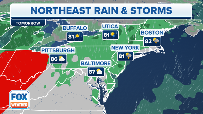
![The Northeast forecast for June 25, 2023.]() Image 1 of 3
Image 1 of 3The Northeast forecast for June 25, 2023. ( )
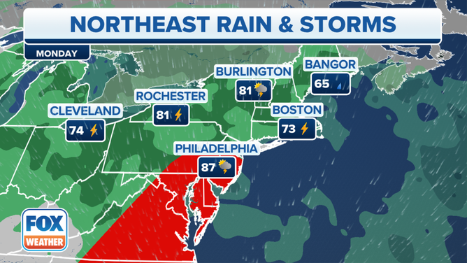
![The Northeast forecast for June 26, 2023.]() Image 2 of 3
Image 2 of 3The Northeast forecast for June 26, 2023. ( )
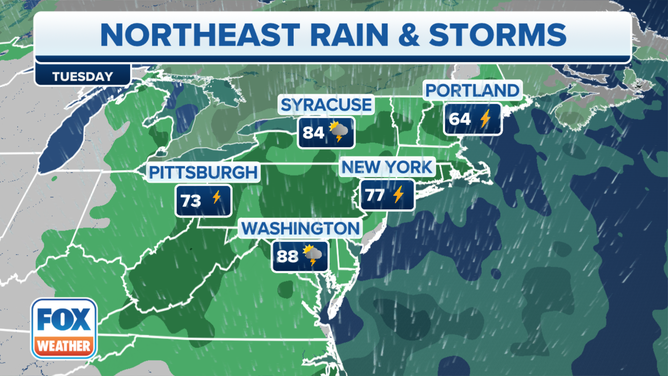
![The Northeast forecast for June 27, 2023.]() Image 3 of 3
Image 3 of 3The Northeast forecast for June 27, 2023. ( )
Although the rain won’t be overly heavy, there may still be a risk of flash flooding in some parts of the Northeast where the heaviest rain falls.
A Flash Flood Warning was issued Friday evening for Philadelphia for 2-4 inches of rain that fell during a short time period. Traffic cameras along Interstate 95 showed slow traffic and flooding along the interstate during rush hour.
Other instances of flooding were reported around Washington and in central Virginia.
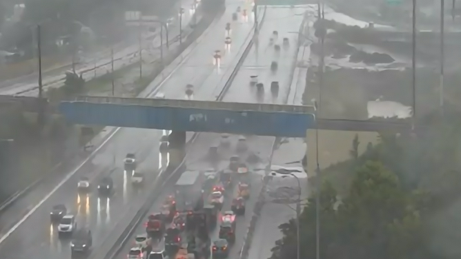
I-95 traffic camera in Philadelphia
(FOX Weather)