Harsh-cold February? NOAA's warm outlook shows winter still hiding for some
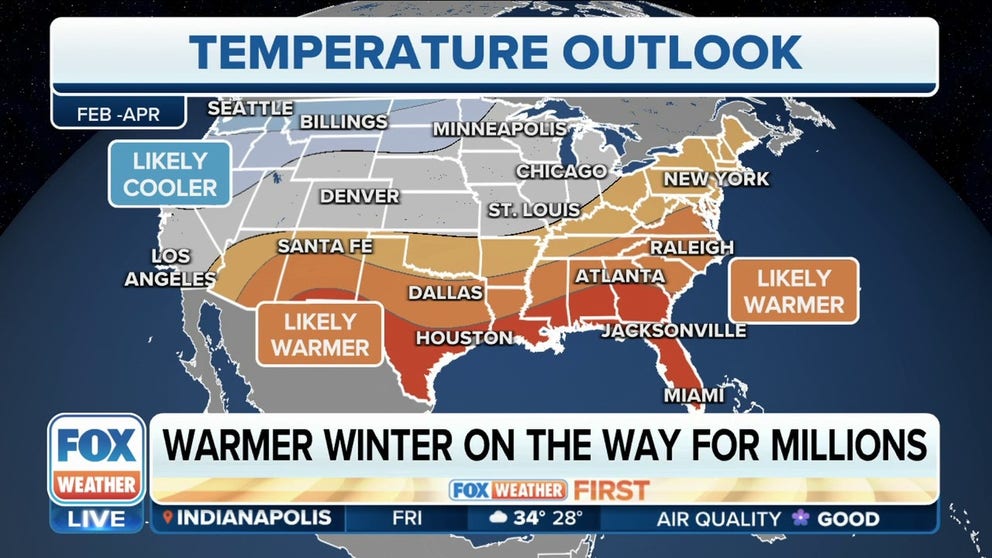
NOAA's Climate Prediction Center released its monthly temperature and precipitation outlooks, and it looks as though millions of Americans could experience warmer-than-average temperatures and above-average precipitation in February.
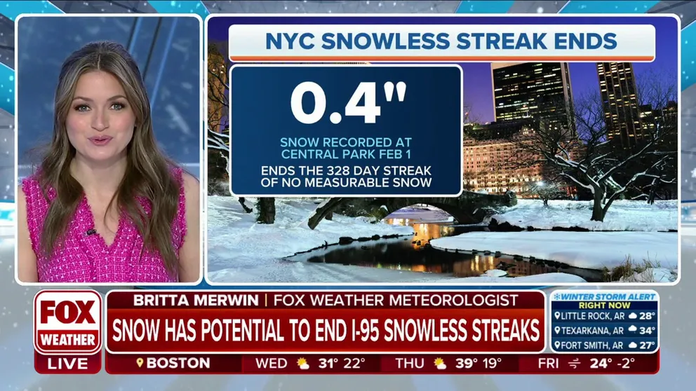
New York City records latest first measurable snow on Wednesday
It took until February, but New York City finally saw its first snow of the season early Wednesday morning, ending a 328-day snowless streak that dated back to March 2022.
NEW YORK – If you are hoping to pack up the winter coats and boots, think twice about that if you are out West.
Meanwhile, it took until February, but New York City finally saw its first measurable snow of the season early Wednesday morning, ending a 328-day snowless streak that dated back to March 2022.
The National Oceanic and Atmospheric Administration’s Climate Prediction Center recently issued its three-month outlook for February through April. If it’s correct, warmer-than-average temperatures are slightly favored across the eastern half of the country, while the western half sits with greater odds of being colder than average.
MILLIONS ACROSS US COULD SEE WARMER, WETTER WEATHER AS WINTER ENDS
NOAA outlook: Millions across U.S. could see warmer, wetter weather as winter ends
NOAA's Climate Prediction Center released its three-month temperature and precipitation outlook on Thursday, and it looks as though millions of Americans could experience higher temperatures and more precipitation through April.
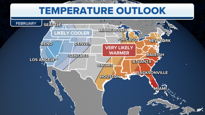
February temperature outlook
According to NOAA's updated February outlook released Tuesday, the greatest chance of warmer-than-average conditions is in portions of the southern Plains extending north into the Great Lakes, from the Tennessee Valley northeast into New England and in southwestern Alaska.
HERE'S WHY THE US HAS THE LOWEST SNOW COVER ON OVER A DECADE
(FOX Weather)
Above-average temperatures are also heavily favored in the southeastern U.S. and along much of the East Coast. Below-average temperatures are favored from the Pacific Northwest southward along the West Coast and east into the Rockies.
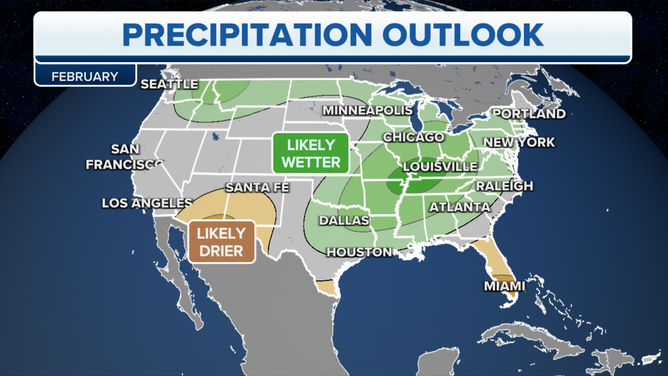
February precipitation outlook
Wetter-than-average conditions are favored from the Pacific Northwest eastward into the Midwest, and from the Tennessee Valley northeastward into parts of New England.
The highest probability of above-average precipitation is found from eastern Washington into northern Idaho and western Montana. Another area singled out for a wet February is around Memphis, Tennessee, and Louisville, Kentucky.
(FOX Weather)
Drier-than-average conditions are favored across the extreme southern U.S. The highest probability of a dry February is across southern Arizona and New Mexico and most of the state of Florida.
According to the National Weather Service, this is the third consecutive winter impacted by La Niña. Since 1900, this has only happened four times.
The cooler and wetter forecasts in the North and the drier, warmer forecasts in the South are a sign of continuing La Niña conditions in the short term.
The base mark of near-record heat has some climatologists concerned that once an El Niño is able to shake off the lagging effects of La Niña, temperatures could be off to the races and reach levels never seen before.