

Numerous tornadoes and hurricane-force wind gusts slam the Midwest during severe weather outbreak
Numerous confirmed tornadoes were reported across central and northern Illinois on Thursday.
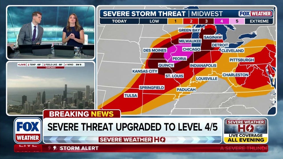
Severe weather risk upgraded over Chicago, Midwest for widespread damaging winds and tornadoes
NOAA's Storm Prediction Center (SPC) has upgraded Thursday's severe storm risk for millions in Chicago and other parts of the Midwest, warning of widespread damaging winds and tornadoes, part of an ongoing outbreak that spawned a 350-mile derecho Wednesday.
CHICAGO — Severe storms moved through Chicago and other parts of the Midwest, causing damage from tornadoes and strong winds on Thursday night.
NOAA's Storm Prediction Center (SPC) upgraded the severe storm risk for millions on Thursday.
The storms were part of an ongoing severe weather outbreak that delivered a 350-mile derecho which knocked out power to hundreds of thousands of people Wednesday.
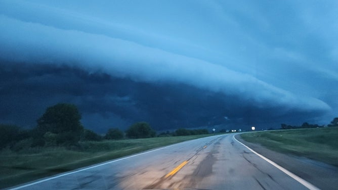
![Line of thunderstorms approaches Dwight, Illinois, Wednesday, June 10, 2026.]() Image 1 of 3
Image 1 of 3Line of thunderstorms approaches Dwight, Illinois, Wednesday, June 10, 2026. (Travis Lanham)
![]() Image 2 of 3
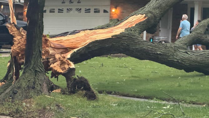
Image 2 of 3Trees down in Joilet, IL after severe thunderstorms. (@JolietWeather/X)
![]() Image 3 of 3
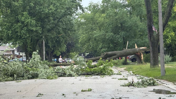
Image 3 of 3Downed trees blocking roads in Joilet, IL. (@JolietWeather/X)
Over 500,000 customers were without power at the height of Wednesday's storms, with wind gusts over 80 mph reported across Wisconsin, Illinois and Kansas.
On Thursday, numerous confirmed tornadoes were reported across central and northern Illinois.
That includes a Tornado Emergency that was issued around 5:11pm CT for Bell Plain, IL, as a dangerous tornado was reported on the ground.
DESTRUCTIVE DERECHO SLAMS MIDWEST WITH INTENSE WINDS, KNOCKING OUT POWER TO OVER 500K HOUSEHOLDS
About a dozen reports of tornadoes came in across Illinois as well as southern Wisconsin, according to the FOX Forecast Center.
More significant damage was also reported in Streator, IL, as the same cell, which was tagged as a confirmed tornado, moved through.
A third confirmed tornado near Hobard, IN, was marked a Particularly Dangerous Situation (PDS), and had a large debris signature on radar.
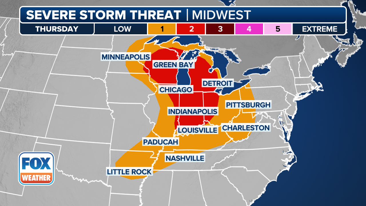
(FOX Weather)
Strong thunderstorms hit parts of Nebraska, Iowa, Illinois and Indiana early Thursday.
The greatest tornado risk of strong tornadoes (EF-3+) was just west of Chicago and covered parts of northwestern Illinois and eastern Iowa.
A Level 3 out of 5 risk of severe thunderstorms covered a broad 600-mile corridor Thursday from eastern Missouri to northern Michigan which includes Milwaukee and Des Moines.
WHAT IS A SUPERCELL THUNDERSTORM?
Damaging wind gusts exceeding 70 mph were the most widespread hazard, but large hail and tornadoes were also possible, especially within supercell thunderstorms that developed.
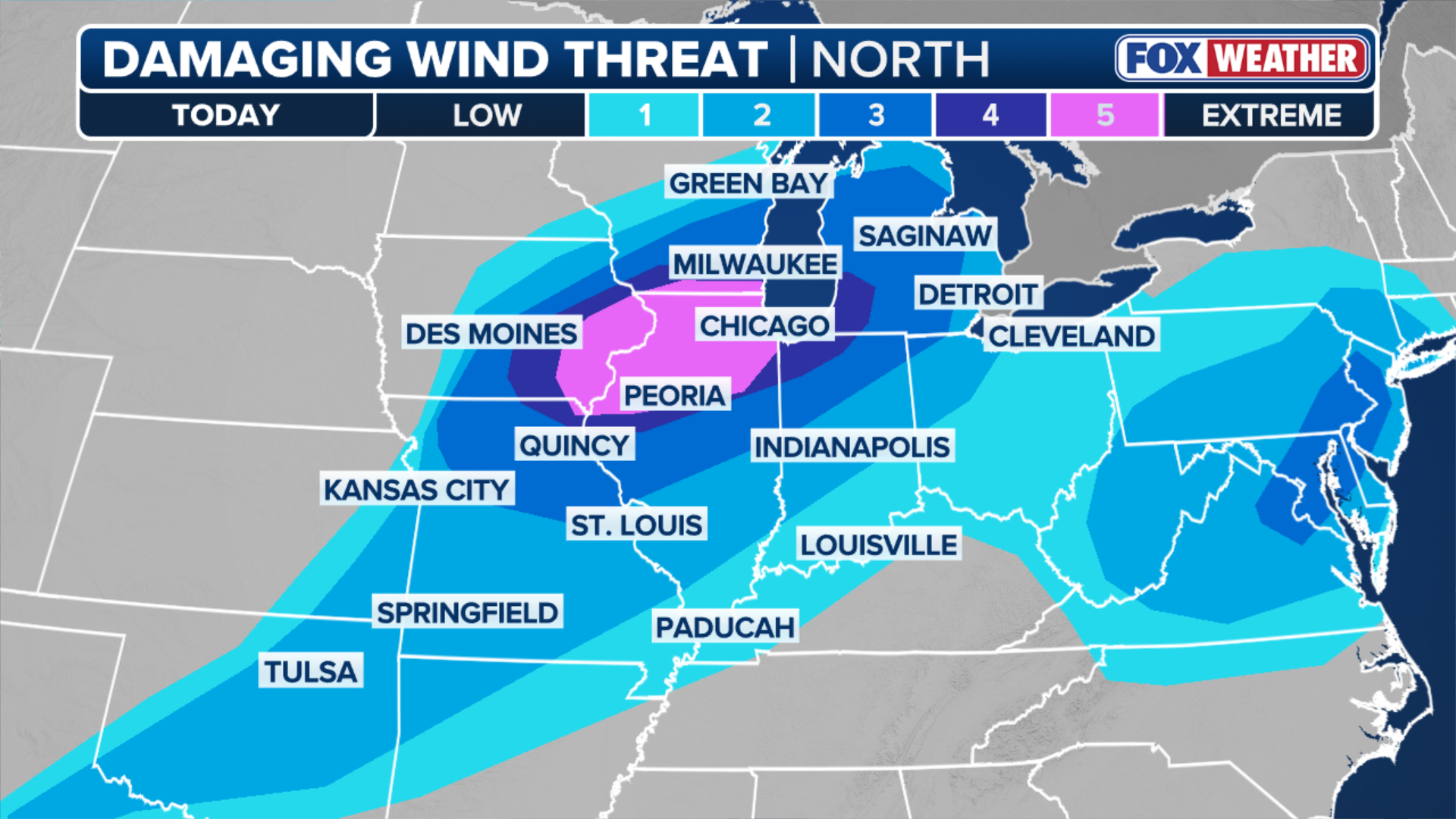
(FOX Weather)
Kansas City, St. Louis, Indianapolis, Detroit and Cleveland were under a Level 2 risk of severe thunderstorms.
FLASH FLOODS TRIGGER WATER RESCUES IN MISSOURI, KANSAS AS GROWING FLOOD THREAT COVERS NEARLY 50M
These moisture-rich storms also brought the potential for low-end risk flash flooding, with widespread rainfall totals of 1 to 2 inches across Minnesota, Wisconsin, Iowa and Illinois through Thursday night.
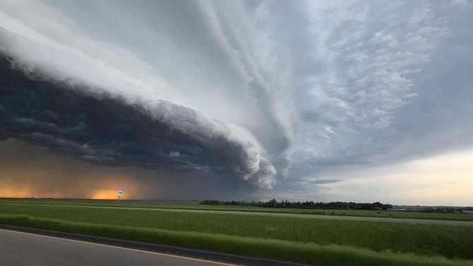
Mothership supercell thunderstorm captured by Exclusive FOX Weather Storm Tracker Corey Gerken near Bismarck, North Dakota, on Tuesday, June 9, 2026.
(FOX Weather)
The Midwest will see a reprieve from severe weather Friday after a week of storms began Tuesday.
Stay tuned to FOX Weather for the latest updates on the multiday severe weather event.