Gulf of Mexico among 4 areas of possible tropical development being tracked in Atlantic basin
Three areas are far from the U.S., but a third area is being watched as it moves toward the Gulf of Mexico.
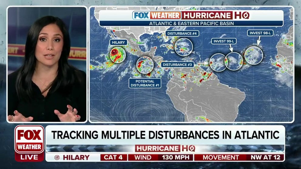
Tracking multiple disturbances in the Atlantic
Known as Disturbance #4, Disturbance #3, Invest 99-L and Invest 98-L, four disturbances brew in the Atlantic Ocean as hurricane season nears its peak. August 18, 2023.
The National Hurricane Center (NHC) is monitoring four areas in the Atlantic basin that have the potential for tropical development as Category 4 Hurricane Hilary churns closer to the U.S. in the Pacific.
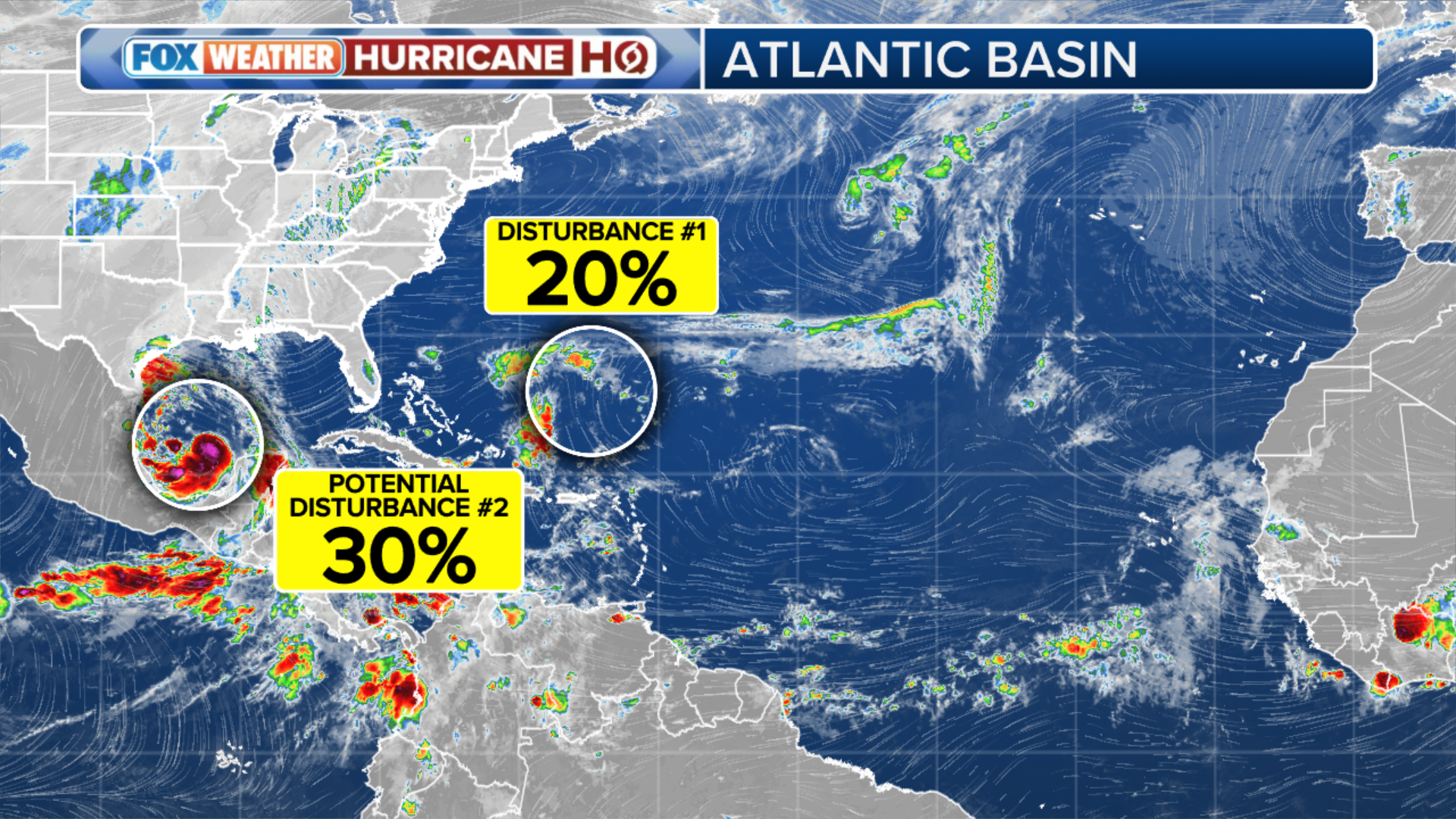
The closest disturbance to the U.S. is located in the southwest Atlantic. The wave is expected to increase rain chances in South Florida over the weekend before entering the Gulf of Mexico next week. According to the NHC, the disturbance has a low chance of development – near 0% within two days and 50% within a week. Once free from the influences of the land, the disturbance will have the best chance for development before generally heading westward towards Texas.
GUIDE FOR 2023 HURRICANE SEASON
A second feature is located about 400 miles away from the Lesser Antilles. The NHC said some slow development of this system is possible over the weekend and into early next week as it moves generally west-northwestward at 10-15 mph across the Lesser Antilles and into the northeastern Caribbean Sea. Due to shear and dry air, forecasters have given the disturbance the lowest chances of development out of all the tropical entities. It has only a 10% chance of forming in two days and a 30% chance in a week.
(FOX Weather)
Furthest east, the NHC is monitoring two invests with a medium and high chance of development over the next week. An invest is the designation the NHC uses to identify an area of disturbed weather being investigated for possible tropical development.
The first invest is 99L. The elongated trough of low pressure is located roughly halfway between the Cabo Verde Islands and the Lesser Antilles and is producing some disorganized showers and thunderstorms. The NHC said a tropical depression could still form during the next couple of days while it moves west-northwestward at 10 to 15 mph across the central tropical Atlantic. The area has a 40% chance of development over the next two days and a 40% chance over the next week.
The second invest is located in the eastern Atlantic and is known as 98L and is located a few hundred miles west of the Cabo Verde Islands. The NHC said further development of this low is possible while it moves toward the west-northwest at about 10 mph. A tropical depression could form over the weekend before environmental conditions become unfavorable for development early next week. The disturbance has a 70% chance of development during the next two days and a 70% chance during the next week.
Atlantic basin has been unusually quiet
After a busy start to the season, with five cyclones, including a hurricane, there hasn't been much to track in the Atlantic.
The FOX Forecast Center is tracking both Saharan dust and upper-level winds, which are making the basin hostile to development.
NOAA expects warm water temperatures to contribute to the above-normal activity and recently released an updated seasonal forecast which called for 14-21 named storms and 6-11 hurricanes.
Forecasters widely consider August the month when the proverbial "flip of the switch" happens, meaning when hostile conditions tend to relax and allow for more tropical cyclones.
To mark the occasion, hurricane experts at Colorado State University ring a bell every Aug. 20 to signify the arrival of the most active part of the Atlantic hurricane season.
Some years are more active than others, but it doesn’t get quieter than last year’s August.
No tropical storms or hurricanes formed, marking only the second August in the modern satellite era that did not see a named cyclone.
Hurricane season in the Atlantic runs from June 1 through November 30.