

Nearly 50 record highs shatter as omega block locks in a summer sizzle across the Northern Tier
Once the omega block establishes itself, it will act like an atmospheric roadblock, keeping the unseasonable warmth anchored over the region for days.
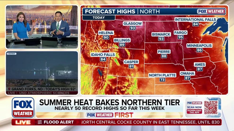
Nearly 50 record highs tumble as omega block bakes the Northern Tier
Summer heat has finally arrived across the Northern Tier, shattering nearly 50 records with temperatures up to 20 degrees above average. With an omega block set to anchor over the region, the sizzle will lock in for the rest of the week. Latest:
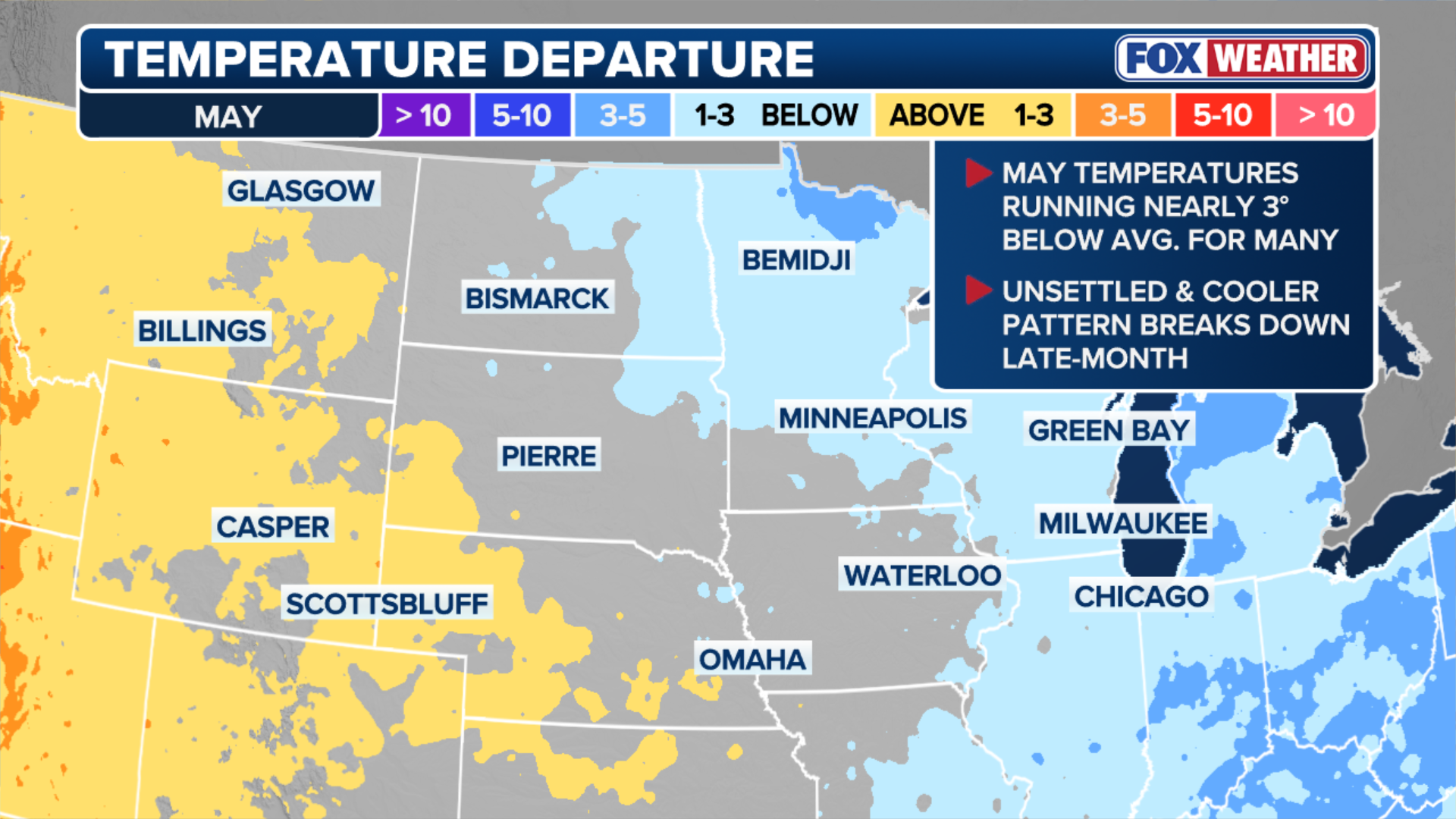
Up until this week, two regions in particular remained cooler than average or right at average for spring, unlike the rest of the Lower 48: the Northern Tier and Upper Midwest. But that all changed as temperatures continued to climb 10 to 20 degrees above average.
(FOX Weather)
Nearly 50 record highs have already been broken, with Minneapolis eyeing its first 90-degree day since last October.
According to the FOX Forecast Center, May has featured the largest temperature anomalies of the season across this region.
Cities like Minneapolis, Green Bay and Detroit, were recording temperatures several degrees below normal.
However, temperatures are finally surging into summer-like territory and will last most of this week as an omega block will keep the unseasonable warmth anchored over the region.
OMEGA BLOCK WEATHER PATTERN TO BRING LATE SEASON SNOW, HEAVY RAIN AND COOLER TEMPS TO THE WEST COAST
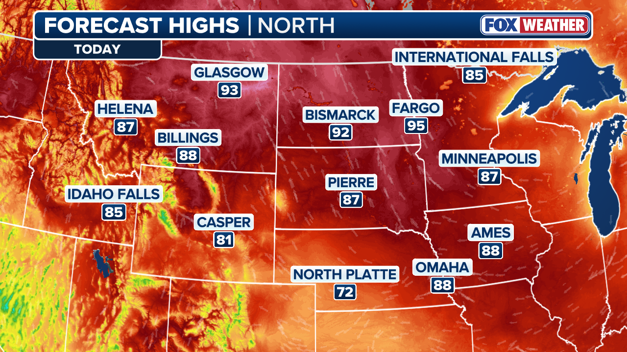
Thursday’s forecast features more high temperatures rising up to 20 degrees above average from the Northern Plains through the Upper Midwest.
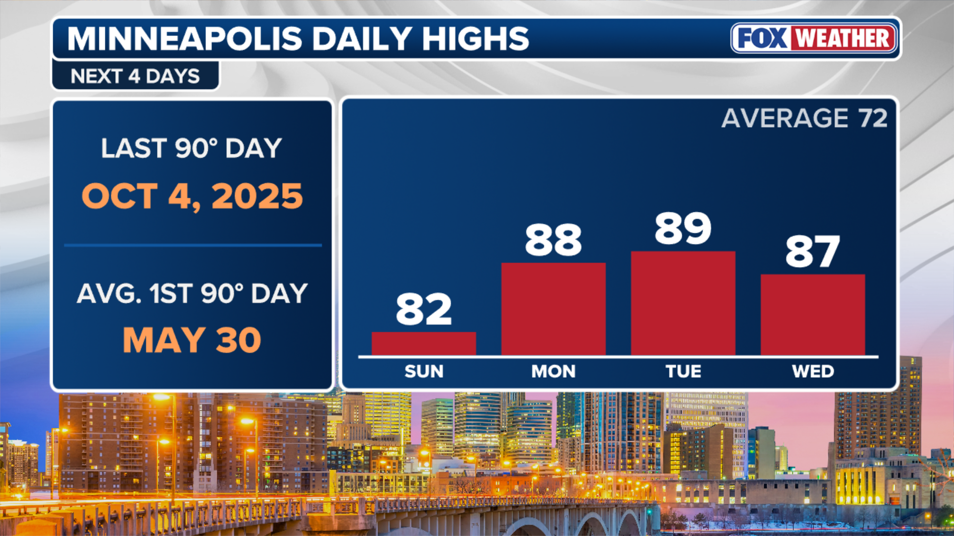
Minneapolis was very close to reaching 90 degrees on Wednesday with a high of 89 and could flirt with 90 degrees again on Thursday.
(FOX Weather)
This would mark the city’s warmest temperature since October 2025.
That said, heat alerts are also in effect across portions of Montana through Thursday.
While the record temperatures started to wane on Wednesday after 50 record highs fell within the prior two days, the FOX Forecast Center reminds us that despite the heat, water temperatures remain chilly, generally in the middle to lower 50s. Thus, relief from the heat may be a shock to the system.
(FOX Weather)
The initial spike early this week was driven by a standard, progressive ridge of high pressure tracking across the country. But Thursday and Friday bring the real staying power for this warmth.
The atmospheric pattern is forecast to buckle and lock into a powerful omega block.
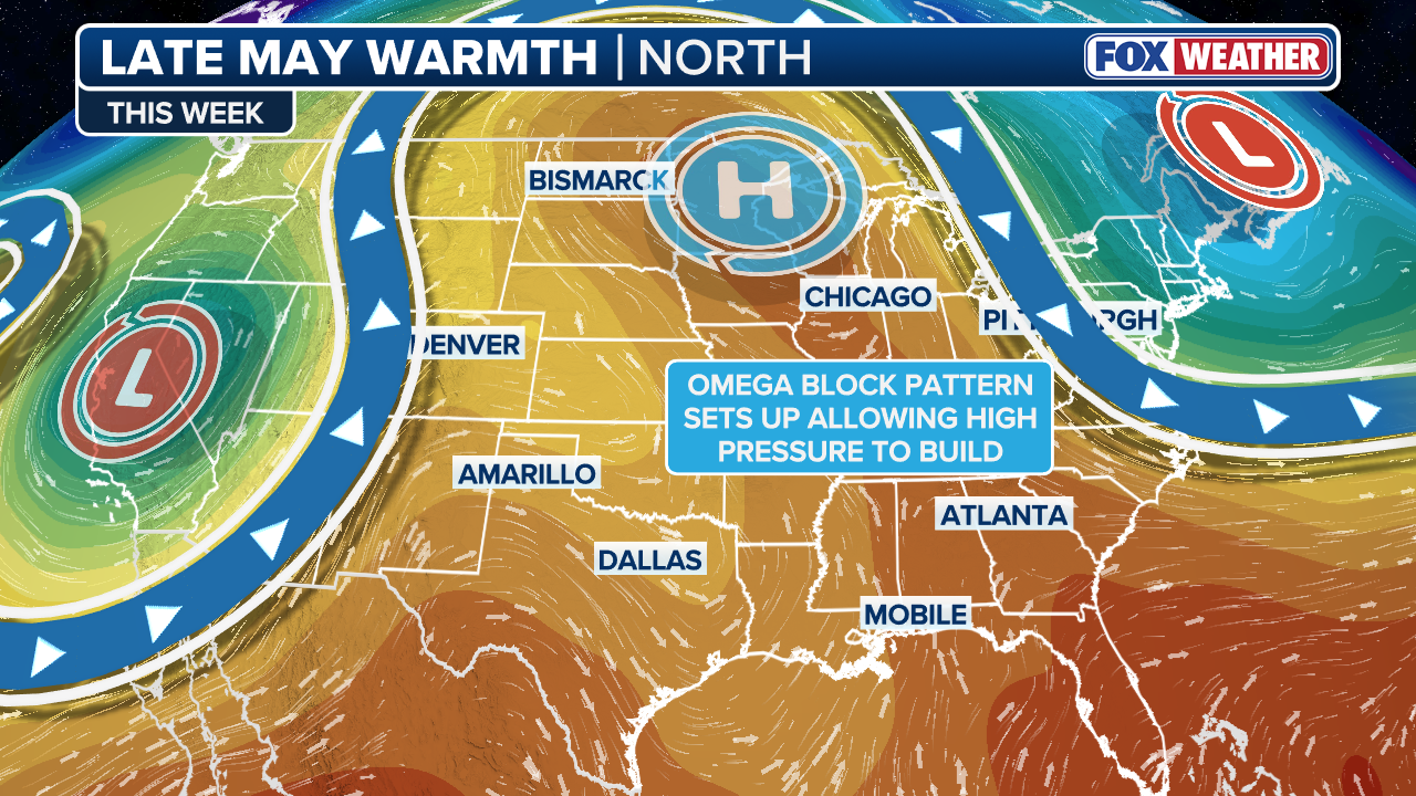
(FOX Weather)
Named for its resemblance to the Greek letter Omega, this setup features a massive ridge of high pressure trapped between two deep areas of low pressure on either side.
Once this block establishes itself, it will act like an atmospheric roadblock, keeping the unseasonable warmth anchored over the region for days.
Through the first week of June, long-range outlooks from the Climate Prediction Center continue to show much of the Northern Tier remaining above average after a chillier start to May.