Strong winds, dry air expand fire threat from the Plains into the Rockies as Southeast risk eases
The most critical conditions are expected in central and southeastern Wyoming, where conditions are favorable for fast-moving grass fires.

Extreme dry conditions, gusty winds fuel expanding fire threat across the Plains into the Rockies
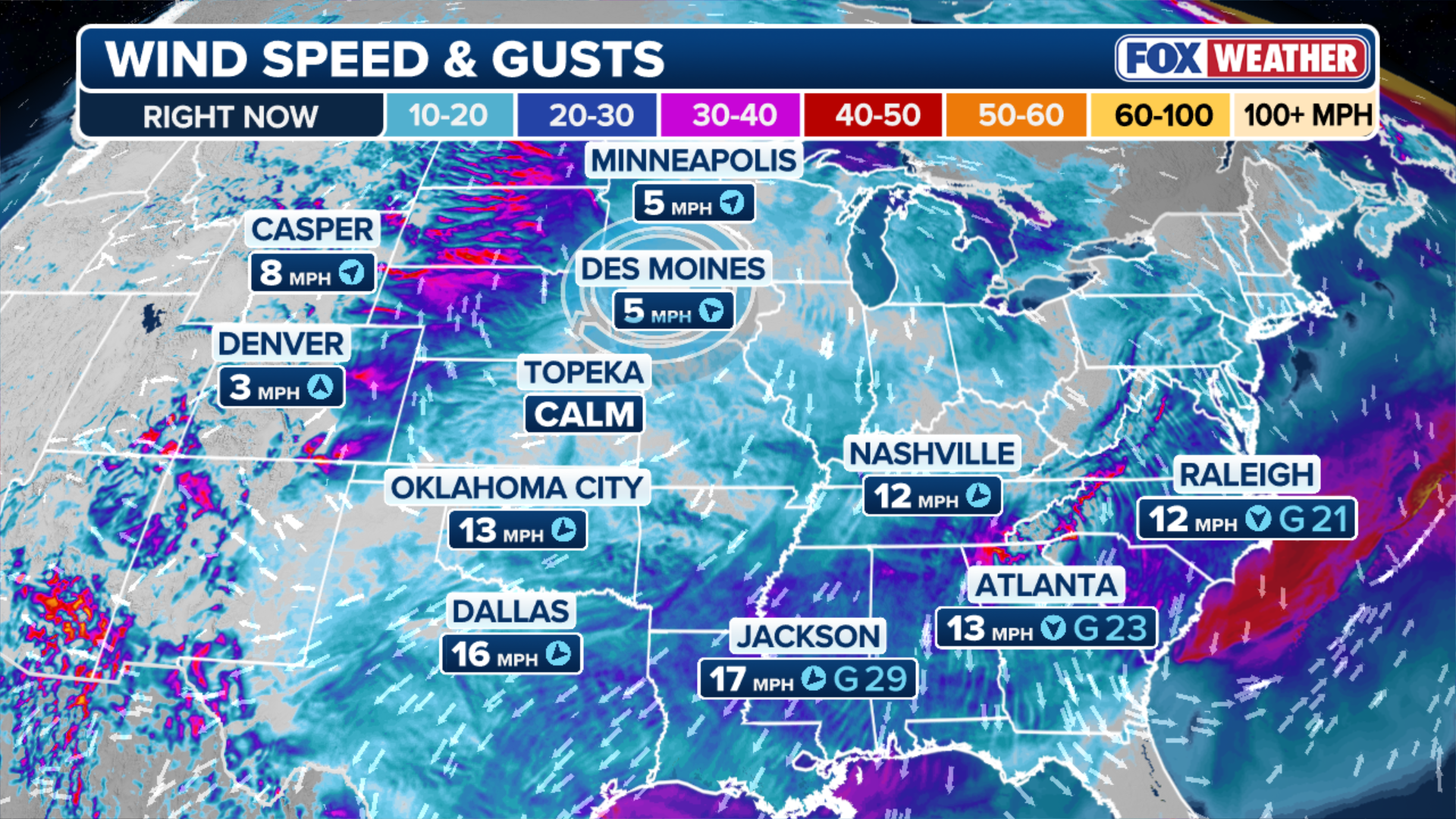
Extreme dry conditions, ongoing lack of moisture, and gusty winds—some reaching 20–30 mph—are fueling the fire threat across the Plains, expanding into the Rockies. The most critical conditions are expected in central and southeastern Wyoming, where conditions are favorable for fast-moving grass fires. Latest:
After elevated fire danger persisted across parts of the Plains Sunday and through the night, the threat is now expanding across the Intermountain West and High Plains on Monday.
Driven by a combination of strong winds, very dry air, and an ongoing lack of moisture, the most critical conditions are expected in central and southeastern Wyoming.
APRIL WEATHER OUTLOOK: SEVERE STORMS TARGET MILLIONS AS SPRING TEMPERATURE WARMUP FINALLY NEARS
The atmosphere across the eastern half of the country has undergone a harsh correction, trading record-breaking heat for a bone-dry arctic chill in less than 48 hours.
As temperatures plummeted by as much as 30 degrees, a dangerous combination of biting winds and plummeting humidity has turned the landscape into a tinderbox.
(FOX Weather)
The FOX Forecast Center said a weakening dome of high pressure is setting up a strong west-to-east flow, which will help drive winds around 20–30 mph.
At the same time, humidity levels are expected to drop sharply, down into the 15% to 20% range.
(FOX Weather)
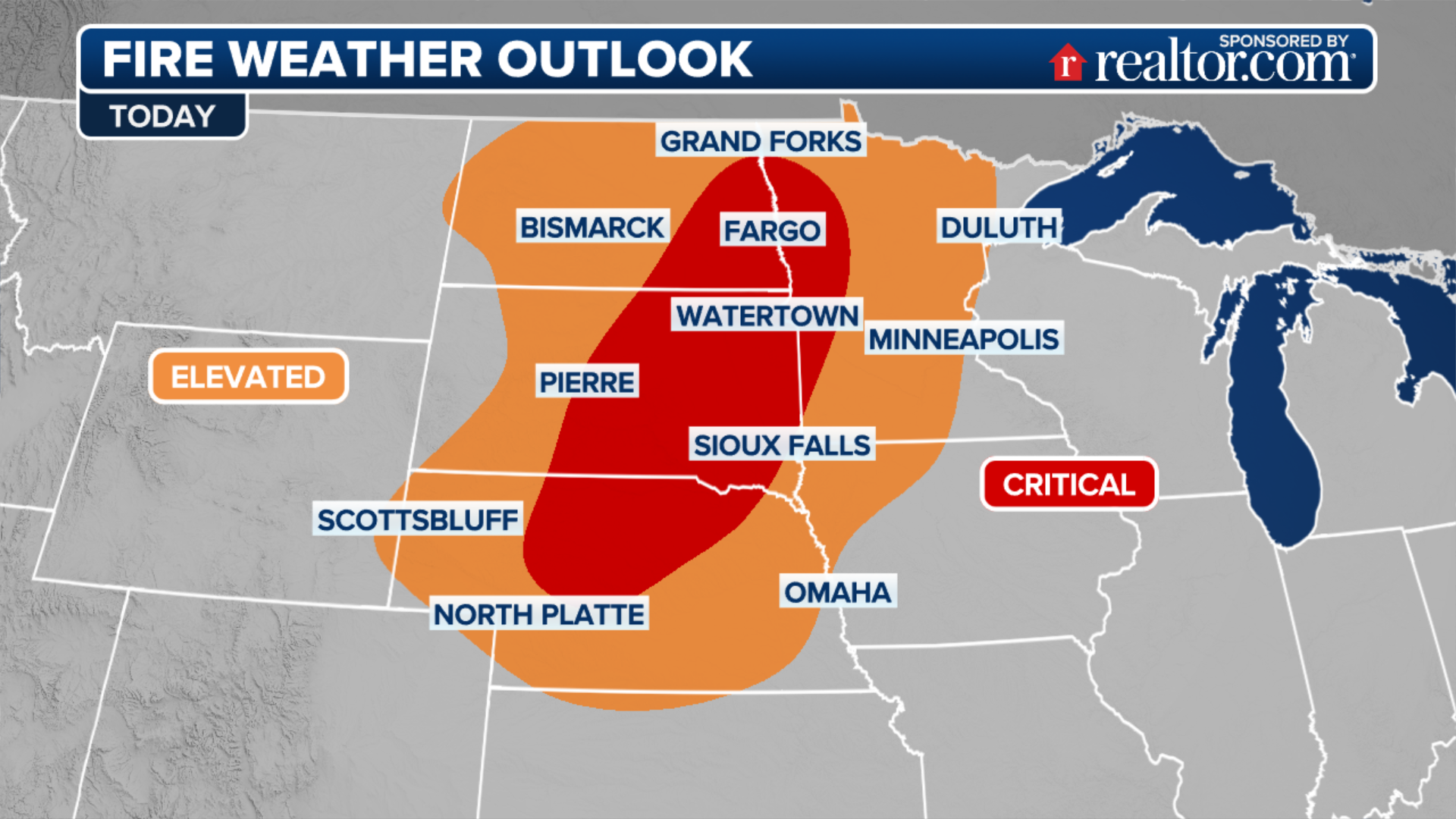
With that said, this combination of dry air and gusty winds is enough to support rapid fire growth if anything starts, and conditions are favorable for fast-moving grass fires.
However, the FOX Forecast Center said the fire risk is not limited to Wyoming.
A broad area of dry, downslope winds stretching across Colorado, Kansas, and the Oklahoma and Texas Panhandles will be enhanced by a low pressure developing over the Northern Plains.
While winds may be weaker than farther north, extremely dry air will still allow fires to start and spread quickly, with humidity in some areas dropping as low as 10%.
(FOX Weather)
Arizona and western New Mexico will also be monitored for dry thunderstorms, which can produce lightning without rain at the surface, creating a risk for fires.
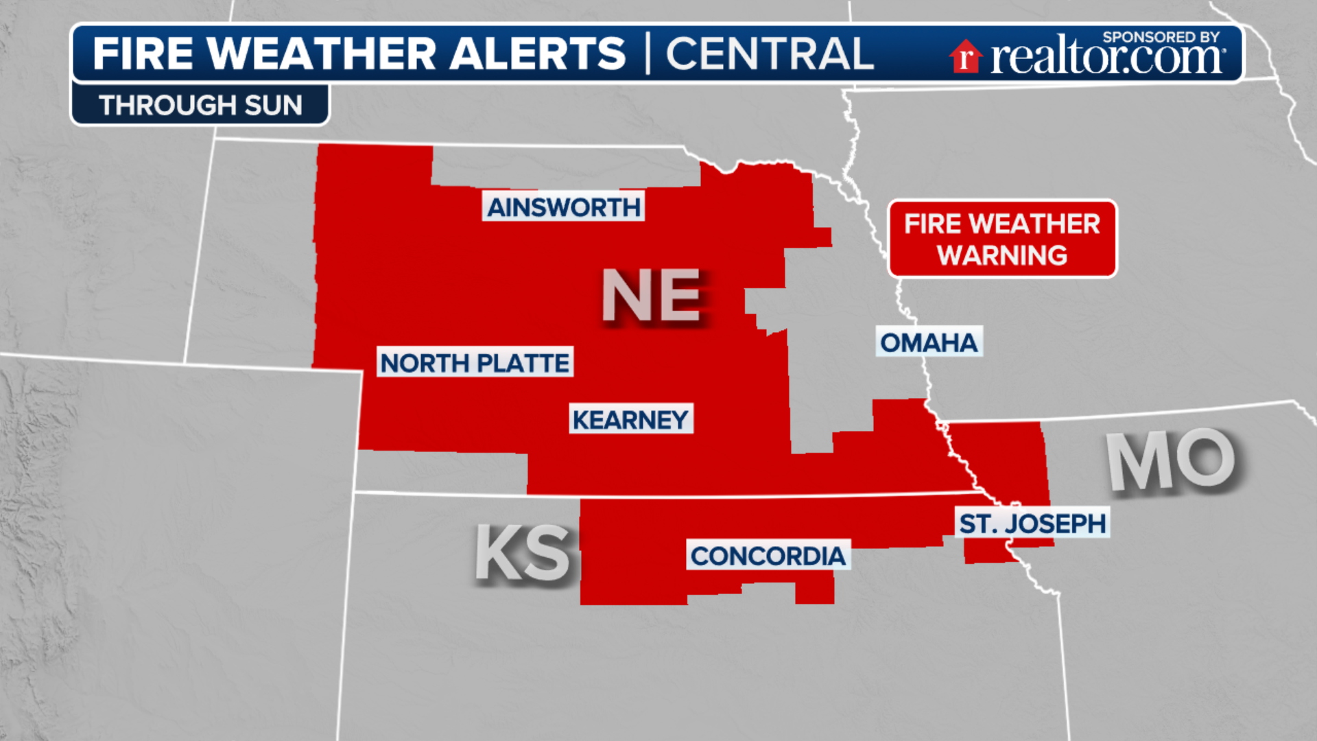
This all comes on the heels of a heightened weekend, as at one point, nearly the entire Southeast was under some form of fire weather alert on Saturday and the elevated fire risks continued across the Plains on Sunday.
The most dangerous areas remained in parts of Wyoming, Nebraska and Utah, where strong, gusty winds continued to pose a serious risk.
Originating from polar regions, the cooler air mass is exceptionally dry, causing humidity to drop into the teens across a large portion of the country. While the dry air is significant on its own, the combination of the dryness with strong winds creates a dangerous potential for the spread of wildfire.
The winds are driven by an area of high pressure building behind the cold front.
HISTORIC HEAT WAVE EXPANDS INTO CENTRAL US AFTER WEEKS OF RECORD HEAT IN THE SOUTHWEST
On Saturday, this seasonably strong high settled over the southern Great Lakes, and the pressure gradient tightened over a relatively short distance, generating stiff breezes, causing the fire threat to intensify across the Southeast and the Plains.
This prompted Fire Weather Warnings for nearly 50 million people across nearly 20 states.
![]() Image 1 of 4
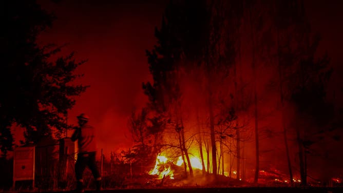
Image 1 of 4Flames and burning vegetation are seen during a wildfire in the town of Florida near the city of Concepción, Chile, on January 20, 2026. Residents of southern Chile, ravaged by four days of deadly wildfires, pleaded for help on January 20 from communities reduced to rubble, as smoke lingered and firefighters braced for the return of hot weather. (Photo by Raul BRAVO / AFP via Getty Images)
![]() Image 2 of 4
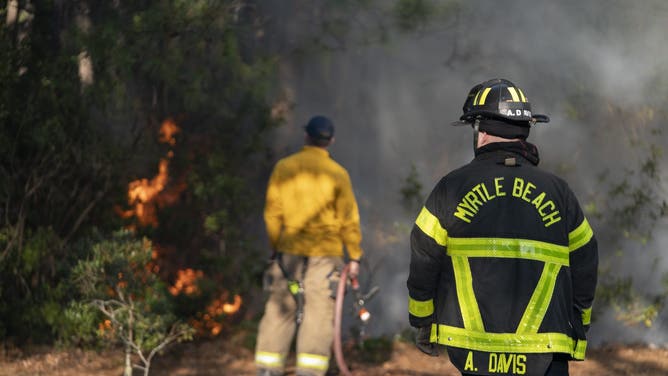
Image 2 of 4MYRTLE BEACH, SOUTH CAROLINA - MARCH 02: Firefighters attend to a flare-up in the Carolina Forest neighborhood on March 2, 2025 in Myrtle Beach, South Carolina. Multiple forest fires in the area have caused evacuations along the South Carolina coast. (Photo by Sean Rayford/Getty Images)
![]() Image 3 of 4
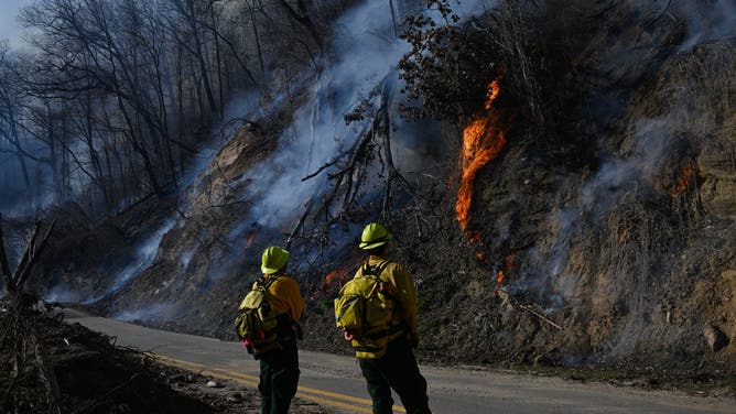
Image 3 of 4TRYON, USA - MARCH 3: Firefighters work to put out wildfire in in Tryon, North Carolina, United States on March 03, 2025. One of hundreds of wildfires in the Carolinas is burning just about six months after the water damage for communities by the devastating Hurricane Helene in Tryon. (Photo by Peter Zay/Anadolu via Getty Images)
![]() Image 4 of 4
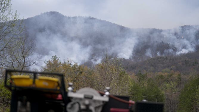
Image 4 of 4PUMPKINTOWN, SOUTH CAROLINA - MARCH 29: Smoke rises at the Table Rock complex fire March 29, 2025 near Pumpkintown, South Carolina. According to a report from wildfire officials published the previous afternoon, the Table Rock complex fire has burned 12,983 acres. (Photo by Sean Rayford/Getty Images)
In the Southeast, humidity dropped as low as 20%, especially across parts of South Carolina, southern Georgia and north Florida. Sustained winds reached 10 to 20 mph with higher gusts.
Fire Weather Warnings spanned from western North Carolina through Louisiana, including parts of the Florida panhandle, with a Fire Weather Watch issued for parts of east Texas.

Watch: Smoke arises from Nebraska wildfires
Video from Nebraska State Patrol shows a helicopter flying over a wildfire in Dawson County. Multiple wildfires are burning in Nebraska as high winds and low humidity create critical fire danger across the state.
In Nebraska, several wildfires continue to burn near the historic Morrill Fire.
The Minor Fire, which has burned 14,000 acres and is about 30% contained, and the Ashby Fire, which has burned just over 36,000 acres and is 51% contained, could grow again on Sunday as locally stronger winds move through the area.
Some forecasts indicate gusts up to 30 mph, which may further complicate containment efforts.