

Level 4/5 severe storm risk issued for millions in the Midwest, destructive tornadoes and winds possible
Severe weather will kick off Tuesday in parts of the Midwest, bringing thunderstorms with gusty winds, hail, and a possible isolated tornado before the storm threat escalates on Wednesday.
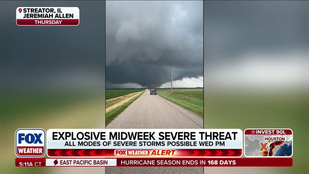
Level 4/5 severe storm threat issued for parts of the Midwest, tornado outbreak possible
Another severe storm outbreak is set to slam parts of the Midwest already hit hard this season. Intense tornadoes and damaging winds are the biggest risk on Wednesday, with some parts of the region seeing a Level 4 out of 5 severe weather threat. Stay with FOX Weather for the latest.
Severe storms are set to slam portions of the Midwest and Northeast through Wednesday, raising concerns for another major outbreak coming just days after tornadoes, destructive winds and large hail battered many of the same areas.
This pattern isn’t unusual for Illinois, which has led the nation in tornado reports, with more expected this week.
Severe weather will begin Tuesday in Illinois, Indiana and Michigan, sparking thunderstorms with gusty winds and hail. However, an isolated tornado cannot be ruled out, the FOX Forecast Center said.
With that, the Storm Prediction Center has issued a Level 2 out of 5 risk for areas in the Midwest, including the metros of Chicago, Indianapolis and Detroit.

(FOX Weather)
According to the FOX Forecast Center, a strong area of low pressure is expected to develop across parts of the Plains on Tuesday and race eastward.
Ahead of it, a strong upper-level jet stream will drive southerly winds, pulling Gulf moisture northward to interact with a cold front—setting the stage for severe weather.
By Wednesday, the severe weather threat will increase as the area of low pressure moves from the Midwest into the Great Lakes.
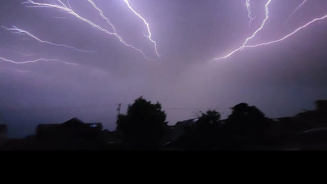
Lightning spiders across Fort Riley, Kansas, on June 9, 2026.
(Jonathan / FOX Weather)
Ahead of the risks, a Level 4 out of 5 severe storm threat was added Tuesday morning for areas across north-central Illinois and western Indiana.
Meanwhile, a Level 3 out of 5 severe storm risk has been issued from Kansas City to St. Louis, and northward into Chicago, with a broader Level 2 threat stretching from Kansas to Kentucky, including Louisville, Indianapolis, and Columbus.

(FOX Weather)
Meanwhile, a Level 3 out of 5 severe storm risk has been issued from Kansas City to St. Louis, and northward into Chicago, with a broader Level 2 threat stretching from Kansas to Kentucky, including Louisville, Indianapolis, and Columbus.
WHAT IS A SUPERCELL THUNDERSTORM?
The FOX Forecast Center said there could be two distinct rounds of severe storms: One in the morning to afternoon hours bringing damaging winds and large hail, followed by a second round as atmospheric conditions rapidly destabilize by Wednesday afternoon.
With a significant amount of wind shear in place, discrete supercells capable of producing intense, long-track tornadoes are expected to develop initially.
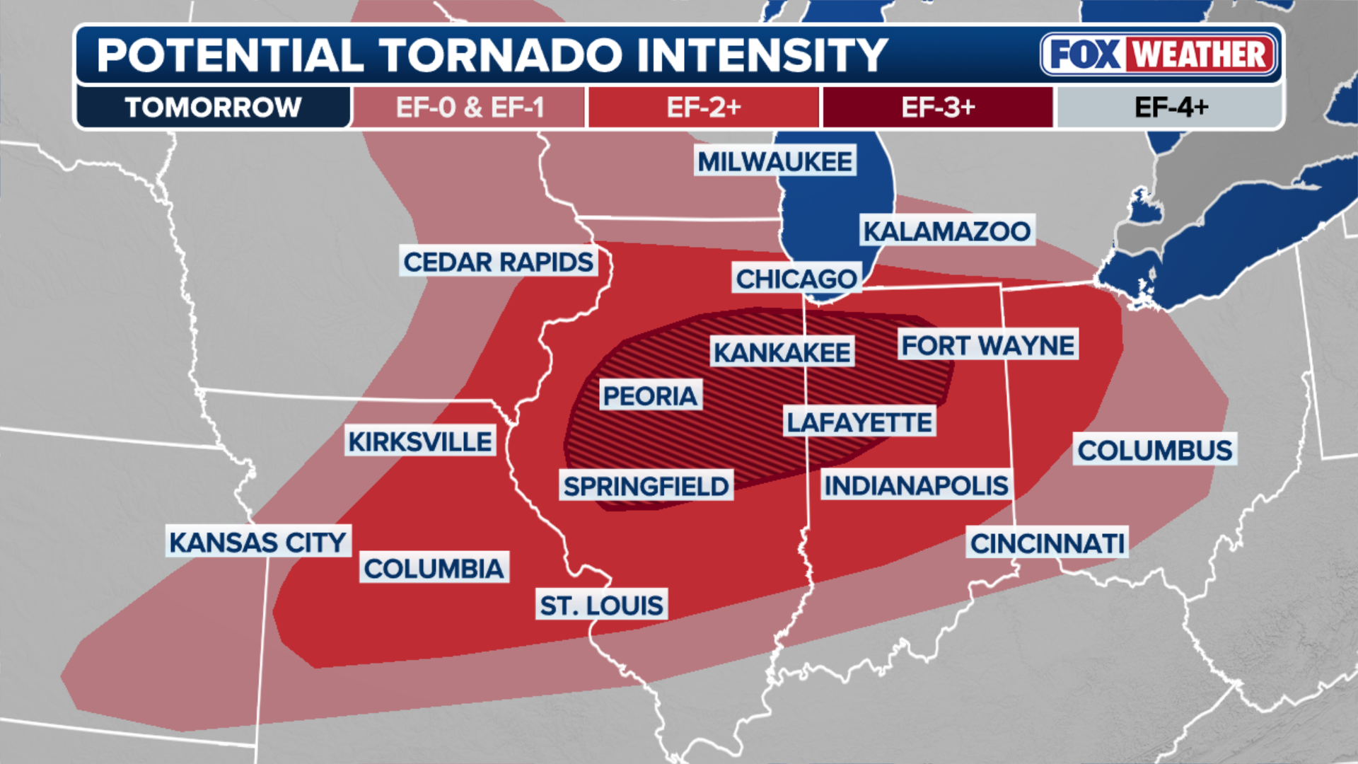
(FOX Weather)
Through the evening hours, these storms will develop into an intense line of severe storms bringing a widespread threat of destructive, straight-line winds through the region.
1 DEAD AND 22 INJURED AFTER SEVERE WEATHER PROMPTS OUTDOOR TENT FAILURE AT VIRGINIA CHURCH
A flash flood threat is in place across the Midwest as storms move through. Since much of this area is already saturated from previous weeks of storms, it will take only some additional rainfall to spark flash flooding.
KNOW YOUR FLOOD TERMINOLOGY: WHAT FLOOD WATCHES, WARNINGS AND EMERGENCIES REALLY MEAN
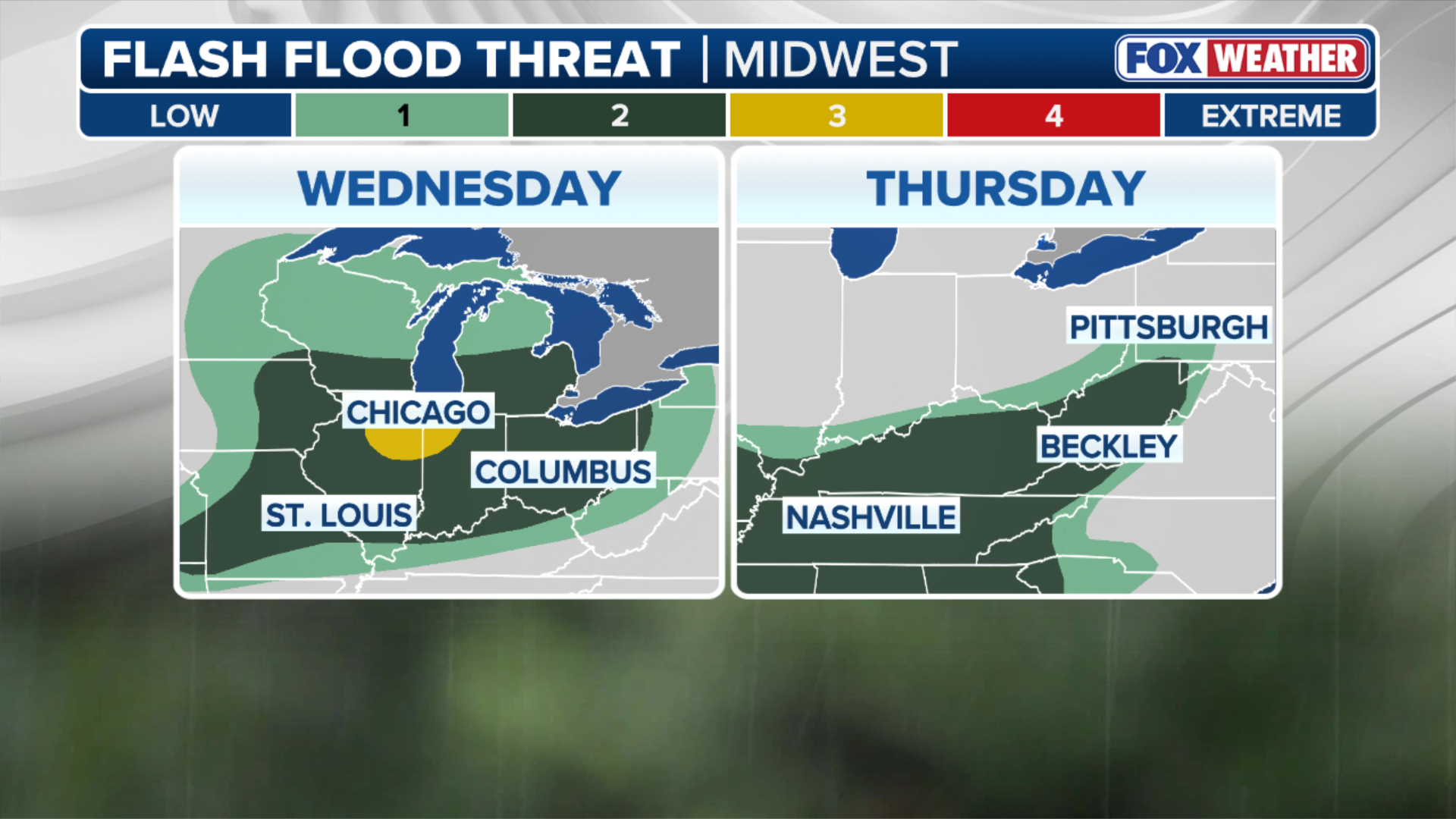
(FOX Weather)
The FOX Forecast Center said widespread rainfall totals of 1 to 2 inches are expected across Wisconsin, Illinois, Michigan, and Indiana, with localized amounts exceeding 2 to 3 inches.
Stay with FOX Weather as this situation continues to unfold.