Miami faces tornado threat for second day after twisters reported in North Florida, Georgia
South Florida's potential weather threats include large hail, wind gusts over 60 mph and the possibility of a tornado. On Sunday, Miami saw a gust of 67 mph.
Tornadoes could threaten Miami for second straight day Monday as severe weather risk returns to South Florida
Severe thunderstorms could develop again Monday across South Florida after powerful storms produced damaging winds, hail and a few tornadoes across portions of Florida and Georgia on Sunday.
MIAMI – South Florida faces a renewed threat of severe weather on Monday with strong winds, hail and the possibility of a tornado.
This second straight day of severe thunderstorms comes after the Miami and Florida Keys areas were under a Tornado Watch for part of Sunday. The Miami area did see heavy rainfall and powerful winds, with the University of Miami Health System recording a gust of 67 mph.
However, multiple reports of tornadoes did come in from North Florida and South Georgia. More than 26 Tornado Warnings were issued during Sunday's severe weather. The National Weather Service in Tallahassee will be out surveying possible tornado damage near Valdosta, Georgia, on Monday. According to the FOX Forecast Center, the last time Valdosta was under a Tornado Warning in February was in 2009.
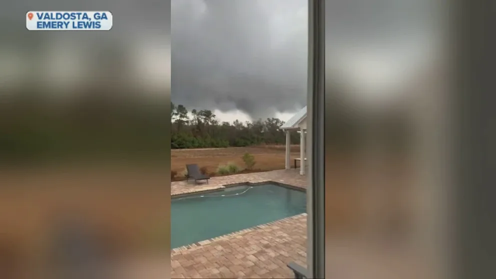
Possible tornado tosses debris in Valdosta, Georgia
A Lowndes County Sheriff official told local media that the apparent tornado damaged several homes. This Valdosta homeowner had a few tense minutes watching the twister uncomfortably close to his home.
On Monday, the same low-pressure system responsible for the weekend storms will move south across the Florida Peninsula. The day started out gloomy on Florida's Gulf Coast before the thunderstorms drove into the South Florida area.
Similar to Sunday's pattern, thunderstorms will sweep up the peninsula on Monday, bringing storms to the Interstate 4 corridor.
The storm system is also creating hazardous marine conditions along both Florida coasts. A Gale Warning is in place for Flagler Beach to Sebastian Inlet through Wednesday. Surf between 6 and 12 feet is possible from Tuesday into Wednesday.

(FOX Weather)
"We have this area of low pressure that's kind of wrapping itself around. It's moving down to the Gulf of Mexico today. And so that taps into all that moisture from the Gulf of Mexico that does produce the potential here for heavy rain," FOX Weather Meteorologist Britta Merwin said. "But also just the trajectory of these storms can spark the threat of severe weather."
TORNADO SAFETY: HOW TO IDENTIFY THE SAFEST PLACES INSIDE YOUR HOME
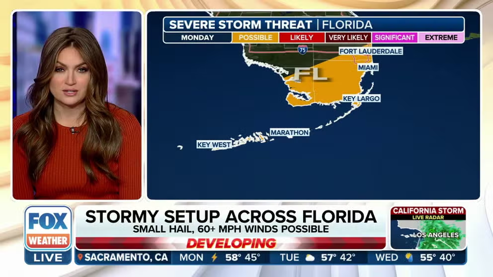
South Florida may have severe weather, encompassing more than 3.5 million people, including Miami, Fort Lauderdale and Hollywood.
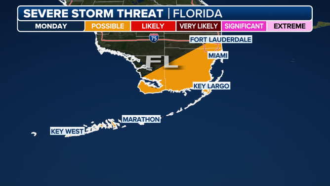
Monday's severe storm threat area in Florida.
(FOX Weather)
NOAA’s Storm Prediction Center has placed the Miami area and the Florida Keys at a Level 1 out of 5 risk for severe weather on Monday. The potential threats include large hail, wind gusts over 60 mph and a possible tornado.
More than an inch of rain is likely to fall through Monday in South Florida before this system moves out. Some areas in far southwestern Florida could see up to 2 inches.
Better weather ahead
The good news is that after Monday, the storms will move out into the Atlantic. Florida will have a reprieve with a quieter weather pattern and mild temperatures.
The improvement will help the four private Ax-3 mission astronauts return from the International Space Station and splashdown off Florida's coast on Tuesday. Florida's stormy weather conditions caused SpaceX to delay the return to Earth for the crew by several days.