From fire to ice: Denver braces for heavy snow as temps plummet nearly 60 degrees
Heavy, wet snow poses a significant threat of downed tree branches and power outages
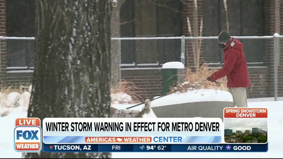
Late-season winter storm delivers snow to Colorado
FOX Weather correspondent Max Gorden with an update on the storm from Castle Rock, Colorado where 12-18 inches of snow is expected.
It's a clash of summer and winter across the Rockies as the Denver metro braces for several inches of heavy, wet snow from an impactful late-season winter storm on the heels of Thursday's dangerous fire weather fueled by temperatures in the upper 80s.
Winter Storm Warnings and Winter Weather Advisories have been issued by the National Weather Service across the central Rockies and the adjacent Front Range.
Denver and Boulder, Colorado, are among the cities included in the Winter Storm Warnings along the Interstate 25 urban corridor.
HOW TO WATCH FOX WEATHER ON TV

(FOX Weather)
Light to moderate snow was already ongoing Friday morning in the mountains and foothills of the northern and central Rockies, while rain showers were spreading into portions of the Front Range urban corridor, including the Denver metro area.
WHY SNOWFALL RATE IS IMPORTANT TO UNDERSTANDING WINTER WEATHER
As much colder air continues to rush into the region, the rain showers in the Front Range will begin mixing with snow by early Friday evening, eventually changing over to all snow later in the evening and continuing through Saturday morning. Snow will lighten in intensity and mix with rain Saturday afternoon before ending Saturday night.
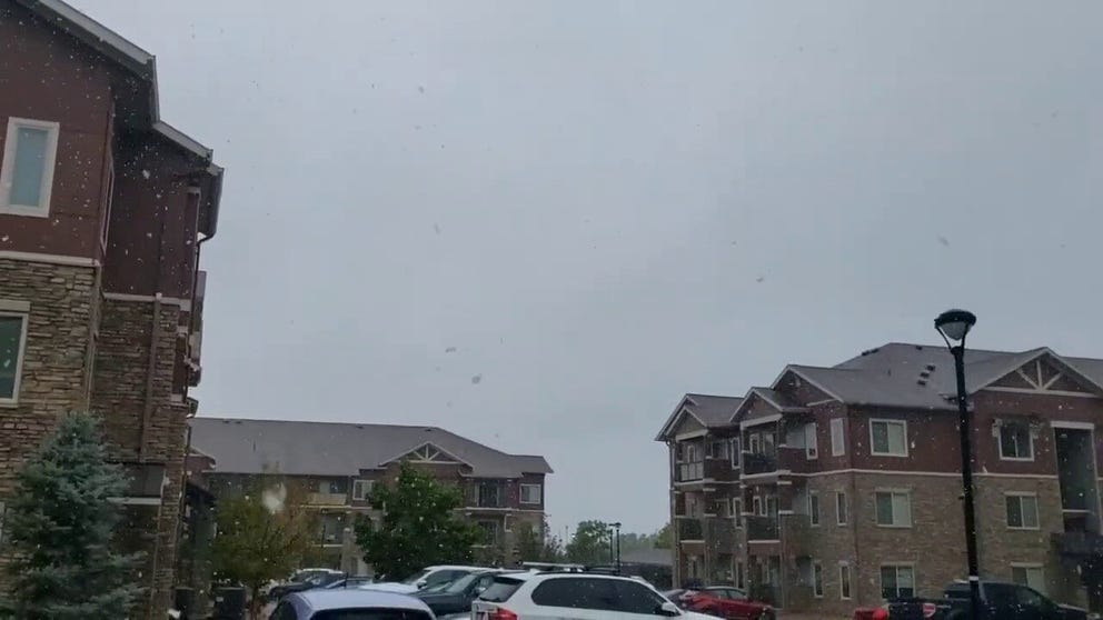
Late-season winter storm hits Littleton, Colorado
Late-season winter storm hits Littleton, Colorado on Friday.
Denver already experienced its sixth-largest one-hour temperature drop on record Thursday evening. Temperatures plummeted 25 degrees in 23 minutes, from 84 degrees at 7:30 p.m. Mountain time to 59 degrees by 7:53 p.m.
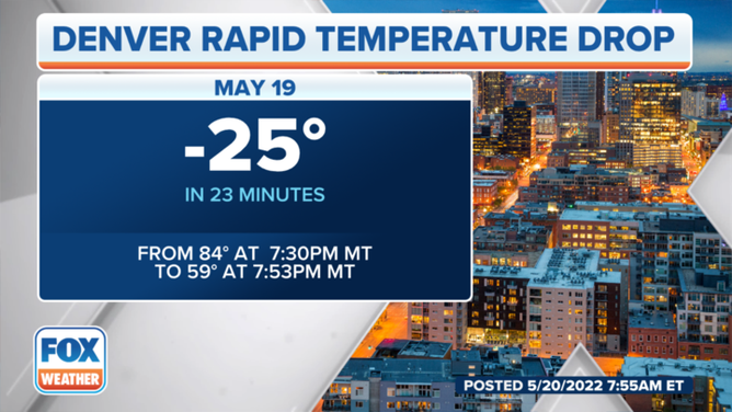
The temperature in Denver dropped from 84 degrees to 59 degrees in 23 minutes on Thursday evening, May 19, 2022.
(FOX Weather)
This winter storm will bring a heavy, wet snow due to temperatures very close to freezing. Most trees already have their leaves, which means there's a significant threat of downed tree branches and power outages as the weight of the heavy snow adds increased stress while it collects on leaves and power lines.
HERE'S WHY YOU SHOULD NEVER STORE FOOD OUTSIDE DURING A WINTER POWER OUTAGE
Between 3 and 5 inches of snow is expected in the city of Denver, with a wide range of 5- to 12-inch totals possible near Boulder due to elevation changes.

(FOX Weather)
More than a foot of snow could pile up in the higher elevations west of Interstate 25. Localized amounts over 2 feet are possible near the Continental Divide.
The accumulating snow will create difficult driving conditions across the region, so be prepared to change or postpone any travel plans you might have between now and Saturday.

(FOX Weather)
While late-May snow is rare in Denver, it is not unprecedented. The latest that measurable snow has ever been reported was on June 2 in 1951, but if at least 0.1 inches of snow is measured this Saturday, it would tie with five other years for the 10th-latest snowfall on record.
The heaviest snowstorm this late in the season was on May 25-26, 1950, when 10.7 inches piled up in the Mile High City.
WHEN CAN YOU EXPECT THE LAST SNOW OF THE SEASON?
According to the NWS, April 28 is the average date of the season's last snowfall in Denver.
CLICK HERE TO GET THE FOX WEATHER UPDATE PODCAST
As this snowstorm exits the region Saturday night, a hard freeze is expected with low temperatures dipping into the mid- to upper 20s by Sunday morning.
The snow won't stick around long, however. Denver will climb back into the 60s on Monday and into the 70s by Wednesday.