California slammed by much-needed rain and snow, as major weather pattern shifts
Winter finally makes its return to the West, as a major shift in the overall weather pattern will bring rain and heavy mountain snow to places running dangerous deficits.

California soaked by much-needed rain and snow, as major weather pattern shifts
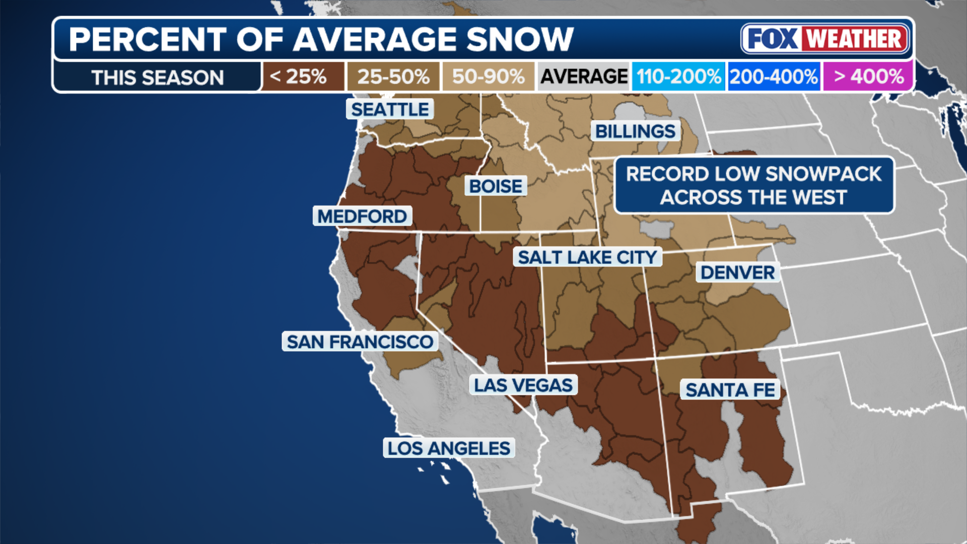
After weeks of dry weather, California is finally beginning to receive much-needed rain. San Francisco and Los Angeles could see up to 1 inch of rain by Thursday. Flash flooding is possible, particularly near burn scars from last year's devastating wildfires. Up to a foot of snow is forecast for parts of the Sierras through Wednesday. Many parts of the mountain range are sitting at just 50 percent of their typical snowpack season to date. This snow is key for ski resorts, as well as water supply for drinking and agriculture in the summer months.
After weeks of dry weather across the West, California is finally beginning to receive much-needed rain. This comes as the Sierra Nevada is sitting at just 50 percent of its typical snowpack season to date — a critical deficit for ski resorts, as well as the water supply for drinking and agriculture in the summer months.
This week's storm heralds a major change in the overall weather pattern that will bring more rain and snow to the entire western half of the country, including some locations that are at dangerous, record-low levels.
MILLIONS ACROSS THE SOUTH FACE BREWING CROSS-COUNTRY STORM AS FLOOD THREAT INCREASES

(FOX Weather)
San Francisco and Los Angeles could see up to an inch of rain by Thursday. Flash flooding is possible, particularly near burn scars from last year's devastating wildfires.
Up to a foot of snow is forecast for parts of the Sierra through Wednesday.
Winter Weather Alerts have been issued for many mountain passes and eastern slopes, with up to 18 inches of snow expected at elevations above 7,000 feet.
(FOX Weather)
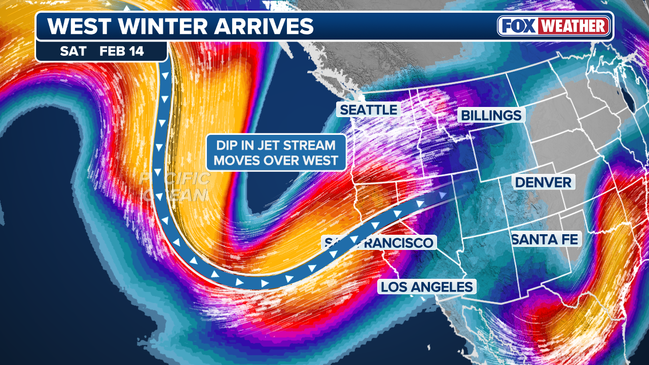
This storm comes ahead of a large dip in the jet stream that is expected to stall over the West starting this weekend.
This will promote a ridge of high pressure to shift over to the East, reversing the weather pattern that has dominated much of the beginning of 2026.
A change in the weather pattern will open the door for more storm systems to originate in the West and strengthen across the Central U.S., eventually making their way to the East as more organized, large-scale and impactful storms.
The exact track and impacts of those storms in the East remain an open question at this point.
(FOX Weather)
One thing is for sure — the abundant moisture and mountain snow associated with this pattern change.
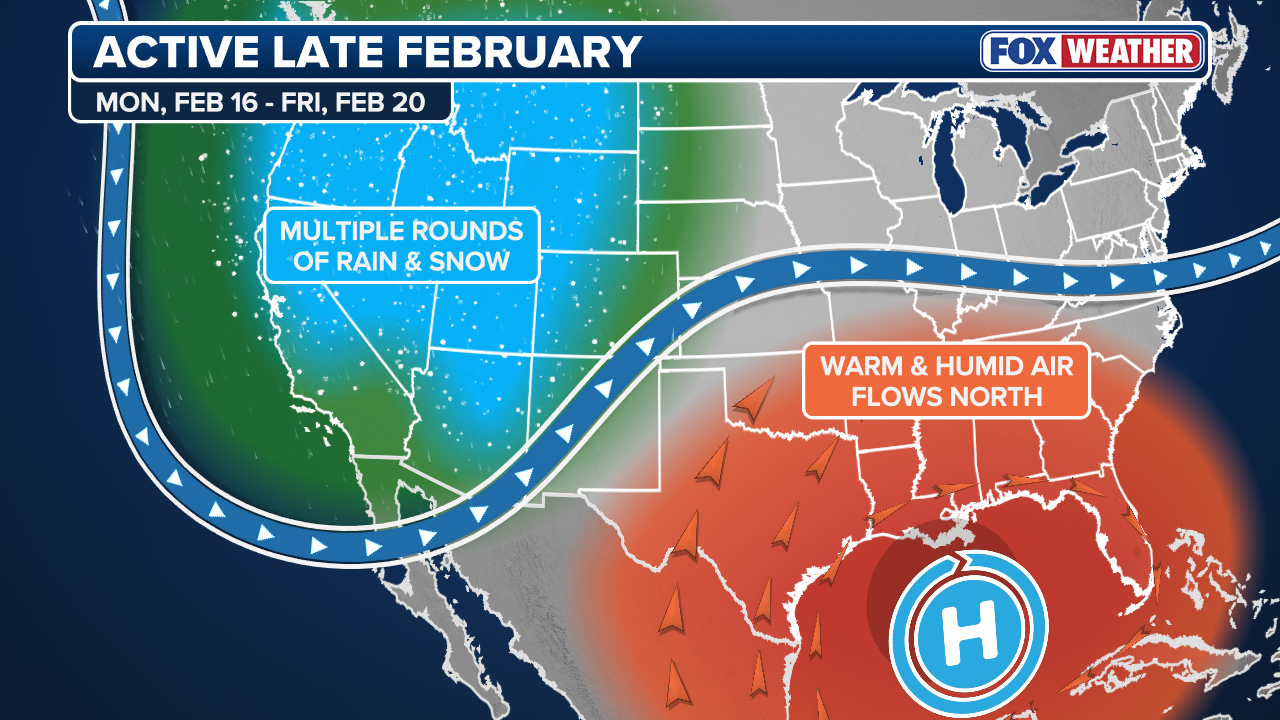
Much of the West will see an above-average amount of precipitation through the end of February, according to the NOAA Climate Prediction Center's latest outlook.
WINTER SEASON SEVERITY INDEX: WHICH PARTS OF THE US HAVE SEEN THE MOST INTENSE WINTER
This guidance shows that areas in the higher terrain, including the Rockies and Sierra Nevada, will receive at least 8 to 10 feet of snow by the end of next week.
This will be particularly beneficial for the Upper Colorado Basin snowpack, which is at an all-time record low.
(FOX Weather)
Grand Junction, Colorado, has not seen one inch of snow in one day since Nov. 11, 2024 and Salt Lake City has not picked up an inch of snow in one day since March 19, 2025.
HOW HIGH PRESSURE AND LOW PRESSURE DRIVE THE WEATHER
In addition to the snow, this pattern is also likely to increase the potential of severe weather in the South.
An area of high pressure in the South will promote warmer air and instability, fueling stronger thunderstorms.
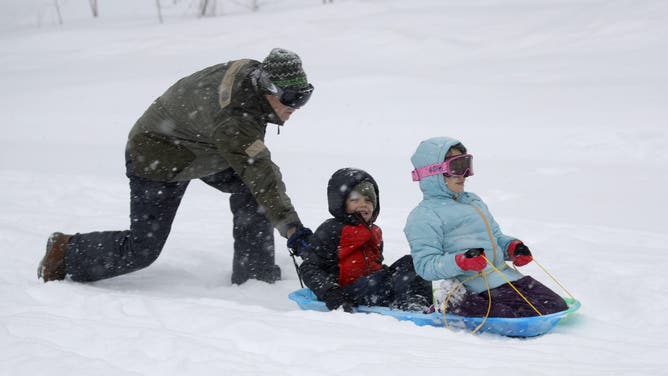
A grandad pushes his grandchildren, from Oakland, at Northstar California Resort in Truckee, Calif., on Friday, March 1, 2024.
(Jane Tyska / Digital First Media / East Bay Times / FOX Weather)
The upshot of this pattern change is a return to active weather for most of the country.