Labor Day weekend forecast: Winners and losers of summer’s last hurrah
The FOX Forecast Center's Labor Day weekend weather outlook is here. Overall, it will be a gorgeous weekend for millions, but some will have rain and cooler temperatures to contend with.

Labor Day weekend forecast looks tranquil for most, but flooding rain is possible
Most the U.S. will see tranquil weather as we close out the Labor Day holiday weekend, but flooding could be a concern in some parts of the country. FOX Weather Meteorologist Bayne Froney has the latest on Aug. 31, 2025.
As Americans celebrate summer's last big weekend, a vast majority of the nation will do so without significant weather impacts. But Mother Nature does look to dampen the holiday weekend spirits for parts of the Plains and Gulf Coast.
While dry elsewhere, much of the U.S. will be running cooler than average, which may make those last-minute vacations feel a bit brisk. Below-average temperatures are expected to settle in through at least Labor Day.

Surfers and a beachgoer are at sunrise in Juno Beach, Florida. (Photo by Ronen Tivony/NurPhoto via Getty Images).
(Getty Images)
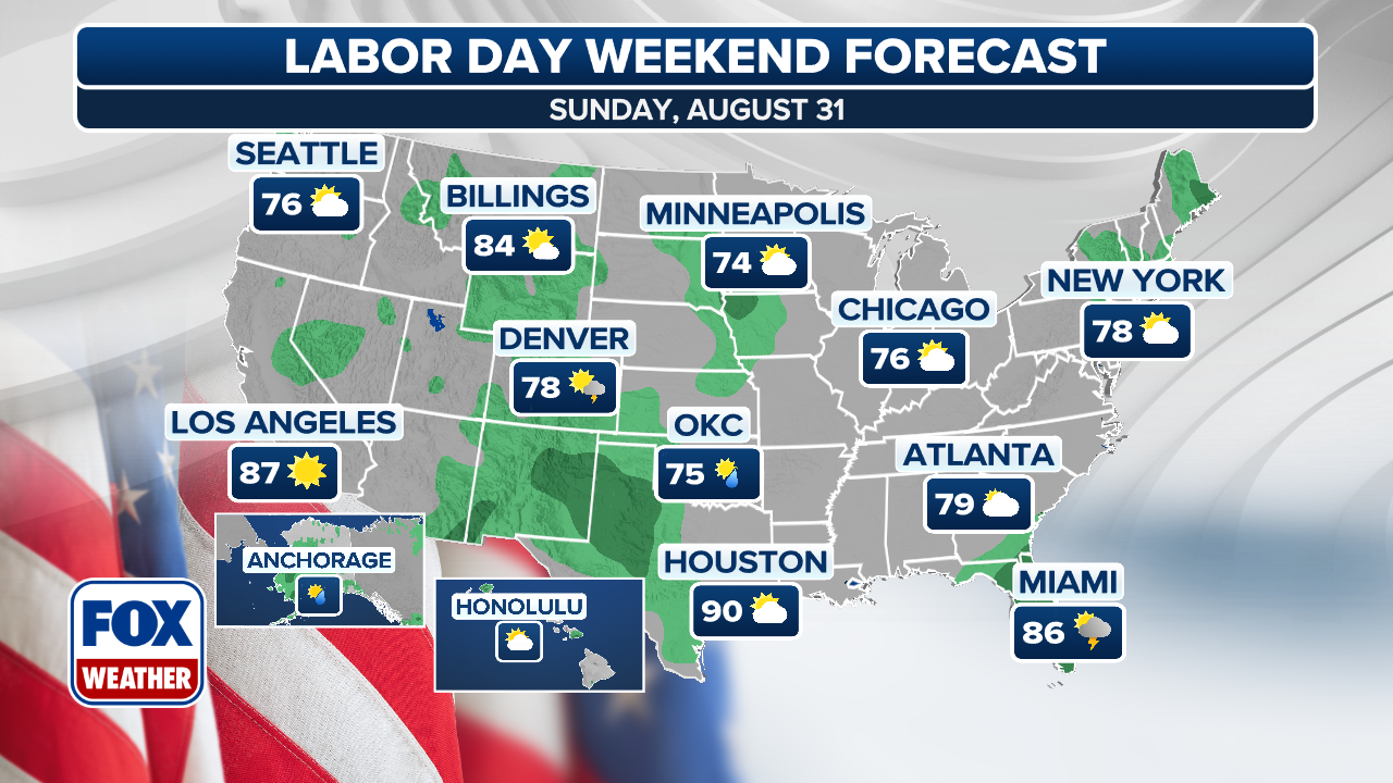
Sunday: Heavy rain, flooding possible in Plains, South
On Sunday, most of the precipitation will be confined to the central and southern Plains, as well as in Florida.
Florida is expected to remain in a soggy stretch, with daily rounds of showers and thunderstorms possible.

(FOX Weather)
That’s not good news for those who are trying to catch some rays at the beach.
Storm chances will persist into Labor Day.
Meanwhile, a stalled-out cold front will keep showers and storms in place across parts of the Southwest, as well as in the southern Plains.

(FOX Weather)
A large chunk of Texas is under a Flood Watch, and Flash Flood Warnings were already issued as of Sunday morning.
And a slow-moving system crawling through the central Plains is bringing periods of heavy rain and isolated thunderstorms from eastern Nebraska and Kansas into Iowa and Missouri.
Showers are expected to last through the holiday before moving into the Tennessee Valley.
(FOX Weather)
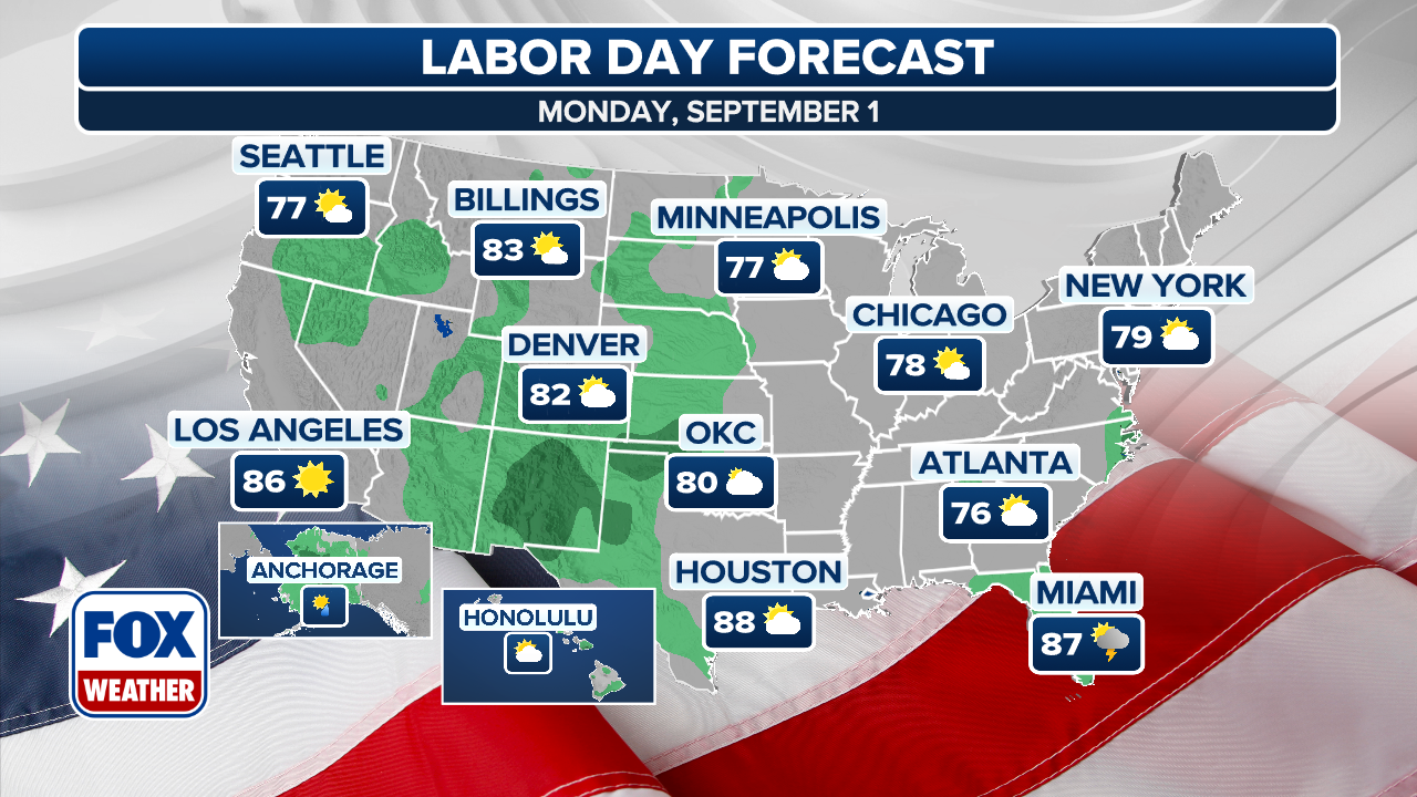
Labor Day: Cooler for many, still hot for West Coast
Labor Day Monday again looks tranquil for just about the entire nation, with pleasant conditions across much of the Northeast and the West Coast. For the East, relatively cool air will continue to push in from Canada, leaving temperatures about 10-15 degrees below average.
Scattered showers still dot the weather map across the Plains and Mississippi Valley back into Texas and the Desert Southwest, but no severe or overwhelming rains are predicted.
The West will remain warm-to-hot with 90s expected in Southern California up through the Intermountain West and into Montana.
(FOX Weather)
As far as the tropics go, FOX Weather Hurricane Specialist Bryan Norcross said overall conditions are hostile to any development.
"Most likely, significant development won't restart until the second week or maybe the middle of September."