Parts of the mid-Atlantic, Northeast seeing snow on Super Bowl Sunday
Accumulations are expected to remain light compared to recent winter storms
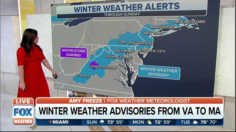
Winter weather alerts in effect from the mid-Atlantic into the Northeast
A storm system will bring snow from the mid-Atlantic into the Northeast on Sunday.
FOX Weather meteorologists are tracking snow showers from the Mid-Atlantic to the Northeast, but all signs point to the system having less of an impact than the blizzard that blanketed the region with feet of snow nearly two weeks ago.
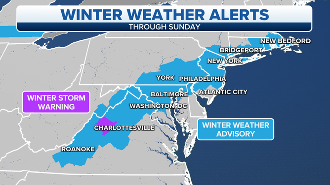
Winter weather alerts in effect on Sunday.
(FOX Weather)
The snow started falling on Saturday along the Appalachians and expanded into the Delmarva Peninsula, southern New Jersey and southern New England on Sunday morning.
Because of the expected snowfall during the day and into the evening, winter weather alerts are in effect from the mid-Atlantic into New England.
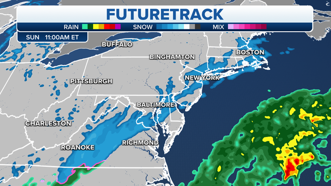
![]() Image 1 of 2
Image 1 of 2The Futuretrack for late Sunday morning. ( )
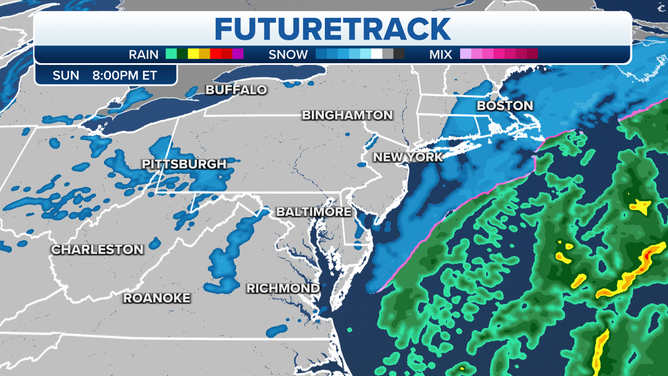
![]() Image 2 of 2
Image 2 of 2The Futuretrack for Sunday evening. ( )
The major cities along Interstate 95 between Boston and Washington are forecast to see an inch or less of snow. There's a possibility that some areas of New England, like eastern Connecticut, Rhode Island central and eastern Massachusett and southern New Hampshire, could see 1 to 3 inches of snow.
SUPER BOWL LVI IN LOS ANGELES MIGHT BE THE HOTTEST BIG GAME ON RECORD
Because of the system's quick movement and the circulation center hundreds of miles off the coast of the mid-Atlantic, accumulations on Sunday are expected to remain light.
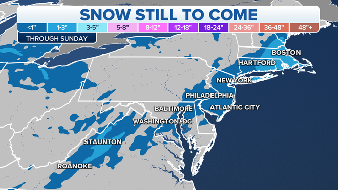
The snow forecast through Sunday night.
All of the snow is expected to be well off the coast by Valentine's Day, leaving behind sunny skies and cold temperatures.