Hurricane Erin makes closest approach to US with coastal flooding, dangerous rip currents
Hurricane Erin made its closest approach to the U.S. overnight, sending powerful waves toward the coast and causing a nearly 50-mile stretch of a coastal highway to shut down due to overwash.

Wednesday evening Hurricane Erin update
Hurricane Erin made its closest approach to the U.S. coastline on Wednesday and is expected to quickly become post-tropical over the northern Atlantic. Even though the cyclone stayed offshore, the threat for significant waves and rip currents is expected to remain for the rest of the week for the Eastern Seaboard.
HATTERAS, N.C. – Hurricane Erin made its closest approach to the U.S. overnight, sending powerful waves toward the coast and causing a nearly 50-mile stretch of a coastal highway to shut down due to overwash.
The hurricane never made landfall in the U.S. but plenty of advisories and alerts were issued due to the threats from fringe impacts.
Officials in three coastal counties in North Carolina issued mandatory evacuation orders and the state's governor issued a state of emergency, over worries that some infrastructure could be compromised.
Photos and videos along N.C. Highway 12 showed the thoroughfare covered by water on Wednesday evening, with officials concerned that days of significant tides could lead to erosion.
![Overwash in Hatteras Island, North Carolina as Hurricane Erin's biggest impacts begin on Wednesday, Aug. 20, 2025.]() Image 1 of 24
Image 1 of 24Overwash in Hatteras Island, North Carolina as Hurricane Erin's biggest impacts begin on Wednesday, Aug. 20, 2025. (Jenni Koontz/Epic Shutter Photography/Dare County)
![Overwash in Hatteras Island, North Carolina as Hurricane Erin's biggest impacts begin on Wednesday, Aug. 20, 2025.]() Image 2 of 24
Image 2 of 24Overwash in Hatteras Island, North Carolina as Hurricane Erin's biggest impacts begin on Wednesday, Aug. 20, 2025. (Jenni Koontz/Epic Shutter Photography/Dare County)
![Winds and waves in Virginia Beach, Virginia.]() Image 3 of 24
Image 3 of 24Winds and waves in Virginia Beach, Virginia. ( )
![Storm preps in Ocean City, Maryland]() Image 4 of 24
Image 4 of 24Heavy surf pounds the shores of Ocean City, Maryland ahead of Hurricane Erin's passby later this week. (Brandy Campbell)
![Storm preps in Ocean City, Maryland]() Image 5 of 24
Image 5 of 24Heavy surf pounds the shores of Ocean City, Maryland ahead of Hurricane Erin's passby later this week. (Brandy Campbell)
![Storm preps in Ocean City, Maryland]() Image 6 of 24
Image 6 of 24Heavy surf pounds the shores of Ocean City, Maryland ahead of Hurricane Erin's passby later this week. (Brandy Campbell)
![Surf along the beaches near Isle of Palms, South Carolina on Aug. 19, 2025 ahead of Hurricane Erin's major coastal impacts.]() Image 7 of 24
Image 7 of 24Surf along the beaches near Isle of Palms, South Carolina on Aug. 19, 2025 ahead of Hurricane Erin's major coastal impacts. (Robert Ray)
![]() Image 8 of 24
Image 8 of 24( )
![Surf along the beaches near Isle of Palms, South Carolina on Aug. 19, 2025 ahead of Hurricane Erin's major coastal impacts.]() Image 9 of 24
Image 9 of 24Surf along the beaches near Isle of Palms, South Carolina on Aug. 19, 2025 ahead of Hurricane Erin's major coastal impacts. (Robert Ray)
![Surf along the beaches near Isle of Palms, South Carolina on Aug. 19, 2025 ahead of Hurricane Erin's major coastal impacts.]() Image 10 of 24
Image 10 of 24Surf along the beaches near Isle of Palms, South Carolina on Aug. 19, 2025 ahead of Hurricane Erin's major coastal impacts. (Robert Ray)
![Surf along the beaches near Isle of Palms, South Carolina on Aug. 19, 2025 ahead of Hurricane Erin's major coastal impacts.]() Image 11 of 24
Image 11 of 24Surf along the beaches near Isle of Palms, South Carolina on Aug. 19, 2025 ahead of Hurricane Erin's major coastal impacts. (Robert Ray)
![Surf along the beaches near Isle of Palms, South Carolina on Aug. 19, 2025 ahead of Hurricane Erin's major coastal impacts.]() Image 12 of 24
Image 12 of 24Surf along the beaches near Isle of Palms, South Carolina on Aug. 19, 2025 ahead of Hurricane Erin's major coastal impacts. (Robert Ray)
![Surf along the beaches near Isle of Palms, South Carolina on Aug. 19, 2025 ahead of Hurricane Erin's major coastal impacts.]() Image 13 of 24
Image 13 of 24Surf along the beaches near Isle of Palms, South Carolina on Aug. 19, 2025 ahead of Hurricane Erin's major coastal impacts. (Robert Ray)
![Surf along the beaches near Isle of Palms, South Carolina on Aug. 19, 2025 ahead of Hurricane Erin's major coastal impacts.]() Image 14 of 24
Image 14 of 24Surf along the beaches near Isle of Palms, South Carolina on Aug. 19, 2025 ahead of Hurricane Erin's major coastal impacts. (Robert Ray)
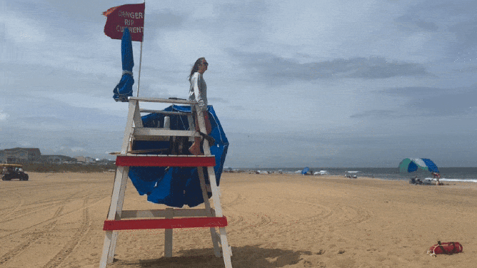
![Maryland Beach Closed For Swimming]() Image 15 of 24
Image 15 of 24Red flags denote warnings to stay out of the water at Maryland's Assateague State Park on Aug. 19, 2025 as Hurricane Erin approaches offshore, making for dangerous ocean conditions. (Maryland DNR)
![North Carolina Storm Preps]() Image 16 of 24
Image 16 of 24Crews work to shore up sand dunes along North Carolina's Highway 12 in the Outer Banks ahead of Hurricane Erin on Aug. 19, 2025. (Mike Seidel)
![Overwash in Hatteras Island, North Carolina as Hurricane Erin's biggest impacts begin on Wednesday, Aug. 20, 2025.]() Image 17 of 24
Image 17 of 24Overwash in Hatteras Island, North Carolina as Hurricane Erin's biggest impacts begin on Wednesday, Aug. 20, 2025. (Jenni Koontz/Epic Shutter Photography/Dare County)
![Minor flooding along Highway 12 on Ocracoke Island after high tide on Tuesday, Aug. 19, 2025.]() Image 18 of 24
Image 18 of 24Minor flooding along Highway 12 on Ocracoke Island after high tide on Tuesday, Aug. 19, 2025. (NC DOT)
![Abandoned homes on Rodanthe Beach on Hatteras Islands, North Carolina ahead of Hurricane Erin's impacts.]() Image 19 of 24
Image 19 of 24Abandoned homes on Rodanthe Beach on Hatteras Islands, North Carolina ahead of Hurricane Erin's impacts. (Mike Seidel)
![Abandoned homes on Rodanthe Beach on Hatteras Islands, North Carolina ahead of Hurricane Erin's impacts.]() Image 20 of 24
Image 20 of 24Abandoned homes on Rodanthe Beach on Hatteras Islands, North Carolina ahead of Hurricane Erin's impacts. (Mike Seidel)
![Abandoned homes on Rodanthe Beach on Hatteras Islands, North Carolina ahead of Hurricane Erin's impacts.]() Image 21 of 24
Image 21 of 24Abandoned homes on Rodanthe Beach on Hatteras Islands, North Carolina ahead of Hurricane Erin's impacts. (Mike Seidel)
![Overwash in Hatteras Island, North Carolina as Hurricane Erin's biggest impacts begin on Wednesday, Aug. 20, 2025.]() Image 22 of 24
Image 22 of 24Overwash in Hatteras Island, North Carolina as Hurricane Erin's biggest impacts begin on Wednesday, Aug. 20, 2025. (Jenni Koontz/Epic Shutter Photography/Dare County)
![Overwash in Hatteras Island, North Carolina as Hurricane Erin's biggest impacts begin on Wednesday, Aug. 20, 2025.]() Image 23 of 24
Image 23 of 24Overwash in Hatteras Island, North Carolina as Hurricane Erin's biggest impacts begin on Wednesday, Aug. 20, 2025. (Jenni Koontz/Epic Shutter Photography/Dare County)
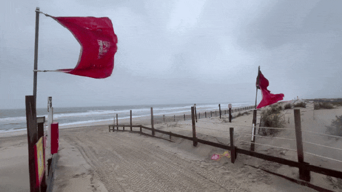
![Red "No Swimming" flags are seen in Brighton Beach amid Hurricane Erin on August 20, 2025 in the Coney Island neighborhood of the Brooklyn borough in New York City. NYC Mayor Eric Adams and Iris Rodriguez-Rosa, the parks commissioner, announced that city beaches would be closed for several days as rip currents and rough waters are expected along the East Coast due to Hurricane Erin.]() Image 24 of 24
Image 24 of 24Red "No Swimming" flags are seen in Brighton Beach amid Hurricane Erin on August 20, 2025 in the Coney Island neighborhood of the Brooklyn borough in New York City. NYC Mayor Eric Adams and Iris Rodriguez-Rosa, the parks commissioner, announced that city beaches would be closed for several days as rip currents and rough waters are expected along the East Coast due to Hurricane Erin. Lifeguards will not be on duty during the closures but will be stationed along the coastline along with members of the Parks Enforcement Patrol to prevent people from attempting to swim. (Michael M. Santiago)


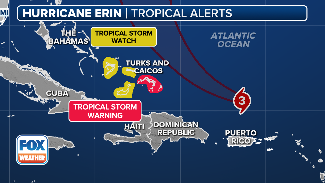
A Tropical Storm Warning was issued for Cape Lookout, North Carolina to the Delmarva Peninsula, but it was the water, not the wind, that was expected to be the big problem.
North Carolina Gov. Josh Stein, held a news conference on Wednesday to provide an update on preparations ahead of the life-threatening impacts from Hurricane Erin.
(FOX Weather)
"Yesterday, I declared a state of emergency across North Carolina to facilitate our emergency response and to keep you safe," Stein said. "The statewide state of emergency enables us to send critical resources across the state and around the country to respond."
Stein said a cross-agency response has been implemented, including the Department of Public Safety and Department of Transportation, as well as the North Carolina National Guard, the state Highway Patrol and other local partners.
"We have already pre-positioned three swift-water rescue teams and 200 National Guard troops to various locations on the coast, along with boats, high-clearance vehicles and aircraft," Stein continued.
DOWNLOAD THE FREE FOX WEATHER APP

Storm surge floods hotel along Outer Banks as Hurricane Erin swirls offshore
Time lapse video Wednesday shows storm surge flooding a beachfront hotel in Buxton, N.C. as Hurricane Erin approached the offshore waters.
Stein said that anyone who defies an evacuation order and remains in areas vulnerable to coastal flooding and storm-surge flooding is putting their lives at risk.
"When there is a major storm, when there is flooding, there is a great risk of death," he warned. "And what we don’t want is for people to die."
He went on to say that officials are doing what they can to keep people safe.
"We’re going to do everything in our power to keep people safe. If you’re on one of the two islands, Hatteras or Ocracoke, and can get off still, we urge you to do that. And if you have not evacuated, make sure to batten down the hatches."
North Carolina Emergency Management officials opened a State Operated Shelter (SOS) in conjunction with Warren County Emergency Management for those who needed to evacuate due to Hurricane Erin.
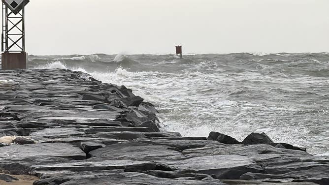
Due to the threats of a storm surge and large waves of up to 12 feet in some spots, local officials and forecasters have been warning people to stay out of the water for safety.

Watch: Drone video shows monster waves, storm surge on North Carolina's Outer Banks
A dramatic drone video shows large waves and storm surge swallowing homes in Buxton, North Carolina, as powerful Hurricane Erin spins off the U.S. East Coast on Aug. 19.
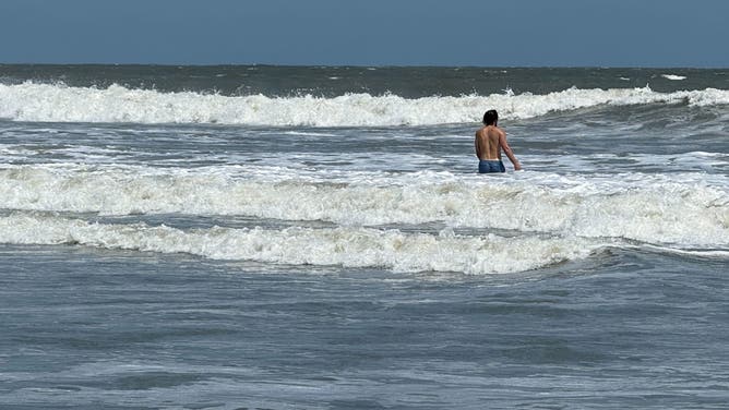
A spokesperson for Wrightsville Beach, North Carolina, told FOX Weather their rescue crews conducted nearly 60 water rescues on Monday and another 20 on Tuesday due to strong rip currents. The town has now told all beachgoers to stay out of the water through Friday as Erin gets even closer.
"These swells are producing powerful rip currents that can create extremely hazardous swimming conditions," said Sam Proffitt, director of Wrightsville Beach Ocean Rescue. "The safety of our beachgoers is always our top priority, and we urge everyone to follow this advisory."
Where is Hurricane Erin?

(FOX Weather)
As of the latest advisory from the National Hurricane Center (NHC), Hurricane Erin had maximum sustained winds of 110 mph, which is significantly down from its peak while being a Category 5 hurricane.
The hurricane is expected to rapidly pull away from the East Coast and become post-tropical over the weekend.
The closest the cyclone got to the U.S. is about 200 miles, but because of its size, barrier islands along North Carolina experienced some of the roughest weather.
On the forecast track, the center of Hurricane Erin will move over the western Atlantic between the East Coast and Bermuda through early Friday, and then pass south of Atlantic Canada on Friday and Saturday.

(FOX Weather)