Holiday weekend snow expected for northeastern I-95 corridor, AI models show potential for significant storm
While traditional computer forecast models are showing less snow across the East Coast Sunday, AI-driven models are confident that a stronger system will develop off the Northeast coast and bring widespread snow to the I-95 corridor.
Weekend winter storms target snow for northeastern portion of Interstate 95 corridor
Though many portions of the densely populated Interstate 95 corridor are seeing below average snow totals this winter, two separate systems could bring snow from Virginia to Massachusetts through this weekend and into Martin Luther King Jr. Day. While traditional computer forecast models are showing less snow across the East Coast Sunday, AI-driven models are confident that a stronger system will develop off the Northeast coast and bring widespread snow to the I-95 corridor.
Though many portions of the densely populated Interstate 95 corridor are seeing below average snow totals this winter, two separate systems could bring snow from Virginia to Massachusetts through this weekend and into Martin Luther King Jr. Day.
While traditional computer forecast models are showing less snow across the East Coast Sunday, AI-driven models are confident that a stronger system will develop off the Northeast coast and bring widespread snow to the I-95 corridor.

FILE: Northbound traffic on I-95 at a standstill during a snowstorm. The densely populated corridor could see light snow this upcoming holiday weekend.
( Jill Brady / Portland Press Herald / Getty Images)
According to the FOX Forecast Center, this could serve as an excellent case study in the accuracy of AI model forecasts for these kinds of coastal weather systems.
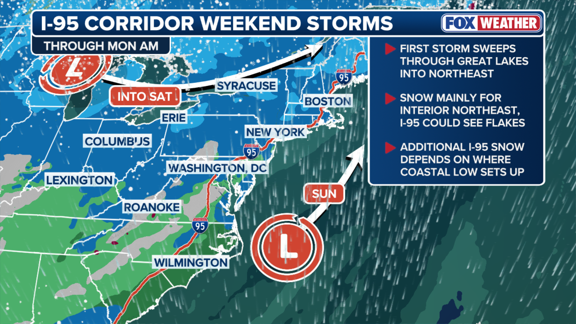
However, there is broad consensus that starting Saturday, an arctic front will swing into the Northeast, paving the way for flakes that could fall in several major cities in the region.
New York City, New Jersey and Connecticut are expected to see 1-2 inches of snow by midday Saturday.
Meanwhile, the Poconos in Pennsylvania north through Upstate New York and interior New England are in the bullseye, where over 6 inches of snow is possible, according to the FOX Forecast Center.

(FOX Weather)
Philadelphia as well as Washington, D.C. and Baltimore could see a dusting of snow Saturday.
THIS ROCK IN ARCHES NATIONAL PARK WILL FALL, IT'S ONLY A MATTER OF TIME
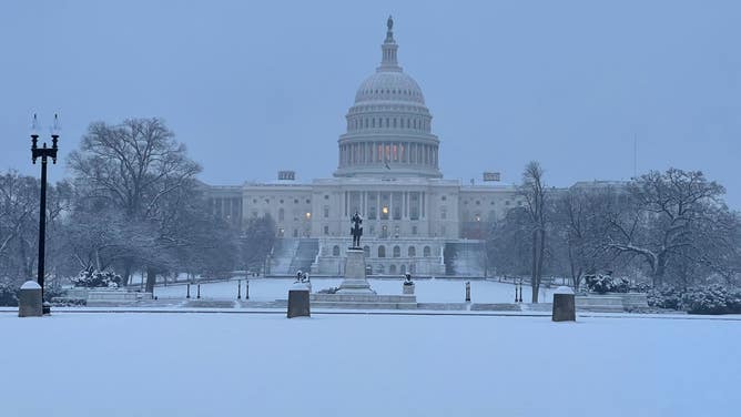
FILE: Snow falls in Washington, D.C. on Jan. 19, 2024. Light snow could again fall in the nation's capital this holiday weekend.
(Nicole Valdes / FOX Weather)
Meanwhile, a potentially more potent snow system could develop Sunday. This is the same storm that could deliver rare snow to the South on Saturday.
Traditional computer forecasts still show this system tracking farther away from the Northeast coast, which would limit Northeast snow totals Sunday.
AI-driven models support a much stronger storm system closer to shore, which would deliver significant snow to the I-95 corridor.
(FOX Weather)
However, there is growing consensus between both traditional and AI forecasts that at least a couple of inches will accumulate Sunday from Philadelphia to Boston, with increasing confidence of snow across Rhode Island and eastern Massachusetts as well.
More specific snow totals should come into focus Saturday.
Check back for updates on this developing story.