Relentless snow blankets Midwest, western New York as lake-effect machine hammers west Michigan, Buffalo
The Interstate 96 corridor in western Michigan and the Interstate 90 and 81 corridors in western New York are once again under the gun of the lake-effect snow machine through next Tuesday.
Relentless lake-effect snow to blanket Midwest, western New York through weekend
Rounds of winter weather from Canada will swing through the Upper Midwest and Great Lakes this weekend and are expected to bring more than a foot of accumulation to the Great Lakes snowbelts. The Interstate 96 corridor in western Michigan and the Interstate 90 and 81 corridors in western New York are once again under the gun of the lake-effect snow machine through next Tuesday.
Rounds of winter weather from Canada will swing through the Upper Midwest and Great Lakes this weekend and are expected to bring more than a foot of snow to the Great Lakes snowbelts.
The Interstate 96 corridor in western Michigan and the Interstate 90 and 81 corridors in western New York are once again under the gun of the lake-effect snow machine through next Tuesday.

A sea of brake lights lined the roads in Chicago Friday morning as winter weather snarled travel.
(Robert Ray/FOX Weather / FOX Weather)
Snow showers rolled through the Midwest Friday, including Chicago, where snow squalls triggered a ground stop at O'Hare International Airport Friday morning which delayed hundreds of flights.
Winter weather also snarled traffic across the Chicago metro.
A strong area of low pressure is moving into and over the Great Lakes through Tuesday which is tapping into Arctic air from a large dip in the jet stream that is ushering in freezing temperatures across the eastern U.S.
This system will restart the lake-effect snow machine as cold winds move over the relatively warmer Great Lakes, after a system earlier this week dropped nearly two feet of snow along the southern shores of Lake Michigan.

A snow plow drives through a lake-effect snow squall on Jan. 14 in Benton Harbor, Michigan.
(FOX Weather Correspondent Robert Ray / FOX Weather)
This weekend, the primary threat for heavy snow lies across southwestern Michigan, in areas like Grand Rapids and Kalamazoo.
Areas along the eastern shores of Lake Michigan could possibly see up to two feet of snow by Tuesday.
Snow already fell along the shores of Lakes Erie and Superior in Ohio, Pennsylvania and New York on Thursday, the usual heavy hitters when it comes to lake-effect snow.

(FOX Weather)
Grand Rapids is running below-average in snowfall, only recording about 34 inches so far this season, whereas they typically see more than three feet of snow at this point, according to the FOX Forecast Center.
The deficit is unlikely to continue for much longer, as forecast models estimate 18 to 24 inches of snow could fall by Tuesday.
Bands of lake-effect snow are likely to produce dangerous snow squalls with extremely low visibility, creating dangerous travel conditions as wind gusts of up to 40 mph are possible.
The FOX Forecast Center said the areas along Lakes Erie, Superior and Ontario will also see snow.
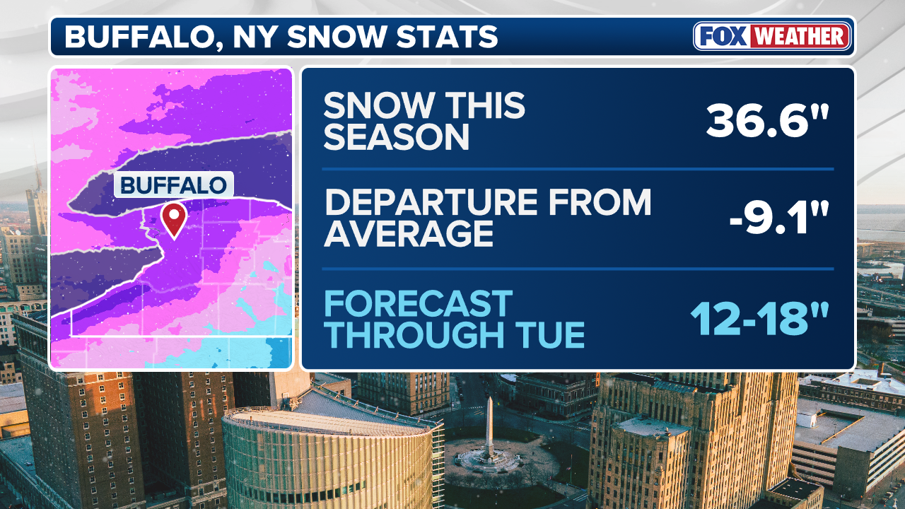
Areas like Buffalo, Syracuse, Rochester and Watertown in New York, and Marquette, Michigan, could still see up to a foot of snow as relentless rounds of lake-effect snow come through Tuesday.
WHAT ARE SNOW SQUALLS AND WHY ARE THEY SO DANGEROUS?

(FOX Weather)
The bulk of the lake-effect snow should wrap up by Tuesday morning, according to the FOX Forecast Center.


