Central US braces for multiday heavy rain threat that could cause flash flooding
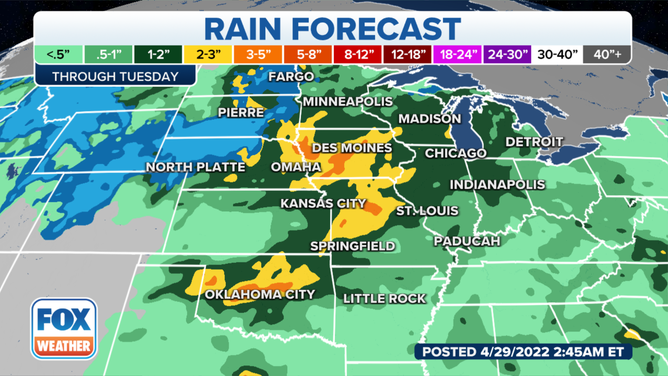
By the time drier conditions work their way in during the middle of next week, nearly the entire region from the Dakotas to North Texas will have picked up 1 to 3 inches of rain, with localized amounts as high as 5 to 7 inches
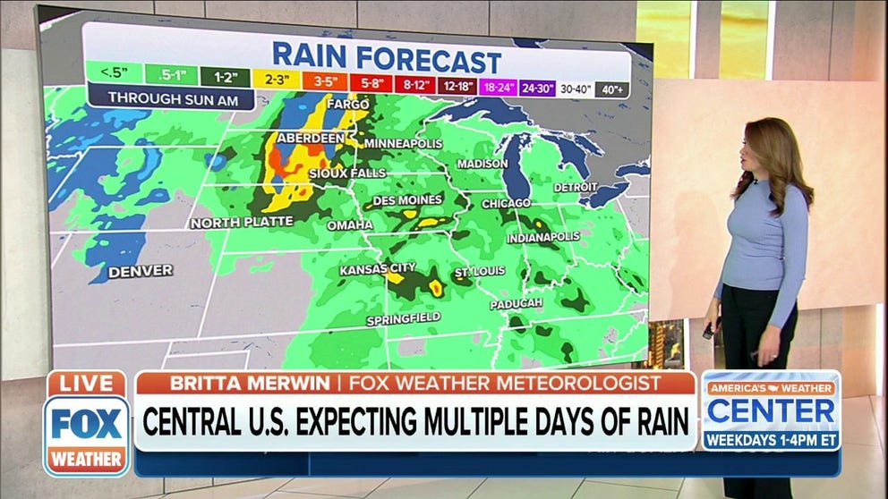
Central US expecting multiple days of rain, some areas could top 7 inches
Outside the severe weather areas, the two systems responsible will produce days of heavy rain which could lead to flooding in the coming days.
Days of heavy rain could lead to flooding in parts of the central U.S. as two systems responsible for severe thunderstorms, including the threat of tornadoes, impact the region through early next week.
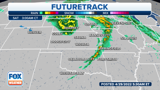
The latest models are locking in on widespread heavy rain stretching from the Dakotas into Oklahoma.
The low-pressure system responsible for Friday's heavy rainfall will dump as much as 1 to 3 inches across the Dakotas, leading to an increased risk of flash flooding as repeated rounds of rain may move over the same spots in a relatively short period of time.
(FOX Weather)
WARMER WORLD EQUALS WETTER WORLD: CLIMATE CHANGE 'SUPERCHARGING' WATER CYCLE, STUDY FINDS
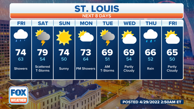
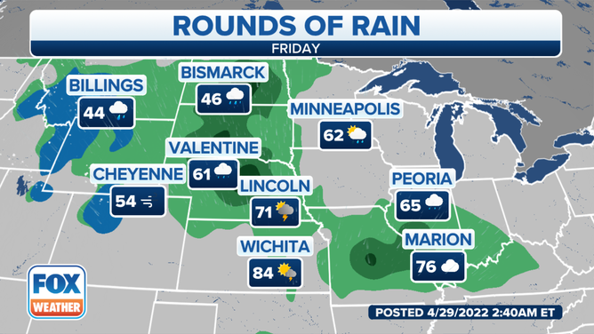
Showers and a few thunderstorms will continue Friday, with the St. Louis area seeing the best chance of rain during the morning, the National Weather Service said. Dry time is expected during portions of the afternoon and evening.
On Saturday, showers and thunderstorms are expected to move from west to east across the region, with some thunderstorms becoming strong to severe during the afternoon across portions of the mid-Mississippi Valley and the western Great Lakes.
(FOX Weather)
To the west in the Kansas City area, rainfall totals of 1.5 inches to locally 4 inches are expected through Tuesday, and that could lead to localized flash and river flooding, the NWS said.
7 FACTS YOU SHOULD KNOW ABOUT FLASH FLOODS
(FOX Weather)
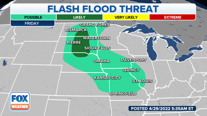
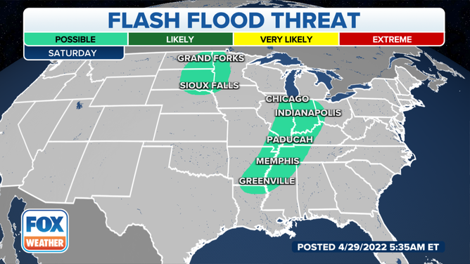
Flash flooding is also a threat in portions of the Northern Plains and the mid-Mississippi and lower Missouri valleys through the weekend.
The focus for moderate to heavy rain will be over central South Dakota on Friday, the entire region Friday night and eastern South Dakota on Saturday before shifting to northeastern South Dakota and west-central Minnesota into Sunday morning.
As much as a half-inch of rain every 6 hours can be expected around Aberdeen, South Dakota, through the day Sunday, the NWS said.
(FOX Weather)
Between 1 and 3 inches of rain is predicted to fall across a broad area from North Dakota southeastward to Iowa and Missouri through Saturday. Some spots could pick up more than 3 inches of rainfall, particularly where any storms slow down or stall over the same locations.
(FOX Weather)
The combination of locally heavy rain and melting snow in parts of North Dakota and northwestern Minnesota will likely exacerbate the ongoing river flooding in the Red River Valley of the North.
SNOWMELT, HEAVY RAINFALL CAUSE MAJOR FLOODING IN NORTHERN PLAINS
More rain is expected across the central states Sunday, Monday and Tuesday as well.
(FOX Weather)
By the time drier conditions work their way in during the middle of next week, nearly the entire region from the Dakotas to North Texas will have picked up 1 to 3 inches of rain, with localized amounts as high as 5 to 7 inches.
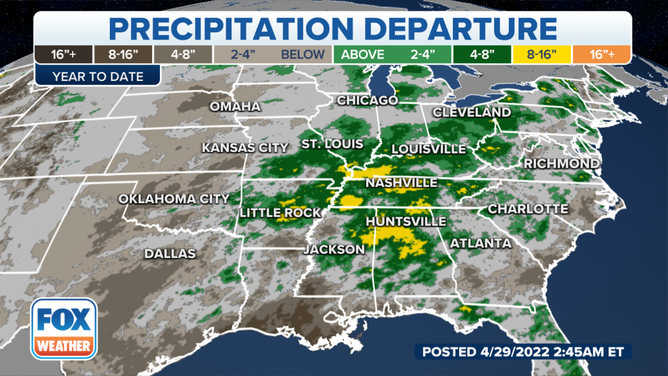
Though some flooding is expected, the rain will be highly beneficial in South Dakota and North Texas – two regions mired in severe to extreme drought.
(FOX Weather)
HOW TO WATCH FOX WEATHER ON TV
Be sure to download the FOX Weather app for the latest forecast and weather alerts for your exact location, plus the 24/7 livestream of America's Weather Team.