Heavy rain moving into Southeast could aid Florida firefight
Rain, strong storms will move across the Southeast before turning north bringing winter weather
Flash flood threat for areas of Southeast beginning Tuesday
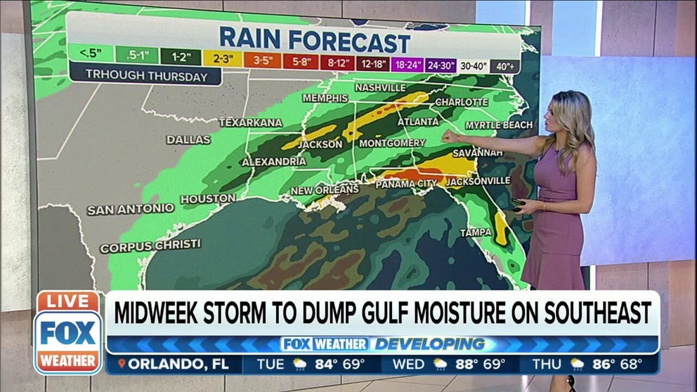
A midweek storm has potential to bring heavy rain to parts of the Southeast.
A second storm system will bring heavy rain into the Southeast beginning Tuesday before churning out some winter weather in the Mid-Atlantic by mid-week.
It will be a rainy week in the Southeast and along the Gulf Coast after a system will bring the potential for severe storms earlier in the week followed by another round of rain.
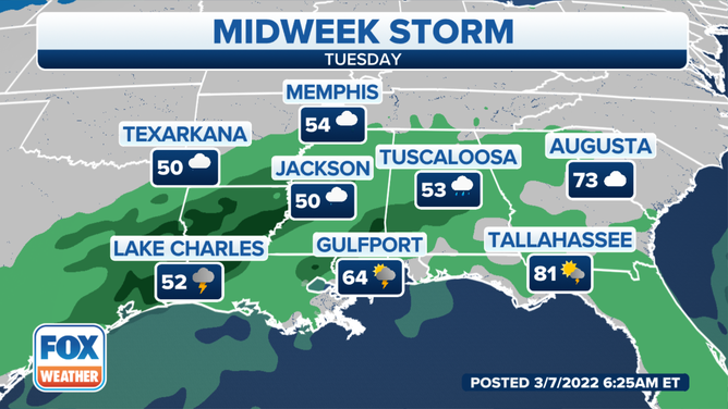
Chances for showers and isolated thunderstorms will begin Tuesday in the Houston area, moving from south to north over the region.
ANOTHER DAY OF ABOVE-AVERAGE TEMPERATURES EXPECTED FROM FLORIDA TO THE NORTHEAST
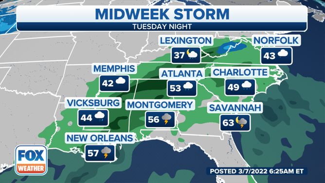
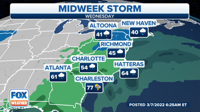
The showers will arch over into the Southeast, pushing up through Georgia into the Carolinas later Tuesday and then into the Interstate-95 corridor by Wednesday.
![What to expect Tuesday.]() Image 1 of 3
Image 1 of 3What to expect Tuesday. ( )
![Midweek storm Tuesday night.]() Image 2 of 3
Image 2 of 3Midweek storm Tuesday night. ( )
![Midweek storm forecast for Wednesday]() Image 3 of 3
Image 3 of 3Midweek storm forecast for Wednesday ( )
Heavy rain will be a welcome sight for the Florida Panhandle beginning Tuesday as fire crews are battling more than 170 wildfires in the Sunshine State that have consumed more than 15,000 acres and prompted evacuations.
According to the NWS Office in Tallahassee, the Panhandle could receive between 2 and 4 inches during the latter half of the week.
Mobile, New Orleans, Jackson, Atlanta and Chattanooga could see isolated thunderstorms as the disturbance shifts northeast.
As the rain continues moving up the coast into the Mid-Atlantic, that precipitation will turn into a wintery mix for parts of the northeast.
SHOTS OF COLD AIR THIS WEEK TO REMIND LOWER 48 THAT WINTER ISN’T FINISHED YET
A shot of cold air will settle in behind the first storm system allowing the second line of storms this week to tap into that colder air by Wednesday morning.
Early forecasts show the potential for several inches of snow and freezing rain during the second part of this week for areas in northern Maryland and central Pennsylvania.
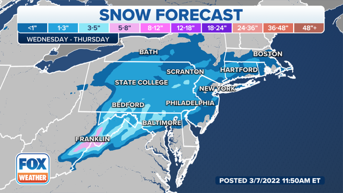
Northeast snow forecast
(FOX Weather)