Florida, Southeast faces threat of severe storms, flash flooding from Gulf of Mexico low
Damaging wind gusts and a brief tornado or waterspout are possible in Florida on Tuesday
Florida, Southeast faces threat of severe storms, flash flooding
Florida and other parts of the Southeast face a threat of severe storms and flash flooding due to a Gulf of Mexico low.
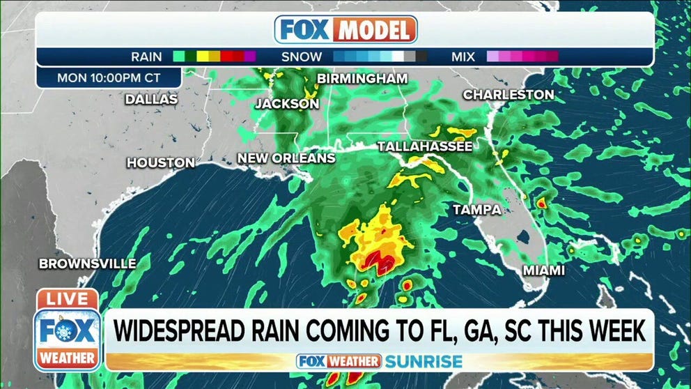
An area of low pressure has formed in the Gulf of Mexico and will deliver severe thunderstorms and heavy rain to Florida and the Southeast coast by Tuesday.
The low-pressure system will strengthen on Monday as it traverses the central Gulf of Mexico, spreading spotty showers along the immediate central Gulf Coast.
By early Tuesday morning, the threat of severe storms and heavy rain will arrive in Florida as the low tracks across the Sunshine State.
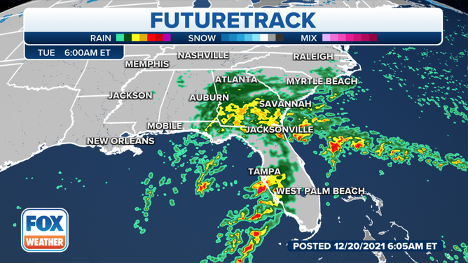
Forecast for early Tuesday morning, Dec. 21, 2021.
(FOX Weather)
Much of the Florida Peninsula is at risk for severe thunderstorms Tuesday morning into the afternoon.
SPACEX PREPARES FOR TRIFECTA OF COAST-TO-COAST LAUNCHES TO END THE YEAR
Damaging wind gusts are the main threat with any severe storms, but a brief tornado or waterspout is also possible in North and Central Florida, including the cities of Jacksonville, Tampa and Orlando.
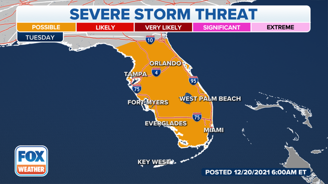
Severe storm threat on Tuesday, Dec. 21, 2021.
(FOX Weather)
Additionally, the low-pressure system will spread a large area of heavy rain across North Florida, South Georgia and far southern South Carolina on Tuesday.
More than an inch of rain is expected before the system tracks off the Southeast coast Tuesday night. Locally higher amounts up to 2 or 3 inches are not ruled out in parts of North Florida and South Georgia.
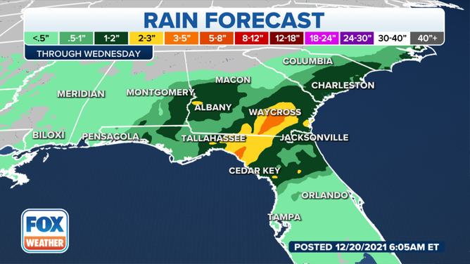
Rain forecast through midweek.
(FOX Weather)
The expected rain might put a damper on vacation plans at some of the popular Florida theme parks.
AAA said the theme parks are expected to be busy during the holiday season and rank as one of the top destinations for travelers.
Before you get stuck in the rain, make sure to download the FOX Weather app so you can track the storms using our mobile 3D radar to help you avoid the downpours.