

Florida faces rare Level 4 flood threat as relentless rain raises risk of catastrophic flooding
Rainfall totals are expected to continue climbing through the weekend.
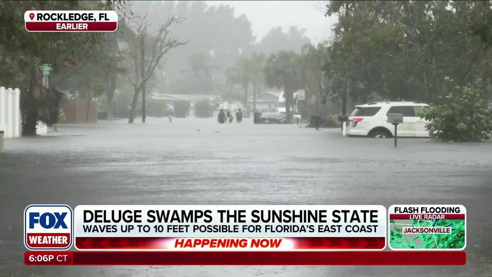
Life-threatening flooding impacts parts of Florida as heavy rain continues to drench the state
Dangerous flash flooding is slamming Florida, with a Level 4 out of 4 flash flood risk in place for parts of the Treasure Coast and Space Coast. More than 2 feet of rain could fall in some areas by Saturday, raising concerns for additional catastrophic flooding.
THE TAKEAWAY
- More than a foot of rain has been reported in parts of South Florida.
- The NOAA Weather Prediction Center has issued a Level 4 out of 4 flash flood risk for parts of Florida.
- Localized rainfall totals could exceed 2 feet by Saturday, potentially creating additional catastrophic flooding concerns.
Flash flooding continues across parts of Florida as heavy rain slams the region, prompting emergency declarations, widespread road closures and high-water rescues.
FLORIDA GOVERNOR DECLARES STATE OF EMERGENCY AS DEADLY FLOODING GRIPS SUNSHINE STATE
More than a foot of rain has been reported in parts of South Florida, with Plantation recording the highest total at 16.38 inches, followed by Hollywood that received 13.79 inches.

(FOX Weather)
Fort Lauderdale recorded 12.17 inches and has now reported the wettest November on record.
Rainfall totals are expected to continue climbing through the weekend.
SUPER EL NIÑO COULD BE SHORT-LIVED AS MAJOR WEATHER PATTERN SHIFT BRINGS LA NIÑA INTO FOCUS
While there may be breaks between showers rather than continuous heavy rain, repeated downpours could still produce localized flooding, particularly in urban areas along Florida's eastern coast.
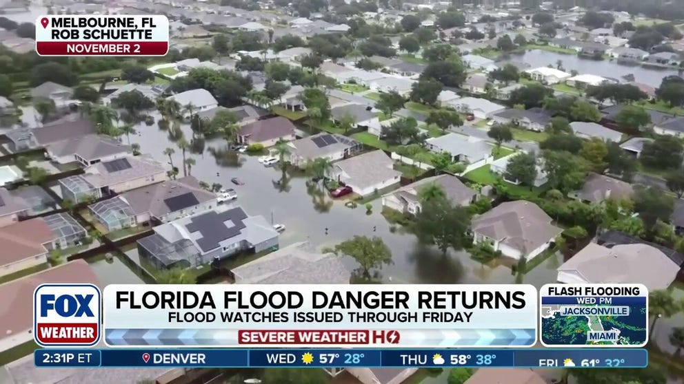
Severe storms target Florida with serious flood threat this week
FOX Weather Correspondent Brandy Campbell reports from Melbourne, Florida, where storm conditions are starting to develop as the state is bracing for days of heavy rain, which has generated a dangerous flash flood risk.
The NOAA Weather Prediction Center has issued a Level 4 out of 4 flash flood risk for parts of Florida's Treasure Coast and Space Coast on Thursday and Friday. These are the same areas that were impacted by historic flooding earlier this month.
Localized rainfall totals could exceed 2 feet by Saturday, potentially creating additional catastrophic flooding concerns.
FUTURE SUBTROPICAL STORM KYLE COULD EMERGE AS ATLANTIC COASTAL STORM PUTS MILLIONS ON ALERT
Flood Watches remain in effect along the Treasure and Space coasts, extending south into parts of South Florida and including areas around Orlando, Melbourne and Miami.
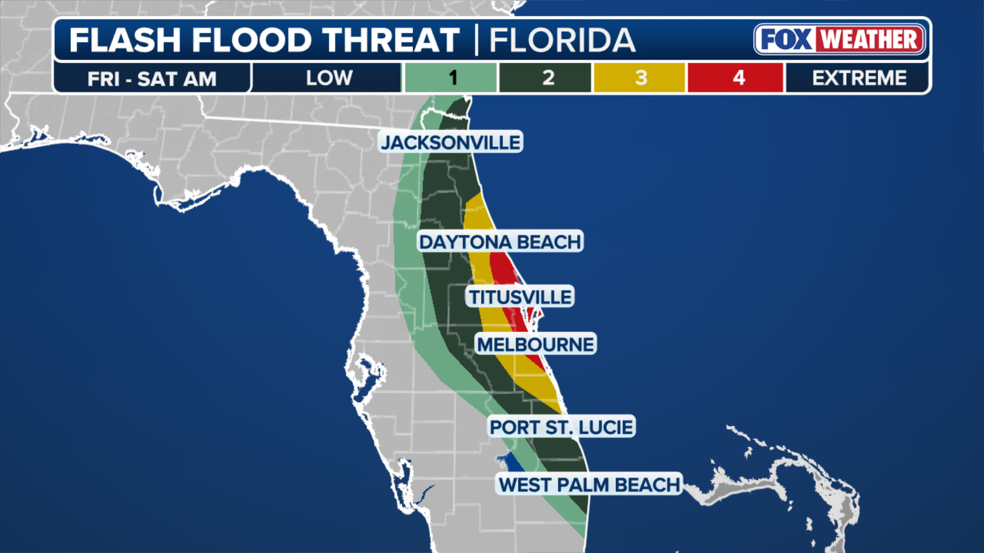
(FOX Weather)
Adding to the concerns, the St. Johns River reached historic levels in Cocoa on Thursday morning, cresting above 18 feet and breaking the previous record of 17.6 feet.
HOW HIGH PRESSURE AND LOW PRESSURE DRIVE THE WEATHER
The river was already experiencing major flooding following heavy rainfall earlier this month, and additional rain could prolong the dangerous conditions.
Because the St. Johns River flows from south to north, water moves through the river system slowly, meaning it can take time for floodwaters to recede even after rainfall decreases.
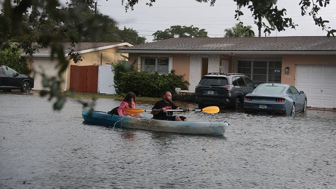
HOLLYWOOD, FLORIDA - NOVEMBER 18: Daniel Supienski and his daughter Dezirae Supienski, 9, use a kayak to paddle around the flooded streets near their home on November 18, 2026 in Hollywood, Florida.
((Photo by Joe Raedle/Getty Images) / Getty Images)
Beyond the heavy rain and flooding, Florida's Atlantic Coast is also facing dangerous coastal conditions. Persistent onshore winds are expected to produce several days of rough surf and dangerous rip currents, increasing hazards for beachgoers.
The persistent winds may also push ocean water toward the shoreline, potentially causing minor tidal flooding in vulnerable coastal communities, especially around high tide.