Strong to severe thunderstorms possible across South Florida on Sunday
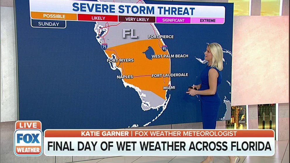
Unsettled weather will be mainly centered south of Interstate 4 on Sunday
Strong to severe thunderstorms possible across South Florida on Sunday
More rain with strong to severe thunderstorms are possible across South Florida on Sunday.
It’s been a very rainy few days across Florida, but things will begin to dry out once a final round of showers and thunderstorms moves offshore on Sunday.
The rainy weather is from the same front that produced tornado outbreak across the South earlier in the week.
The unsettled weather on Sunday will be mainly centered south of Interstate 4 and could impact areas from Fort Myers to West Palm Beach and Miami.
HOW TO WATCH FOX WEATHER ON TV

Depending on daytime heating, some storms could be strong to severe with damaging winds and large hail being the main threats.
Lightning will also be possible in any of the storms that pop up.
A camera captured a lightning strike near a rocket on Saturday at the Kennedy Space Center.

Forecast models show high pressure building into the region by Sunday night, which will help to cut down on widespread showers and storms during the workweek.
The next wet weather threat could approach the western Panhandle late on Tuesday.