Florida's Lake County swamped by more than 19 inches of rain in rare Flash Flood Emergency
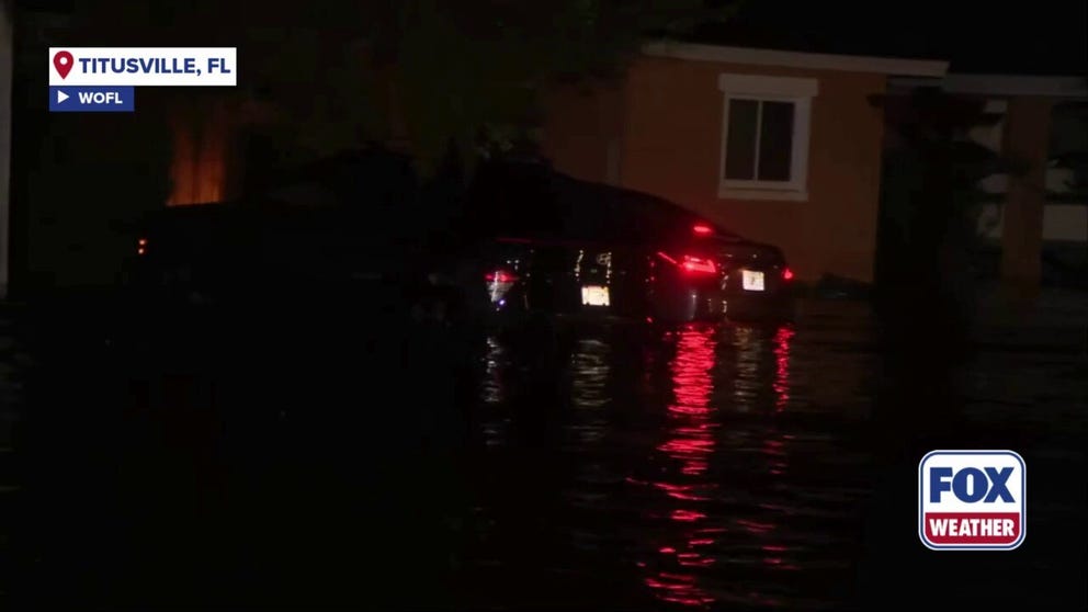
Cars were swamped as inundation remained through the early-morning hours of Monday in Central Florida.
Flash Flood Emergency swamps Central Florida
More than 19 inches of rain fell in just a few hours in Lake County, Florida, Sunday night, triggering a Flash Flood Emergency. Cars were swamped as inundation remained through the early-morning hours of Monday.
LAKE COUNTY, Fla. – More than 19 inches of rain fell in just a few hours in Lake County, Florida, Sunday night, prompting the National Weather Service office in Melbourne to issue a rare Flash Flood Emergency.
KNOW YOUR FLOOD TERMINOLOGY: WHAT FLOOD WATCHES, WARNINGS AND EMERGENCIES REALLY MEAN
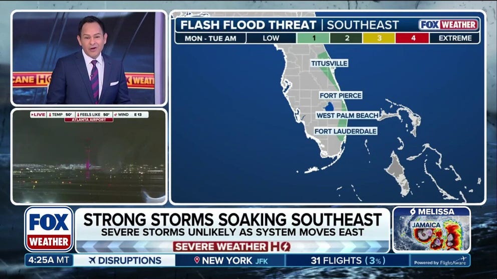
Storms race across Southeast, Florida causing flash flooding
More than 19 inches of rain fell in just a few hours in Lake County, Florida Sunday night, leading the National Weather Service Office in Melbourne to issue a Flash Flood Emergency. The flooding was caused by severe thunderstorms that rolled through the Gulf Coast Sunday night into Monday morning. More rounds of storms will move through the region Monday afternoon.
The flooding was caused by severe thunderstorms that rolled through the Gulf Coast Sunday night and into Monday morning. This was the same potent area of low pressure in the upper atmosphere that caused storms in Texas on Saturday that knocked out power to hundreds of thousands.
Cars were swamped as inundation remained through the early-morning hours of Monday in Central Florida.
Images from Florida Department of Transportation cameras showed State Route 46 near Sanford completely underwater, even as the sun came up Monday morning.
More rounds of thunderstorms will move through the region Monday afternoon. A Flood Watch remains in effect through 8 p.m. Monday night for Orlando and portions of east-central Florida from Daytona Beach to just north of Vero Beach.
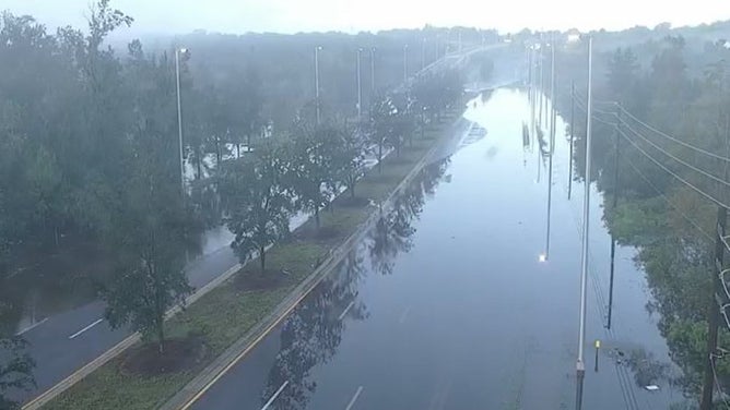
Residual flooding from Flash Flood Emergency near Sanford, Florida.
(NWS Melbourne)
The Lake County Sheriff's Department reported that two sinkholes opened up Sunday night near a roadway in Eustis. Other road closures were posted near downtown Eustis Sunday night as conditions worsened. Mount Dora and Titusville were among some of the other cities that had to close roads due to flooding.
Lake County schools, however, were not impacted by flooding and were operating on a normal schedule, according to a social media post from the county.
As of Monday morning, there was no word on any injuries associated with the flooding.
The heaviest rain Tuesday will stay north of Jacksonville before this cold front draped over the Southeast moves offshore.