Snow continues to blanket northern tier on Friday as relentless rain begins to ease in South
Lingering snow is possible through Friday across portions of the Upper Midwest and Great Lakes as an area of low pressure continues to slowly track eastward. This will only add to what has already been one of the snowiest winters on record for parts of those regions.
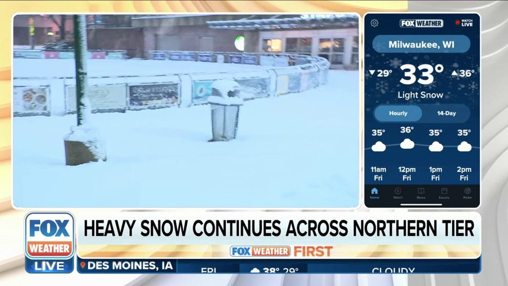
Milwaukee could see up to 8 inches of snow as system moves across northern tier
Milwaukee could see 5-8"+ of snow, though lake-effect enhancement could lead to totals on the higher end of that range. FOX Weather's Mitti Hicks reports.
The flood threat will decrease Friday as a multiday storm system winds down in the Southeast, while snow is expected to continue falling over the Upper Midwest and Great Lakes before moving into the Northeast later Friday.

(FOX Weather)
Snow lingers Friday over Upper Midwest, Great Lakes
Lingering snow is possible through Friday across portions of the Upper Midwest and Great Lakes as an area of low pressure continues to slowly track eastward. This will only add to what has already been one of the snowiest winters on record for parts of those regions.
Accumulations will be minimal in most areas, with the highest additional snowfall amounts focused across parts of Lower Michigan, where 1 to 4 inches could fall by late Friday.
This winter season in Minneapolis-St. Paul has been vaulted to the 11th-snowiest on record following the snow this storm system brought earlier in the week. The Twin Cities had picked up 77.4 inches of snow through Thursday.
HAVE AND HAVE-NOTS: SEE HOW MUCH SNOW FELL AND WHERE THIS WINTER

(FOX Weather)
Multiday flood threat wanes Friday but returns this weekend in South
As the storm system continues to track across the U.S., the flash flood threat will return on Saturday across northern and central Arkansas, southern Missouri, southwestern Kentucky, West and Middle Tennessee and northern parts of Mississippi and Alabama.
Soil moisture is already high after recent rounds of rain, so this region will need to be monitored for a renewed risk of flooding over the weekend.
7 FACTS YOU SHOULD KNOW ABOUT FLASH FLOODS

(FOX Weather)
About 1 to 2 inches of rain is expected across a large area from eastern Arkansas to the Tennessee Valley and Southeast through Sunday, but higher amounts are expected elsewhere.
Between 2 and 3 inches of rain is expected to fall in portions of central and northern Alabama, the Cumberland Plateau in Tennessee and the North Georgia mountains.

(FOX Weather)
River flooding also possible
Most rivers in the South aren't expected to rise above minor flood stage. However, the White River at Des Arc, Arkansas, just east of Little Rock, will be monitored more closely as moderate flooding is expected to continue into this weekend.

(FOX Weather)