Flash flooding likely in Los Angeles area Wednesday as another 1 to 2 feet of snow buries Sierra Nevada
Between 1 and 3 inches of rain is forecast across much of Southern California
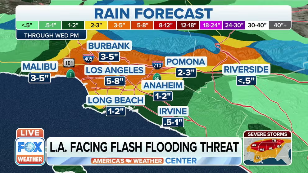
Los Angeles expected to receive more than 5 inches of rain Wednesday
Excessive amounts of rain could lead to flash flooding in the Los Angeles area on Wednesday
LOS ANGELES – Flash flooding is likely in parts of Southern California on Wednesday.
NOAA's Weather Prediction Center has hoisted a Slight Risk area for excessive rainfall from the Los Angeles metro area eastward to the Riverside area and southward into Orange County and northwestern San Diego County. A Marginal Risk is highlighted for the San Diego metro area.
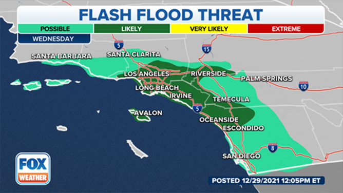
Flash flood threat on Wednesday, Dec. 29, 2021.
(FOX Weather)
Flash Flood Watches have been issued by the National Weather Service for a large portion of Southern California, including the entire San Diego metro area.
EXPLAINING FLOOD ALERTS ISSUED BY THE NATIONAL WEATHER SERVICE
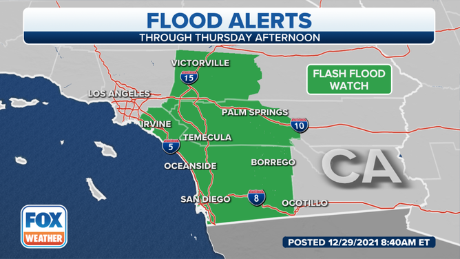
Flash Flood Watches are in effect for parts of Southern California.
(FOX Weather)
Between 1 and 3 inches of rain is forecast across much of Southern California through Friday morning, which has already been saturated by rain since the Christmas weekend.
The most likely spots for flash flooding will be in the upslope areas near mountain ranges.
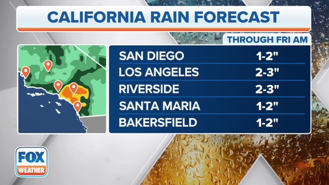
Rainfall forecast through Friday morning, Dec. 31, 2021.
(FOX Weather)
Meanwhile, heavy snow is expected in the highest elevations of California, including the Sierra Nevada.
RECORD DECEMBER SNOWFALL REPORTED AT UC BERKELEY CENTRAL SIERRA SNOW LAB
The highest snowfall totals are forecast from the southern Sierra Nevada and the Transverse Range of Southern California eastward to Utah's Wasatch and portions of the central Rockies.
Snow totals in the highest peaks of these regions will be measured in feet, which, when combined with whiteout conditions, will result in hazardous and, at times, near-impossible travel conditions through the mountains.
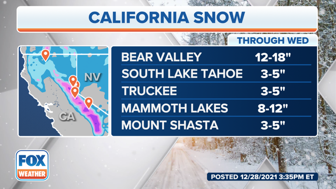
Snow forecast through Wednesday, Dec. 29, 2021.
(FOX Weather)
Donner Pass, in the Sierra Nevada, has already received more than 200 inches (over 16 feet) of snow this month, making it the snowiest December on record at that mountain pass.
Rain and mountain snow will continue to fall across the West through the end of the week.