Two areas of possible tropical development being monitored in Eastern Pacific
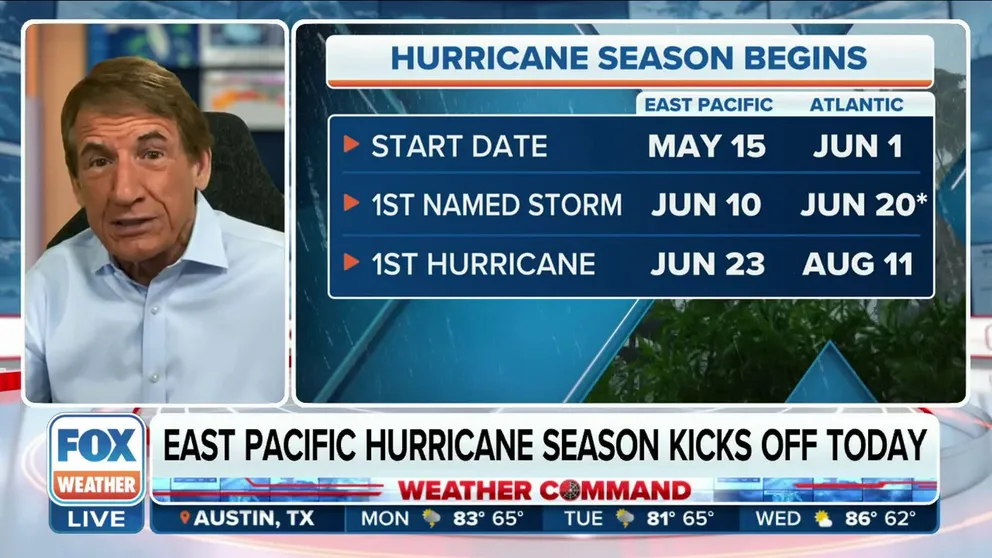
The Eastern Pacific hurricane season began on May 15, two weeks earlier than the start of the Atlantic hurricane season. The Eastern Pacific has an earlier season because waters typically tend to be warmer earlier in the year, helping to provide fuel for any tropical storm development.
Two areas of possible tropical development being monitored in Eastern Pacific
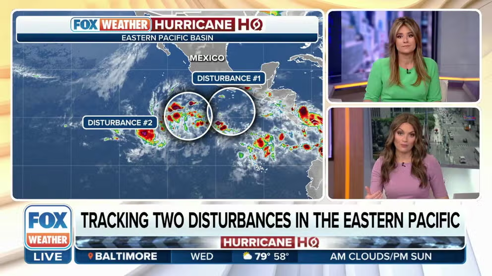
The National Hurricane Center is monitoring two areas in the Eastern Pacific for tropical development.
The National Hurricane Center is monitoring two areas in the Eastern Pacific for tropical development.
The first area for possible development is an area of low pressure located several hundred miles south of the southern tip of Baja California. The NHC said some slow development of this system is possible over the next couple of days while it moves generally west-northwestward at 10 to 15 mph.
By this weekend, conditions are expected to become unfavorable for development, the agency said.
Forecasters are giving this area a 10% chance of developing over the next 2 days and a 10% over the next 7.
The second is an area forecasters are watching is located several hundred miles south off the southern coast of Mexico.
Even though it has a 0% of developing over the next 2 days and a 30% chance over the next 7 days, the NHC said conditions appear favorable for some development of this system.
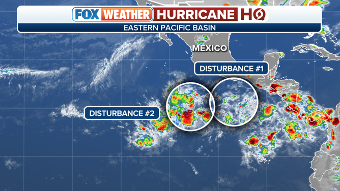
Two areas are being monitored for possible tropical development in the Eastern Pacific.
(FOX Weather)
If a tropical storm were to form, it would be named Adrian.
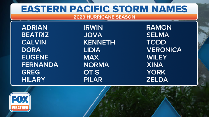
A table showing an alphabetical list of the 2023 Eastern Pacific tropical cyclone names as selected by the World Meteorological Organization. The official Eastern Pacific hurricane season runs from May 15 through Nov. 30.
(FOX Weather)
The Eastern Pacific hurricane season began on May 15, two weeks earlier than the start of the Atlantic hurricane season. The Eastern Pacific has an earlier season because waters typically tend to be warmer earlier in the year, helping to provide fuel for any tropical storm development.
And while the Atlantic and Eastern Pacific hurricane seasons have two different start dates, Nov. 30 marks the end of the season in both ocean basins.
Eastern Pacific hurricane season kicks off, countdown to start of Atlantic hurricane season
FOX Weather Hurricane Specialist Bryan Norcross discusses the start of the Eastern Pacific hurricane season as well as what we could see when Atlantic hurricane season begins June 1.